Old Maps of Wapello County, Iowa
Explore 101 old maps of Wapello County, spanning from 1954 to today. These high-resolution historic maps reveal how streets, neighborhoods, landmarks, and natural features evolved over time — perfect for genealogy, metal detecting, research, and local history exploration.
What you can do with these maps:
- See how Wapello County changed over time: Compare historical maps to modern-day views to trace roads, homesites, rail lines & more.
- View detailed metadata: Each map includes creators, publishers, year, scale, and archive source.
- Overlay maps with satellite & LiDAR: Visualize the past alongside modern tools to explore terrain & human change.
- Trusted historical sources: Maps sourced from the USGS, Library of Congress, and other archives.
- Access maps your way: View online, download high-res files, or order prints for personal or research use.
Start exploring old maps of Wapello County to uncover forgotten places, hidden landmarks, and the deep history beneath your feet.
Wapello County, IA maps
(101)- 1954 Map of Centerville, 1967 Print
 1954 Centerville1967 Print · USGSThe Iowa-Missouri borderlands at mid-century reveal a landscape shaped by river valleys and the height of the regional rail network. Genealogists and historians can trace the paths of the Wabash railroad and locate old townsites like Mystic, Moulton, and Greentop.3 unique versions available
 - 1954 Map of Des Moines, 1973 Print
 1954 Des Moines1973 Print · USGSCentral Iowa's evolving landscape is captured here in the early seventies, just as major reservoirs were reshaping the river valleys. Genealogists and historians can trace the rail corridors of the Burlington Northern or locate family roots near Pella, Indianola, and Knoxville.2 unique versions available
 - 1956 Map of Des Moines
 1956 Des Moines1956 Print · USGSCentral Iowa in the mid-fifties shows a landscape defined by bustling rail hubs and deep-rooted agricultural research. Genealogists and researchers can trace the growth of Des Moines and Ames, locate the Sac and Fox Indian Reservation, or study the paths of the Skunk River and South Skunk River.
 - 1956 Map of Farson, 1958 Print
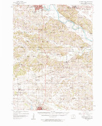
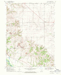
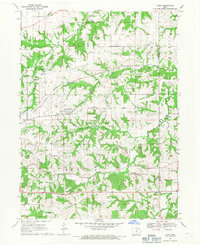
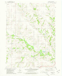
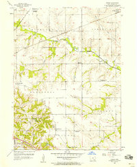 1956 Farson1958 Print · USGSWapello County farming townships are captured here in the mid-fifties during a wave of rural school consolidation. Genealogists can locate family sites near Highland Center, the McCormick Cem, and several sites marked as Nasby Sch (Abandoned).2 unique versions available
 - 1956 Map of Agency, 1958 Print
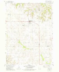
 1956 Agency1958 Print · USGSSoutheastern Iowa's river valleys and rail lines come alive in this mid-century portrait of Wapello County. Researchers can trace rural life through numerous one-room schoolhouses like O'Connor Sch and historic sites such as Alpine Log Ch.2 unique versions available
 - 1956 Map of Ottumwa North, 1958 Print
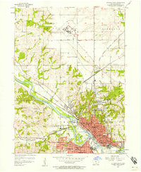
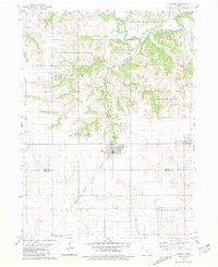
 1956 Ottumwa North1958 Print · USGSMid-century Ottumwa and its surrounding townships show a bustling river-and-rail economy as the region expanded in the fifties. Genealogists can trace family sites at Memorial Lawn Cemetery and locate vanished rural landmarks like Shiloh Church.
 - 1956 Map of Ottumwa South, 1958 Print
 1956 Ottumwa South1958 Print · USGSSouthern Iowa rural life and the outskirts of Ottumwa are captured in the mid-fifties, before modern development reshaped the county lines. Genealogists can trace family footprints at Shaul Cem or Ormanville, and locate numerous vanished rural schoolhouses like Ogg Sch and Union Sch.2 unique versions available
 - 1956 Map of Ottumwa South, 1958 Print
 1956 Ottumwa South1958 Print · USGSSouthern Iowa in the mid-fifties reveals a landscape of transition where rural schoolhouses and busy rail lines connected small farming communities. Researchers can trace family history at sites like Mars Hill Ch, Lester Cem, and the old rail stop at Drakesville (Station).2 unique versions available
 - 1956 Map of Ottumwa North, 1958 Print
 1956 Ottumwa North1958 Print · USGSThe Des Moines River valley in the mid-fifties reveals a bustling Iowa hub at the height of its rail-and-river era. Researchers can trace family history through numerous landmarks like Ottumwa Cemetery, Reveal Sch, and Ottumwa Heights College.2 unique versions available
 - 1957 Map of Des Moines
 1957 Des Moines1957 Print · USGSCentral Iowa's post-war landscape is defined here by the converging rail lines and river valleys that shaped its earliest settlements. Genealogists and historians can trace the paths of the Rock Island Railroad and locate community landmarks in Des Moines, Ames, and Newton.
 - 1957 Map of Centerville
 1957 Centerville1957 Print · USGSThe Iowa-Missouri borderlands in the mid-fifties reveal a landscape of river-valley agriculture and vital rail corridors. Genealogists and historians can trace family-named landmarks and small-town growth in Centerville, Kirksville, and along the Wabash railroad line.
 - 1958 Map of Centerville
 1958 Centerville1958 Print · USGSThe Iowa-Missouri borderlands come into focus during the mid-fifties, showing a landscape defined by river valleys and intersecting rail lines. Genealogists and local historians can trace family roots through dozens of rural hubs like Bloomfield, Unionville, and Corydon.
 - 1965 Map of Eldon, 1966 Print
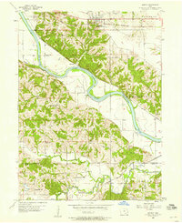
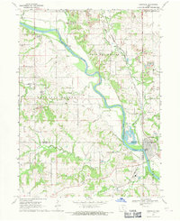
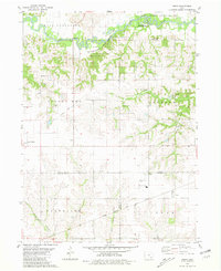
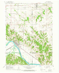 1965 Eldon1966 Print · USGSSoutheast Iowa in the mid-sixties reveals a landscape shaped by the Des Moines River and a complex network of rail lines. Researchers can locate family sites at Gontermand Cem, trace the Old Railroad Grade, or explore the riverfront at Eldon.
 - 1968 Map of Blakesburg NE, 1971 Print
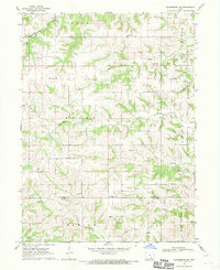 1968 Blakesburg NE1971 Print · USGSSoutheast Iowa's rural townships in the late sixties remain centered around small parish churches and meandering creek beds. Trace local family history through the Jay Cem and Hopewell Cem, or follow the Milwaukee Road rail line.
 - 1968 Map of Kirkville, 1971 Print
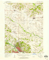
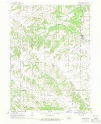
 1968 Kirkville1971 Print · USGSSoutheast Iowa's coal and gravel country comes into focus in the late sixties as industrial mining reshapes the Mahaska and Wapello County line. Researchers can trace the rail sidings of the Chicago and North Western or locate Westview Cemetery and the Eddyville School.
 - 1968 Map of Eddyville, 1971 Print
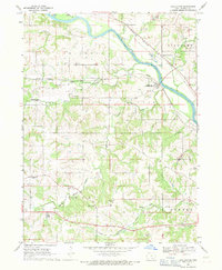
 1968 Eddyville1971 Print · USGSThe Des Moines River valley in the late sixties reveals a landscape shaped by coal mining and heavy rail. Genealogists and researchers can trace local history through the streets of Eddyville, several rural cemeteries like Henness Cem, and the path of the Pacific railroad.
 - 1968 Map of Blakesburg, 1971 Print
 1968 Blakesburg1971 Print · USGSSouthern Iowa farm country and the town of Blakesburg appear here in the late sixties at a rare juncture of four counties. Genealogists can trace family names through rural landmarks like Eslinger Cem, Trussell Cem, and the Union Chapel school and church area.2 unique versions available
 - 1968 Map of Chillicothe, 1971 Print
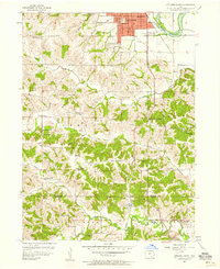
 1968 Chillicothe1971 Print · USGSWapello County in the late sixties shows a landscape defined by the Des Moines River and a massive rail-and-mining infrastructure. Researchers can trace the industrial footprint of Strip Mines alongside historic rural sites like Munterville and Columbia Ch.
 - 1968 Map of Avery, 1971 Print
 1968 Avery1971 Print · USGSMonroe and Wapello counties are shown in the late sixties during a period of active coal extraction and rail transit. Genealogists can trace family names at Hayden Chapel or East Bethel Cemetery and locate vanished stops along the Chicago Burlington and Quincy railroad.2 unique versions available
 - 1969 Map of Des Moines
 1969 Des Moines1969 Print · USGSCentral Iowa's fertile plains and growing capital are captured here during the late sixties, a time of major highway expansion and reservoir construction. Genealogists and researchers can trace rural township boundaries, local cemeteries, and rail lines serving towns like Pella, Grinnell, and Oskaloosa.
 - 1980 Map of Fremont, 1981 Print
 1980 Fremont1981 Print · USGSThe town of Fremont sits at a crossroads of three counties in the early 1980s, anchoring a landscape of precision-surveyed farmland and prairie creeks. Researchers can trace local heritage at Township Memorial Cem, Ford Cem, and the rural Helm Cem.
 - 1980 Map of Hedrick, 1981 Print
 1980 Hedrick1981 Print · USGSHedrick and the surrounding Keokuk County farmland are captured in the early eighties as the rail lines still shaped the local economy. Genealogists and local historians can trace numerous rural burial sites including Akerman Cem, Hook Cem, and Deuser Cem.
 - 1980 Map of Pekin, 1981 Print
 1980 Pekin1981 Print · USGSSoutheast Iowa farming communities thrive at the meeting point of Keokuk, Jefferson, and Wapello counties during the late twentieth century. Researchers can trace rural life through landmarks like Van Orsdall Cem, the Pekin Community Sch, and the Old Railroad Grade.
 - 1980 Map of Abingdon, 1981 Print
 1980 Abingdon1981 Print · USGSSoutheast Iowa farming communities and township lines are preserved here during the late twentieth century. Researchers can trace ancestral roots through local landmarks like Walnut Hill Cem, the village of Abingdon, and the Batavia Peoples Ch.
 - 1981 Map of Centerville, 1982 Print
 1981 Centerville1982 Print · USGSThe borderlands of southern Iowa and northern Missouri are captured here in the early eighties as Rathbun Lake and the Chariton River define the local geography. Researchers can trace historic rail lines like the Norfolk and Western and locate vanished hamlets such as Coal City and Glenwood Junction.
Showing maps 1-25 of 101
Top cities of Wapello County
- Ottumwa historical maps
- Eldon historical maps
- Agency historical maps
- Blakesburg historical maps
- Kirkville historical maps
- Chillicothe historical maps
Frequently asked questions
- What are the different types of historical maps available for Wapello County?
- What is the oldest map of Wapello County?
- Where can I purchase historical maps of Wapello County for my home or office?
- Where can I download high-res historical maps of Wapello County?
- Are there historical topographic maps available for Wapello County?
- Is there historical aerial imagery available for Wapello County?
- Where are historical maps of Wapello County sourced from?