
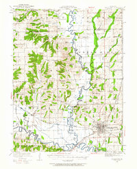
1921 Map of Chillicothe
USGS Topo · Published 1958About this map
The Thompson River and Grand River converge in a landscape defined by an extensive network of country schools and rural post offices at the start of the 1920s. This survey reveals a high density of local educational centers, including Hazelhurst School, Happy Hollow School, and Black Hills School, serving the agricultural communities of Jefferson and Jackson townships. The rail infrastructure is remarkably dense for the era, with four major lines including the Chicago Milwaukee St Paul and Pacific and the Wabash intersecting near the regional hub of Chillicothe.
Find a feature on this map
116 named features on this map. Tap any name to fly to it.
Don’t see what you’re looking for? This feature index may not catch every label — zoom into the map to look around manually.
Map Details
Editions of this 1921 Chillicothe Map
2 editions found
Other maps of this area

1922 · Gallatin
USGS Topo · 1:62,500

1923 · Chillicothe
USGS Topo · 1:62,500

1924 · Dawn
USGS Topo · 1:62,500

1924 · Braymer
USGS Topo · 1:62,500

1924 · Chula
USGS Topo · 1:62,500

1924 · Hale
USGS Topo · 1:62,500

1925 · Gilman
USGS Topo · 1:62,500

1946 · Gilman
USGS Topo · 1:48,000

1946 · Galt
USGS Topo · 1:62,500

1947 · Chula
USGS Topo · 1:62,500