
1947 Map of Chula
USGS Topo · Published 1947About this map
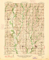
Medicine Creek and Muddy Creek dominate the drainage of this Livingston and Linn County landscape, where mid-century agriculture is supported by a dense network of country schools and rural churches. Small rural hubs like Wheeling and Meadville serve as anchor points along the Chicago Burlington and Quincy line, while Chula sits further north along the Chicago Milwaukee St Paul and Pacific tracks. This survey documents a decentralized educational system just before the consolidation era, evidenced by numerous local institutions such as Jacksnipe School, Maple Grove School, and New York School. Cultural and family history is preserved through scattered burial grounds including Ross Cemetery and Stucker Cemetery, and the presence of the Chilecothe Airport and an Airway Beacon in the south points to the emerging importance of aerial navigation in the post-war years.
Find a feature on this map
93 named features on this map. Tap any name to fly to it.
Don’t see what you’re looking for? This feature index may not catch every label — zoom into the map to look around manually.
Map Details
Editions of this 1947 Chula Map
3 editions found
Other maps of this area

1921 · Chillicothe
USGS Topo · 1:62,500

1923 · Chillicothe
USGS Topo · 1:62,500

1924 · Dawn
USGS Topo · 1:62,500

1924 · Chula
USGS Topo · 1:62,500

1924 · Hale
USGS Topo · 1:62,500

1946 · Brookfield
USGS Topo · 1:62,500

1946 · Galt
USGS Topo · 1:62,500

1948 · Brookfield
USGS Topo · 1:62,500

1948 · Trenton
USGS Topo · 1:62,500

1949 · Sumner
USGS Topo · 1:24,000