
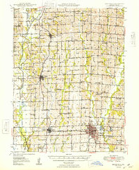
1948 Map of Brookfield
USGS Topo · Published 1948About this map
Pershing State Park occupies the southwestern corner of this Linn County landscape, where the Locust Creek bottomlands meet the rolling Missouri prairie. The Chicago Burlington and Quincy railroad forms the primary industrial axis, connecting the larger hubs of Brookfield and Laclede. This survey reveals a dense network of rural infrastructure typical of the mid-century era, characterized by an exceptionally high concentration of country schools such as Prairie Seminary Sch, Oak Arbor Sch, and Slater Sch. These small school districts, alongside local landmarks like the County Home near Linneus and churches like New Garden Ch, illustrate a decentralized community structure before the consolidation of rural services. The drainage patterns of Yellow Creek and Turkey Creek define the agricultural boundaries of the townships, from Grantsville to North Salem.
Find a feature on this map
72 named features on this map. Tap any name to fly to it.
Don’t see what you’re looking for? This feature index may not catch every label — zoom into the map to look around manually.
Map Details
Editions of this 1948 Brookfield Map
2 editions found
Other maps of this area

1924 · Chula
USGS Topo · 1:62,500

1924 · Hale
USGS Topo · 1:62,500

1946 · Brookfield
USGS Topo · 1:62,500

1946 · Galt
USGS Topo · 1:62,500

1947 · Chula
USGS Topo · 1:62,500

1949 · Sumner
USGS Topo · 1:24,000

1949 · Galt
USGS Topo · 1:62,500

1949 · Rothville
USGS Topo · 1:24,000

1949 · Bucklin
USGS Topo · 1:24,000

1949 · Bucklin NW
USGS Topo · 1:24,000