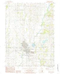
1984 Map of Brookfield
USGS Topo · Published 1985About this map
Brookfield stands as the central hub of this north-central Missouri landscape, situated within a complex network of waterways that defined the region's early development. The settlement is positioned between Turkey Creek to the west and the meandering paths of West Yellow Creek and Yellow Creek to the east. This mid-1980s topography reveals a community shaped by its industrial and infrastructure needs, featuring the Water Plant, City Reservoir, and several Sewage Lagoons that support the local population.
Find a feature on this map
21 named features on this map. Tap any name to fly to it.
Don’t see what you’re looking for? This feature index may not catch every label — zoom into the map to look around manually.
Map Details
Editions of this 1984 Brookfield Map
This is the sole edition of this map. No revisions or reprints were ever made.
Other maps of this area

1946 · Brookfield
USGS Topo · 1:62,500

1948 · Brookfield
USGS Topo · 1:62,500

1949 · Sumner
USGS Topo · 1:24,000

1949 · Rothville
USGS Topo · 1:24,000

1949 · Bucklin
USGS Topo · 1:24,000

1949 · Bucklin NW
USGS Topo · 1:24,000

1950 · Bucklin
USGS Topo · 1:24,000

1950 · Sumner
USGS Topo · 1:24,000

1950 · Rothville
USGS Topo · 1:24,000

1950 · Bucklin NW
USGS Topo · 1:24,000