1980s Maps of Shenandoah, Iowa
Explore 3 historic maps of Shenandoah from the 1980s. These maps offer a rare glimpse into what life looked like during the 1980s — showing old roads, neighborhoods, homes, and landmarks that have changed or disappeared over time.
Whether you're researching your family's past, planning a metal detecting trip, or studying how Shenandoah's landscape evolved across the 1980s, these high-resolution maps are a powerful tool for exploring the history of this region.
- Focus on a specific era: All maps on this page are from the 1980s, giving you a focused view of this time period.
- See what’s changed: Compare century-old streets, trails, and buildings to today's modern landscape using overlays and satellite layers.
- Research with precision: Use these maps for genealogy, historical research, land use analysis, or educational projects.
- View, download, or print: Maps are fully viewable online in high resolution, and can be downloaded or printed for your own records.
Start exploring Shenandoah's history through authentic maps from the 1980s. This is your window into the past.
Shenandoah, IA maps
(3)- 1981 Map of Bingham
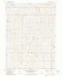 1981 Bingham1981 Print · USGSPage County farmland in the late 1970s is centered here on the Norfolk and Western line and the valley of West Tarkio Creek. Researchers can trace old shipping routes at Norwich or locate family sites near Bingham and the Cem.
 - 1981 Map of Farragut
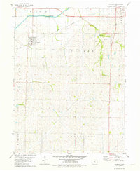 1981 Farragut1981 Print · USGSSouthwest Iowa in the late seventies is centered on the agricultural town of Farragut and the East Nishnabotna River. Genealogists can locate family landmarks like Farragut Cemetery, Manti Cemetery, and the Summit Church.
 - 1985 Map of Nebraska City
 1985 Nebraska City1985 Print · USGSThe Missouri River borderlands of Nebraska, Iowa, and Missouri come into focus in the mid-1980s, showcasing a landscape of river navigation and rail-fed agriculture. Researchers can trace the heritage of Nebraska City, follow the Burlington Northern tracks, or explore river landmarks like Jones Point and McKissick Island.
End of results
Showing maps 1-3 of 3
Top cities near Shenandoah
- Essex historical maps
- Farragut historical maps
- Riverton historical maps
- Coin historical maps
- Randolph historical maps
- Westboro historical maps
See more
Frequently asked questions
- What are the different types of historical maps available for Shenandoah?
- What is the oldest map of Shenandoah?
- Where can I purchase historical maps of Shenandoah for my home or office?
- Where can I download high-res historical maps of Shenandoah?
- Are there historical topographic maps available for Shenandoah?
- Is there historical aerial imagery available for Shenandoah?
- Where are historical maps of Shenandoah sourced from?