2020s Maps of Shenandoah, Iowa
Explore 4 historic maps of Shenandoah from the 2020s. These maps offer a rare glimpse into what life looked like during the 2020s — showing old roads, neighborhoods, homes, and landmarks that have changed or disappeared over time.
Whether you're researching your family's past, planning a metal detecting trip, or studying how Shenandoah's landscape evolved across the 2020s, these high-resolution maps are a powerful tool for exploring the history of this region.
- Focus on a specific era: All maps on this page are from the 2020s, giving you a focused view of this time period.
- See what’s changed: Compare century-old streets, trails, and buildings to today's modern landscape using overlays and satellite layers.
- Research with precision: Use these maps for genealogy, historical research, land use analysis, or educational projects.
- View, download, or print: Maps are fully viewable online in high resolution, and can be downloaded or printed for your own records.
Start exploring Shenandoah's history through authentic maps from the 2020s. This is your window into the past.
Shenandoah, IA maps
(4)- 2022 Map of Shenandoah West, 2022 Print
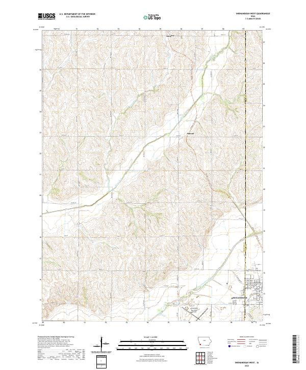 2022 Shenandoah West2022 Print · USGSFremont County agricultural lands and the river valley are captured here in the early 2020s. Researchers can trace the path of the Wabash Trace Nature Trl from Imogene past Summit, or explore the city streets of Shenandoah.
 - 2022 Map of Shenandoah East, 2022 Print
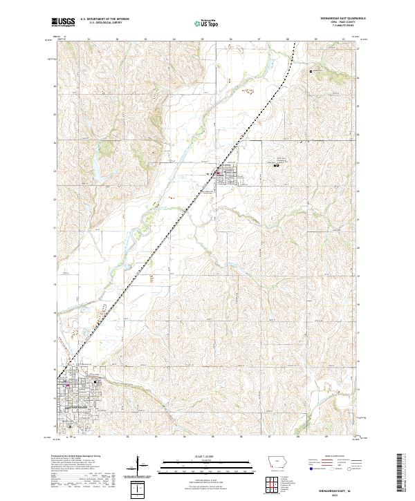 2022 Shenandoah East2022 Print · USGSPage County, Iowa, is captured here in its modern agricultural context, centered on the settlements and creek valleys north of the Missouri border. Genealogists and local historians can locate specific burial sites at Rose Hill Cem, Essex Cem, and Hadden Cem while tracing the path of the Wabash Trace Nature Trl.
 - 2022 Map of Bingham, 2022 Print
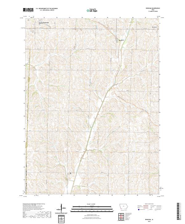 2022 Bingham2022 Print · USGSPage County farmland and small crossroads communities are captured here in the early twenty-first century. Genealogists and local historians can trace the rural landscape near Bingham, Norwich, and the Martin Cem along the Wabash Trace Nature Trl.
 - 2022 Map of Farragut, 2022 Print
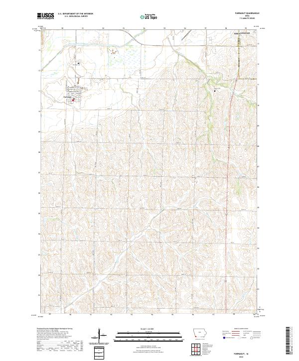 2022 Farragut2022 Print · USGSFremont County agricultural lands and the town of Farragut are documented here in the early twenty-first century. Family historians can locate the Farragut Cem and Manti Cem or trace the winding course of the East Nishnabotna River.
End of results
Showing maps 1-4 of 4
Top cities near Shenandoah
- Essex historical maps
- Farragut historical maps
- Riverton historical maps
- Coin historical maps
- Randolph historical maps
- Westboro historical maps
See more
Frequently asked questions
- What are the different types of historical maps available for Shenandoah?
- What is the oldest map of Shenandoah?
- Where can I purchase historical maps of Shenandoah for my home or office?
- Where can I download high-res historical maps of Shenandoah?
- Are there historical topographic maps available for Shenandoah?
- Is there historical aerial imagery available for Shenandoah?
- Where are historical maps of Shenandoah sourced from?