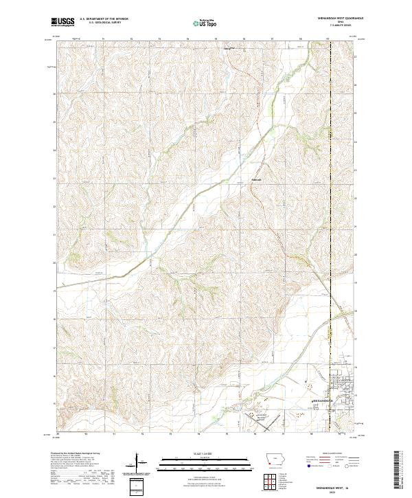
2022 Map of Shenandoah West
USGS Topo · Published 2022About this map
Shenandoah anchors the southeastern corner of this Fremont County landscape, where the residential grid meets the fertile basin of the East Nishnabotna River. The terrain is defined by a dense network of seasonal drainages including Walnut Creek and Honey Cr, which carve through the agricultural uplands typical of southwestern Iowa. A prominent recreational and historical corridor, the Wabash Trace Nature Trl, cuts north-south through the center of the sheet, passing the small settlement at Summit before reaching Imogene near the northern boundary. This route follows a legacy rail alignment, illustrating the shift from industrial transport to modern conservation. Near the city, the Shenandoah Municipal Airport and localized water features like Fisher Cr mark the interface between the municipal infrastructure and the surrounding rural townships.
Find a feature on this map
56 named features on this map. Tap any name to fly to it.
Don’t see what you’re looking for? This feature index may not catch every label — zoom into the map to look around manually.
Map Details
Editions of this 2022 Shenandoah West Map
This is the sole edition of this map. No revisions or reprints were ever made.
Other maps of this area

1939 · Farragut
USGS Topo · 1:62,500

1939 · Hamburg
USGS Topo · 1:62,500

1940 · Farragut
USGS Topo · 1:62,500

1941 · Hamburg
USGS Topo · 1:62,500

1955 · Nebraska City
USGS Topo · 1:250,000

1957 · Nebraska City
USGS Topo · 1:250,000

1957 · Randolph
USGS Topo · 1:24,000

1957 · Tabor NE
USGS Topo · 1:24,000

1958 · Nebraska City
USGS Topo · 1:250,000

1978 · Shenandoah East
USGS Topo · 1:24,000