1970s Maps of Palo Alto County, Iowa
Explore 8 historic maps of Palo Alto County from the 1970s. These maps offer a rare glimpse into what life looked like during the 1970s — showing old roads, neighborhoods, homes, and landmarks that have changed or disappeared over time.
Whether you're researching your family's past, planning a metal detecting trip, or studying how Palo Alto County's landscape evolved across the 1970s, these high-resolution maps are a powerful tool for exploring the history of this region.
- Focus on a specific era: All maps on this page are from the 1970s, giving you a focused view of this time period.
- See what’s changed: Compare century-old streets, trails, and buildings to today's modern landscape using overlays and satellite layers.
- Research with precision: Use these maps for genealogy, historical research, land use analysis, or educational projects.
- View, download, or print: Maps are fully viewable online in high resolution, and can be downloaded or printed for your own records.
Start exploring Palo Alto County's history through authentic maps from the 1970s. This is your window into the past.
Palo Alto County, IA maps
(8)- 1971 Map of Rush Lake East, 1973 Print
 1971 Rush Lake East1973 Print · USGSPalo Alto and Pocahontas counties meet in this early 1970s survey of the Iowa prairie's glacial lakes and agricultural wetlands. Researchers can trace the Chicago and North Western rail corridor or locate the Prairie View Ch and Rush Lake.
 - 1971 Map of Rush Lake West, 1973 Print
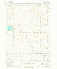
 1971 Rush Lake West1973 Print · USGSNorthwest Iowa's agricultural heartland is documented here in the early 1970s, centered on the rail junction at Leverett. Researchers can trace the intersecting lines of the Milwaukee Road and the Rock Island near Silver Lake and Pickerel Lake.
 - 1972 Map of Graettinger West, 1974 Print
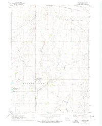
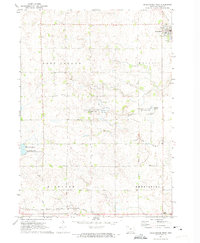 1972 Graettinger West1974 Print · USGSPalo Alto County was a land of wetlands and rail lines in the early seventies, centered on the town of Graettinger. Researchers can trace the heritage of local townships through landmarks like Lost Island Ch, Highland Cem, and the rural junction at Crippin Corners.
 - 1972 Map of Terril, 1974 Print
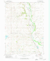
 1972 Terril1974 Print · USGSThe township borders of Dickinson and Emmet counties meet here in the early 1970s, centered on the rail-aligned town of Terril. Genealogists and local historians can trace the Chicago and North Western line, locate Fairview Cem, and explore the wetlands of Twelvemile Lake.
 - 1972 Map of Wallingford, 1974 Print
 1972 Wallingford1974 Print · USGSThe Des Moines River valley in northern Iowa is shown here in the early 1970s, as the railroad still connected the agricultural hubs of Wallingford and Raleigh. Researchers can locate several burial sites including Wallingford Cem and trace the complex network of drainage ditches and state game areas.
 - 1972 Map of Ayrshire, 1974 Print
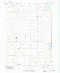
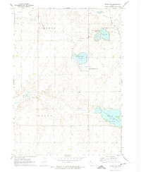
 1972 Ayrshire1974 Print · USGSIn the early seventies, the Palo Alto County landscape around Ayrshire was defined by its dual rail lines and vast drainage networks. Researchers can trace the path of the Chicago and North Western or locate the Silver Lake Cem near the shores of Silver Lake.
 - 1972 Map of Silver Lake, 1974 Print
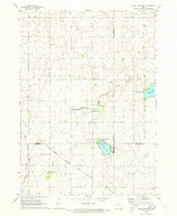
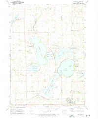
 1972 Silver Lake1974 Print · USGSClay and Palo Alto counties are captured here in the early 1970s, showing a landscape of glacial lakes and prairie conservation areas. Genealogists and researchers can locate the Township Cem and trace the route of the Chicago and North Western railroad past Virgin Lake.
 - 1972 Map of Ruthven, 1974 Print
 1972 Ruthven1974 Print · USGSThe Palo Alto County wetlands and the prairie town of Ruthven are captured here in the early seventies during a period of significant state land management. Researchers can locate Crown Hill Cem, trace the Chicago Milwaukee St Paul and Pacific rail line, and explore the shorelines of Trumbull Lake.
End of results
Showing maps 1-8 of 8
Top cities of Palo Alto County
- Emmetsburg historical maps
- Graettinger historical maps
- Ruthven historical maps
- Mallard historical maps
- Ayrshire historical maps
- Cylinder historical maps
See more
Frequently asked questions
- What are the different types of historical maps available for Palo Alto County?
- What is the oldest map of Palo Alto County?
- Where can I purchase historical maps of Palo Alto County for my home or office?
- Where can I download high-res historical maps of Palo Alto County?
- Are there historical topographic maps available for Palo Alto County?
- Is there historical aerial imagery available for Palo Alto County?
- Where are historical maps of Palo Alto County sourced from?