Old Maps of Palo Alto County, Iowa for Genealogy
Trace your family roots with 127 historic maps of Palo Alto County. These high-res maps reveal old neighborhoods, homesites, landmarks, and streets — helping you uncover where your ancestors lived and how the area evolved over time.
- Explore historic neighborhoods: Identify where your relatives may have lived in the 1800s or 1900s.
- Compare maps over time: Trace the changes in streets, buildings, and landmarks for multi-generational research.
- Perfect for genealogy & ancestry research: Used by family historians and researchers to map out lineage and migration.
These maps are an incredible resource for exploring your personal connection to Palo Alto County's past.
Palo Alto County, IA maps
(127)- 1954 Map of Fairmont, 1967 Print
 1954 Fairmont1967 Print · USGSThe prairie landscape of southern Minnesota and northern Iowa comes alive in this mid-century survey of the Coteau des Prairies. Genealogists and historians can trace the rail-connected growth of Fairmont and Blue Earth or locate family roots near St Kilian Ch and Union Slough National Wildlife Refuge.3 unique versions available
 - 1954 Map of Fort Dodge, 1968 Print
 1954 Fort Dodge1968 Print · USGSNorthwest Iowa is shown here during a period of steady industrial and rail activity in the mid-fifties. Researchers can trace the extensive rail lines connecting Fort Dodge to mining and manufacturing sites like Gypsum and Industry Station.3 unique versions available
 - 1957 Map of Fort Dodge
 1957 Fort Dodge1957 Print · USGSWest-central Iowa thrived as a network of rail-linked agricultural hubs and river towns during the mid-fifties. Researchers can trace the development of the Des Moines River valley and locate historic landmarks in Fort Dodge, Storm Lake, and Lehigh.
 - 1958 Map of Fort Dodge
 1958 Fort Dodge1958 Print · USGSWestern Iowa in the mid-1950s reveals a productive landscape of river-valley industry and prairie agricultural hubs. Researchers can trace the development of the Des Moines River corridor through Fort Dodge and locate vanished local landmarks near Coalville or Storm Lake.
 - 1958 Map of Fairmont
 1958 Fairmont1958 Print · USGSThe borderlands of southern Minnesota and northern Iowa come alive in the mid-1950s, showing a landscape defined by glacial lakes and rail-line commerce. Researchers can trace historic landmarks like Lakeside Laboratory, Gridley Station, and the Bancroft Wildlife Refuge across the prairie.
 - 1971 Map of Rush Lake East, 1973 Print
 1971 Rush Lake East1973 Print · USGSPalo Alto and Pocahontas counties meet in this early 1970s survey of the Iowa prairie's glacial lakes and agricultural wetlands. Researchers can trace the Chicago and North Western rail corridor or locate the Prairie View Ch and Rush Lake.
 - 1971 Map of Rush Lake West, 1973 Print
 1971 Rush Lake West1973 Print · USGSNorthwest Iowa's agricultural heartland is documented here in the early 1970s, centered on the rail junction at Leverett. Researchers can trace the intersecting lines of the Milwaukee Road and the Rock Island near Silver Lake and Pickerel Lake.
 - 1972 Map of Graettinger West, 1974 Print
 1972 Graettinger West1974 Print · USGSPalo Alto County was a land of wetlands and rail lines in the early seventies, centered on the town of Graettinger. Researchers can trace the heritage of local townships through landmarks like Lost Island Ch, Highland Cem, and the rural junction at Crippin Corners.
 - 1972 Map of Terril, 1974 Print
 1972 Terril1974 Print · USGSThe township borders of Dickinson and Emmet counties meet here in the early 1970s, centered on the rail-aligned town of Terril. Genealogists and local historians can trace the Chicago and North Western line, locate Fairview Cem, and explore the wetlands of Twelvemile Lake.
 - 1972 Map of Wallingford, 1974 Print
 1972 Wallingford1974 Print · USGSThe Des Moines River valley in northern Iowa is shown here in the early 1970s, as the railroad still connected the agricultural hubs of Wallingford and Raleigh. Researchers can locate several burial sites including Wallingford Cem and trace the complex network of drainage ditches and state game areas.
 - 1972 Map of Ayrshire, 1974 Print
 1972 Ayrshire1974 Print · USGSIn the early seventies, the Palo Alto County landscape around Ayrshire was defined by its dual rail lines and vast drainage networks. Researchers can trace the path of the Chicago and North Western or locate the Silver Lake Cem near the shores of Silver Lake.
 - 1972 Map of Silver Lake, 1974 Print
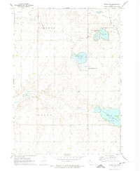 1972 Silver Lake1974 Print · USGSClay and Palo Alto counties are captured here in the early 1970s, showing a landscape of glacial lakes and prairie conservation areas. Genealogists and researchers can locate the Township Cem and trace the route of the Chicago and North Western railroad past Virgin Lake.
 - 1972 Map of Ruthven, 1974 Print
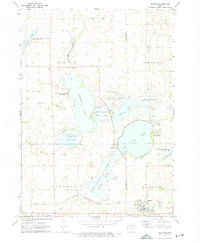 1972 Ruthven1974 Print · USGSThe Palo Alto County wetlands and the prairie town of Ruthven are captured here in the early seventies during a period of significant state land management. Researchers can locate Crown Hill Cem, trace the Chicago Milwaukee St Paul and Pacific rail line, and explore the shorelines of Trumbull Lake.
 - 1980 Map of Fenton
 1980 Fenton1980 Print · USGSKossuth and Palo Alto counties are captured here in the late seventies, showing a landscape of productive Iowa prairie and evolving small towns. Trace rural community roots at St Johns Cem, St Lukes Ch, and the settlement of Fairville.
 - 1980 Map of Depew
 1980 Depew1980 Print · USGSPalo Alto County farmland during the late seventies shows a landscape of meticulously drained townships and quiet rural centers. Genealogists and local historians can locate several family burial grounds, including Township Cem and St Johns Cem, alongside the small settlement of Depew.
 - 1980 Map of Seneca
 1980 Seneca1980 Print · USGSThe rural landscape of northern Iowa is captured here in the late twentieth century, showing the farmsteads and resource extraction sites along the East Fork Des Moines River. Genealogists and local historians can trace legacy sites like St Pauls Cem and Blakjer Ch.
 - 1980 Map of Mallard
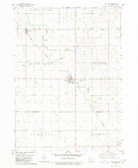 1980 Mallard1980 Print · USGSNorthwest Iowa's farm country is shown here during the late twentieth century, centered on the railroad hub of Mallard. Genealogists and historians can trace the local landscape through landmarks like St Marys Cem and the Chicago and North Western rail line.
 - 1980 Map of Ringsted
 1980 Ringsted1980 Print · USGSEmmet County, Iowa, is shown here in the late twentieth century as its agricultural landscape matured around established towns. Genealogists and historians can trace the streets of Ringsted, the settlement at Halfa, and the remnants of an Old Railroad Grade.
 - 1980 Map of Ingham Lake
 1980 Ingham Lake1980 Print · USGSEmmet County’s lake country is seen here in the late twentieth century, showing a landscape defined by conservation areas and glacial waters. Researchers can trace family roots at the Swan Lake Village Cem or locate the Old Railroad Grade near the Des Moines River.
 - 1980 Map of Plover
 1980 Plover1980 Print · USGSThe rural agricultural landscapes of Pocahontas and Palo Alto Counties are captured here in the late twentieth century. Genealogists and local historians can trace property lines and find quiet landmarks like Lincoln Cem, Ellington Cem, and the C & N W rail line.
 - 1980 Map of Graettinger East
 1980 Graettinger East1980 Print · USGSPalo Alto County in the early eighties shows a transition from traditional rail-side farming to modern conservation and education. Genealogists and historians can trace the Chicago Rock Island and Pacific tracks past Osgood and Valley View Cem.
 - 1980 Map of Emmetsburg
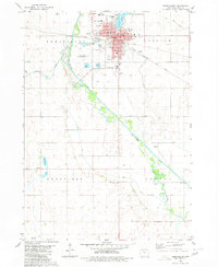 1980 Emmetsburg1980 Print · USGSEmmetsburg and its surrounding townships thrived at the intersection of major rail lines and the Des Moines River in the late 1970s. Researchers can trace the local landscape through landmarks like Evergreen Cemetery, St Marys Sch, and the Old Channel of the river.
 - 1980 Map of West Bend, 1981 Print
 1980 West Bend1981 Print · USGSWest Bend and its surrounding farmsteads are shown during the early 1980s at the junction of four Iowa counties. Researchers can trace the Chicago Rock Island and Pacific rail line between West Bend and Ottosen or locate family sites near McKnights Point and Union Cem.
 - 1980 Map of Whittemore, 1981 Print
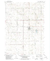 1980 Whittemore1981 Print · USGSWhittemore and its surrounding townships show a settled agricultural landscape in the early 1980s. Researchers can locate family roots at St Michaels Cem or St Pauls Cem and follow the old Chicago Milwaukee and Pacific rail corridor through town.
 - 1980 Map of Cylinder, 1981 Print
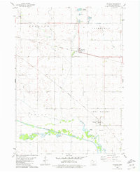 1980 Cylinder1981 Print · USGSPalo Alto County's agricultural heartland is documented here in the early eighties, showing the rail-and-river networks of Cylinder and Rodman. Genealogists can locate Riverside Cem and trace the paths of the Rock Island and Milwaukee Road railroads.
Showing maps 1-25 of 127
Top cities of Palo Alto County
- Emmetsburg historical maps
- Graettinger historical maps
- Ruthven historical maps
- Mallard historical maps
- Ayrshire historical maps
- Cylinder historical maps
See more
Frequently asked questions
- What are the different types of historical maps available for Palo Alto County?
- What is the oldest map of Palo Alto County?
- Where can I purchase historical maps of Palo Alto County for my home or office?
- Where can I download high-res historical maps of Palo Alto County?
- Are there historical topographic maps available for Palo Alto County?
- Is there historical aerial imagery available for Palo Alto County?
- Where are historical maps of Palo Alto County sourced from?