2020s Maps of Hickory Grove Township, Iowa
Explore 4 historic maps of Hickory Grove Township from the 2020s. These maps offer a rare glimpse into what life looked like during the 2020s — showing old roads, neighborhoods, homes, and landmarks that have changed or disappeared over time.
Whether you're researching your family's past, planning a metal detecting trip, or studying how Hickory Grove Township's landscape evolved across the 2020s, these high-resolution maps are a powerful tool for exploring the history of this region.
- Focus on a specific era: All maps on this page are from the 2020s, giving you a focused view of this time period.
- See what’s changed: Compare century-old streets, trails, and buildings to today's modern landscape using overlays and satellite layers.
- Research with precision: Use these maps for genealogy, historical research, land use analysis, or educational projects.
- View, download, or print: Maps are fully viewable online in high resolution, and can be downloaded or printed for your own records.
Start exploring Hickory Grove Township's history through authentic maps from the 2020s. This is your window into the past.
Hickory Grove Township, IA maps
(4)- 2022 Map of Dixon, 2022 Print
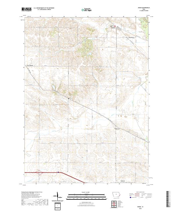 2022 Dixon2022 Print · USGSScott County, Iowa, is captured in this modern survey as a patchwork of productive farmland and small prairie towns. Researchers can trace family history at Dixon Cem and Kizer Cem or explore the settlements of Plainview and New Liberty.
 - 2022 Map of Donahue, 2022 Print
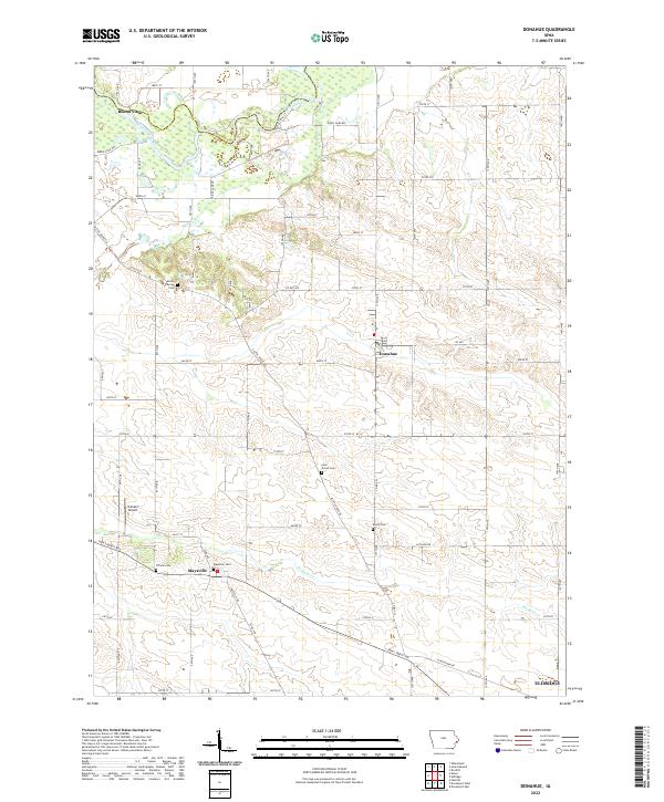 2022 Donahue2022 Print · USGSThis Scott County landscape showcases the rural heart of Iowa at the turn of the millennium. Genealogists can trace family roots through several local burial grounds, including Allens Grove Cem, Maysville Cem, and Linn Grove Cem.
 - 2022 Map of Davenport West, 2022 Print
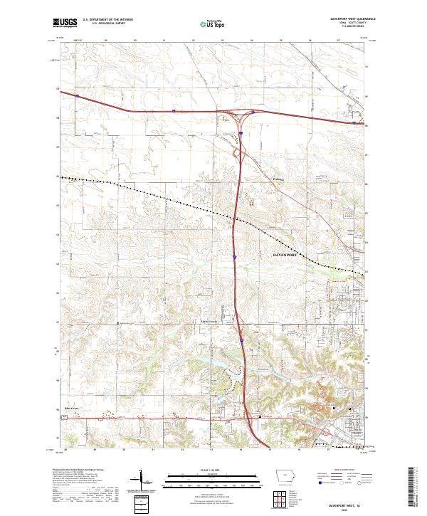 2022 Davenport West2022 Print · USGSWestern Scott County is shown in this recent survey as residential neighborhoods reach toward rural farmland. You can trace family history at the Fairmont Cem or explore the geography of Little Groves and the creeks of Duck Cr.
 - 2022 Map of Walcott, 2022 Print
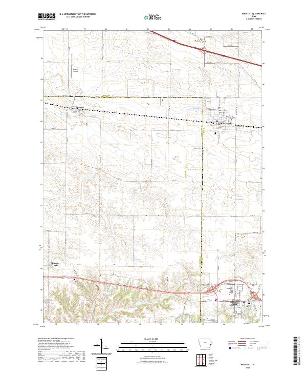 2022 Walcott2022 Print · USGSThe borderlands of Scott and Muscatine counties are shown in this modern survey of eastern Iowa. Researchers can locate family roots at Walcott Cemetery or Parr Cemetery and trace the agricultural development surrounding Stockton and Blue Grass.
End of results
Showing maps 1-4 of 4
Top cities near Hickory Grove Township
- Davenport historical maps
- Moline historical maps
- Bettendorf historical maps
- Rock Island historical maps
- Eldridge historical maps
- De Witt historical maps
See more
Top neighborhoods of Hickory Grove Township
Frequently asked questions
- What are the different types of historical maps available for Hickory Grove Township?
- What is the oldest map of Hickory Grove Township?
- Where can I purchase historical maps of Hickory Grove Township for my home or office?
- Where can I download high-res historical maps of Hickory Grove Township?
- Are there historical topographic maps available for Hickory Grove Township?
- Is there historical aerial imagery available for Hickory Grove Township?
- Where are historical maps of Hickory Grove Township sourced from?