2020s Maps of Milford Township, Iowa
Explore 2 historic maps of Milford Township from the 2020s. These maps offer a rare glimpse into what life looked like during the 2020s — showing old roads, neighborhoods, homes, and landmarks that have changed or disappeared over time.
Whether you're researching your family's past, planning a metal detecting trip, or studying how Milford Township's landscape evolved across the 2020s, these high-resolution maps are a powerful tool for exploring the history of this region.
- Focus on a specific era: All maps on this page are from the 2020s, giving you a focused view of this time period.
- See what’s changed: Compare century-old streets, trails, and buildings to today's modern landscape using overlays and satellite layers.
- Research with precision: Use these maps for genealogy, historical research, land use analysis, or educational projects.
- View, download, or print: Maps are fully viewable online in high resolution, and can be downloaded or printed for your own records.
Start exploring Milford Township's history through authentic maps from the 2020s. This is your window into the past.
Milford Township, IA maps
(2)- 2022 Map of Nevada, 2022 Print
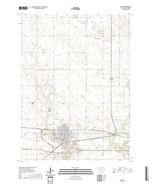 2022 Nevada2022 Print · USGSThe Story County seat of Nevada and the surrounding Iowa prairie are documented here in the early 2020s. Researchers can pinpoint several local burial sites including Nevada Cem, Knoll Cem, and Saint Patricks Cem, or trace the winding course of East Indian Creek.
 - 2023 Map of Ames East, 2023 Print
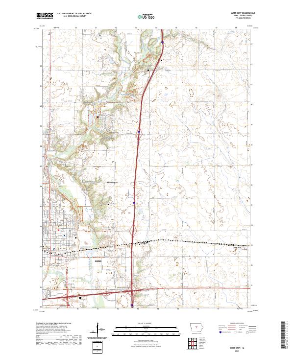 2023 Ames East2023 Print · USGSThe eastern edge of Ames and the surrounding Story County countryside are shown here in the 2020s. Researchers can trace family sites like Brouhard Cem and Arrasmith Cem or follow the South Skunk River corridor.
End of results
Showing maps 1-2 of 2
Top cities near Milford Township
- Ames historical maps
- Nevada historical maps
- Huxley historical maps
- Story City historical maps
- Slater historical maps
- Roland historical maps
See more
Frequently asked questions
- What are the different types of historical maps available for Milford Township?
- What is the oldest map of Milford Township?
- Where can I purchase historical maps of Milford Township for my home or office?
- Where can I download high-res historical maps of Milford Township?
- Are there historical topographic maps available for Milford Township?
- Is there historical aerial imagery available for Milford Township?
- Where are historical maps of Milford Township sourced from?