Old Maps of Warren County, Iowa for Metal Detecting
Plan your next treasure hunt with 132 historic maps of Warren County. Find old homesites, ghost towns, trails, and gathering spots that may be lost to time — perfect for identifying promising metal detecting locations.
- Locate forgotten sites: Uncover places like long-lost settlements, abandoned rail lines, or gathering spots.
- Plan better hunts: Use map overlays combined with LiDAR or satellite views to narrow in on historically rich areas.
- Made for detectorists: Thousands of hobbyists use these maps to discover relics, coins, and hidden history.
Use these historic maps to boost your research and find new opportunities beneath the surface of Warren County.
Warren County, IA maps
(132)- 1905 Map of Des Moines, 1954 Print
 1905 Des Moines1954 Print · USGSAt the dawn of the twentieth century, the state capital was a thriving rail hub where the Des Moines River met a complex network of iron rails. Genealogists and historians can trace early neighborhood development near the State Fairgrounds or locate family roots near rural landmarks like Red Brick School and Valley Junction.
 - 1907 Map of Des Moines
 1907 Des Moines1907 Print · USGSThe capital city and its surrounding coal-and-rail towns are shown in detail at the start of the twentieth century. Genealogists can locate family homesteads near Fort Des Moines or trace ancestors in vanished settlements like Oralabor, Saylorville, and Valley Junction.3 unique versions available
 - 1908 Map of Waukee
 1908 Waukee1908 Print · USGSDallas County at the turn of the century shows a landscape shaped by competing railroads and the winding Raccoon River. Genealogists and local historians can trace early schoolhouse locations like Valley Grove School and the original rail footprints of Waukee and Van Meter.2 unique versions available
 - 1910 Map of Milo
 1910 Milo1910 Print · USGSWarren and Marion counties are captured here at the height of their early 20th-century rural development, before the modernization of the road network. Genealogists can trace family footprints through numerous country schools like Prairie Creek School and the river-crossing at Hammondsburg Bridge.2 unique versions available
 - 1918 Map of Chariton
 1918 Chariton1918 Print · USGSChariton and its neighboring townships thrive as a rail-connected agricultural hub during the late First World War era. Trace family roots at Chariton or locate rural landmarks like Indianola Junction and the Horstman School.4 unique versions available
 - 1930 Map of Mitchellville
 1930 Mitchellville1930 Print · USGSCentral Iowa's fertile prairie and river valleys come alive in this late 1920s survey of the settlements between the Skunk and Des Moines rivers. Researchers can locate dozens of country schools like Nebo Sch and Peacock Sch or trace family roots near Camp Center Ch.3 unique versions available
 - 1931 Map of Indianola
 1931 Indianola1931 Print · USGSWarren County at the end of the 1920s reveals a landscape of thriving rail junctions and rural schoolhouses across central Iowa. Researchers can trace the path of the Chicago Great Western RR through Martensdale and locate local landmarks like Scotch Ridge Sch and the Orillia Mine.4 unique versions available
 - 1950 Map of New Virginia, 1978 Print
 1950 New Virginia1978 Print · USGSThe rural borders of Warren and Clarke counties come into focus at mid-century, showing a landscape of small settlements and neighborhood schoolhouses. Genealogists can trace family roots through numerous sites like Mt Tabor Cem, Ottawa Sch, and the Chicago Burlington and Quincy rail line.
 - 1951 Map of Osceola, 1953 Print
 1951 Osceola1953 Print · USGSSouthern Iowa's rural townships are captured here in the early fifties, showing the rail-centered growth of OSCEOLA and Murray. Researchers can trace the layout of numerous vanished country schoolhouses like Prairie Grove Sch and old burial sites such as Ebenezer Cem.2 unique versions available
 - 1951 Map of St. Charles, 1953 Print
 1951 St. Charles1953 Print · USGSMadison and Warren counties are seen here in the early 1950s, when a dense network of rail lines and country schools still knit these rural townships together. Genealogists and local historians can trace family locations near landmarks like Imes Bridge, St Charles Cem, and Blair Chapel.2 unique versions available
 - 1952 Map of New Virginia
 1952 New Virginia1952 Print · USGSSouthern Iowa rural life in the early fifties is mapped here in fine detail across the border of Warren and Clarke counties. Genealogists can locate family landmarks like Mt Tabor Cem, Ottawa, and numerous local schoolhouses including Quiet Dell Sch and Cool School.2 unique versions available
 - 1954 Map of Des Moines, 1973 Print
 1954 Des Moines1973 Print · USGSCentral Iowa's evolving landscape is captured here in the early seventies, just as major reservoirs were reshaping the river valleys. Genealogists and historians can trace the rail corridors of the Burlington Northern or locate family roots near Pella, Indianola, and Knoxville.2 unique versions available
 - 1956 Map of Des Moines
 1956 Des Moines1956 Print · USGSCentral Iowa in the mid-fifties shows a landscape defined by bustling rail hubs and deep-rooted agricultural research. Genealogists and researchers can trace the growth of Des Moines and Ames, locate the Sac and Fox Indian Reservation, or study the paths of the Skunk River and South Skunk River.
 - 1956 Map of Des Moines SW, 1958 Print
 1956 Des Moines SW1958 Print · USGSMid-century expansion across Polk County shows the growth of the state capital as suburban neighborhoods reached toward West Des Moines. Researchers can trace historic rail lines, old schools like Plainview Sch, and the layout of Drake University or Glendale Cemetery.4 unique versions available
 - 1956 Map of Des Moines SE, 1958 Print
 1956 Des Moines SE1958 Print · USGSMid-century Des Moines and its southeastern suburbs are captured here during a time of significant growth and transit expansion. Genealogists and historians can trace neighborhood landmarks like Fort Des Moines, the State Fairground, and numerous family-named cemeteries such as Oakwood Cem.4 unique versions available
 - 1956 Map of Des Moines, 1959 Print
 1956 Des Moines1959 Print · USGSThe Des Moines metro area is captured in the mid-1950s, showing a landscape defined by rapid suburban growth and deep-rooted military and rail history. Trace the development of Urbandale and Windsor Heights alongside landmarks like Camp Dodge and the State Fairgrounds.
 - 1957 Map of Des Moines
 1957 Des Moines1957 Print · USGSCentral Iowa's post-war landscape is defined here by the converging rail lines and river valleys that shaped its earliest settlements. Genealogists and historians can trace the paths of the Rock Island Railroad and locate community landmarks in Des Moines, Ames, and Newton.
 - 1965 Map of Pleasantville, 1966 Print
 1965 Pleasantville1966 Print · USGSIn the mid-1960s, this portion of Marion County was undergoing significant hydrological change as the reservoir system began to shape the river valleys. Researchers can trace the paths of three major rail lines and locate local landmarks like Swan Cem, the Scatling Mine, and the village of Beech.
 - 1965 Map of Milo, 1966 Print
 1965 Milo1966 Print · USGSWarren County’s rural townships come to life in the mid-1960s, showing the agricultural patterns and small-town centers of south-central Iowa. You can trace early settlement history through the Old Railroad Grade and several local burial grounds like Hammondsburg Cem and the IOOF Cem.
 - 1965 Map of Hartford, 1966 Print
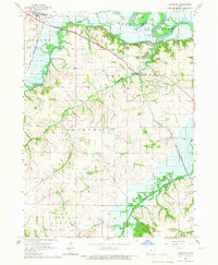 1965 Hartford1966 Print · USGSThe mid-1960s landscape of Warren County is defined by the valley of the Des Moines River and the emerging Lake Red Rock. Genealogists and researchers can trace the rail lines of the Chicago Rock Island and Pacific or locate burial sites like Black Cem and Carlisle Cem.
 - 1965 Map of Beech, 1966 Print
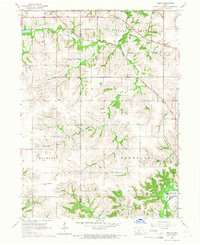 1965 Beech1966 Print · USGSMarion County farming communities and rail lines are documented here in the mid-1960s, just as regional water management began altering the landscape. Genealogists can locate family landmarks like Highland Cem, Motor Ch, and the rural settlements of Beech and Caloma.
 - 1965 Map of Commerce, 1966 Print
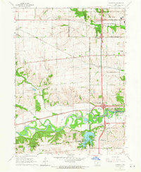 1965 Commerce1966 Print · USGSSuburban development meets Iowa farmland in the mid-1960s as the Raccoon River valley undergoes rapid change. Trace old rail lines like the Chicago Rock Island and Pacific or locate local landmarks like Valley High Sch and Sugar Creek Lake.2 unique versions available
 - 1969 Map of Des Moines
 1969 Des Moines1969 Print · USGSCentral Iowa's fertile plains and growing capital are captured here during the late sixties, a time of major highway expansion and reservoir construction. Genealogists and researchers can trace rural township boundaries, local cemeteries, and rail lines serving towns like Pella, Grinnell, and Oskaloosa.
 - 1972 Map of Scotch Ridge, 1974 Print
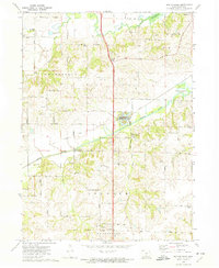 1972 Scotch Ridge1974 Print · USGSWarren County terrain in the early seventies shows a landscape shaped by the Middle River and the regional rail network. Genealogists and local historians can locate the Laverty Cem, North River Ch, and the community of Summerset along the railroad line.
 - 1972 Map of Rising Sun, 1974 Print
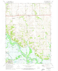 1972 Rising Sun1974 Print · USGSSoutheast of Des Moines in the early seventies, the river landscape around Carlisle and Rising Sun shows a blend of rural township life and growing suburban tracts. Researchers can trace the heritage of local families at Powers-Warren Cem and locate old rail corridors like the Chicago Rock Island and Pacific Railroad.
Showing maps 1-25 of 132
Top cities of Warren County
Frequently asked questions
- What are the different types of historical maps available for Warren County?
- What is the oldest map of Warren County?
- Where can I purchase historical maps of Warren County for my home or office?
- Where can I download high-res historical maps of Warren County?
- Are there historical topographic maps available for Warren County?
- Is there historical aerial imagery available for Warren County?
- Where are historical maps of Warren County sourced from?