1980s Maps of Warren County, Iowa
Explore 10 historic maps of Warren County from the 1980s. These maps offer a rare glimpse into what life looked like during the 1980s — showing old roads, neighborhoods, homes, and landmarks that have changed or disappeared over time.
Whether you're researching your family's past, planning a metal detecting trip, or studying how Warren County's landscape evolved across the 1980s, these high-resolution maps are a powerful tool for exploring the history of this region.
- Focus on a specific era: All maps on this page are from the 1980s, giving you a focused view of this time period.
- See what’s changed: Compare century-old streets, trails, and buildings to today's modern landscape using overlays and satellite layers.
- Research with precision: Use these maps for genealogy, historical research, land use analysis, or educational projects.
- View, download, or print: Maps are fully viewable online in high resolution, and can be downloaded or printed for your own records.
Start exploring Warren County's history through authentic maps from the 1980s. This is your window into the past.
Warren County, IA maps
(10)- 1982 Map of Lacona, 1983 Print
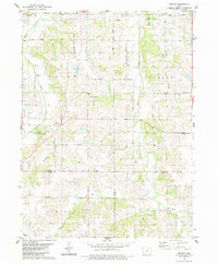
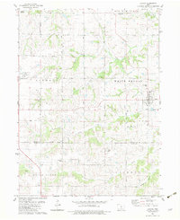 1982 Lacona1983 Print · USGSSouthern Iowa's rural landscape is captured here in the early eighties, centered on the community of Lacona. Family historians can locate numerous local burial sites including Graceland Cem and Fletcher Cem, alongside landmarks like Green Plain Ch.
 - 1982 Map of Newbern, 1983 Print
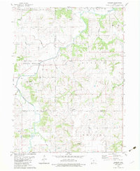 1982 Newbern1983 Print · USGSThe crossroads of Marion and Warren counties are captured here in the early eighties, showcasing a landscape of established family farms. Genealogists can trace local roots through numerous sites like St Paul Cem, Newbern Cem, and the community of Bauer.
 - 1983 Map of St. Charles
 1983 St. Charles1983 Print · USGSMadison County at the start of the 1980s shows a landscape of small river towns and agricultural grids. Genealogists and local historians can trace family roots through numerous rural burial grounds like St Charles Cem and Blair Chapel.
 - 1983 Map of New Virginia
 1983 New Virginia1983 Print · USGSNew Virginia and the surrounding Warren and Clarke County townships are documented here during the early eighties. Local researchers can trace the Old RR Grade or locate historic burial sites like Mt Tabor Cem and Liberty Cem.
 - 1983 Map of Medora
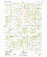
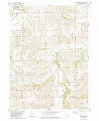
 1983 Medora1983 Print · USGSWarren County farm country comes into focus in the early 1980s, showcasing the rural road network and township divisions south of Indianola. Researchers can trace family history through sites like Indian Valley Cem, the crossroads at Medora, and Bethel Chapel.2 unique versions available
 - 1983 Map of Indianola
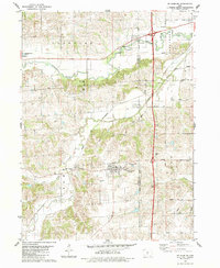
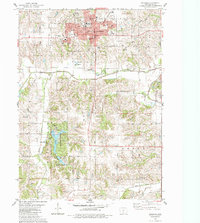 1983 Indianola1983 Print · USGSIndianola and central Warren County are captured here in the early eighties, documenting the city's growth and its surrounding recreational lands. Genealogists and local historians can locate Simpson College, trace the Chicago and North Western rail line, or find family sites like Hewitt Cem and Browns Chapel.
 - 1983 Map of Truro
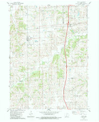 1983 Truro1983 Print · USGSTruro and the surrounding Iowa farm country are captured here in the early 1980s as modern interstate travel began to eclipse older transit routes. Researchers can trace the Old Railroad Grade or locate family plots at Worthing Cem and Fremont Cem.
 - 1983 Map of Martensdale, 1984 Print
 1983 Martensdale1984 Print · USGSWarren County in the early eighties shows a landscape of steady agricultural communities linked by a dense network of township roads. Genealogists can trace family locations near St Marys, the Wallace Cem, and rural churches like Center Chapel.
 - 1984 Map of Indianola
 1984 Indianola1984 Print · USGSSouth-central Iowa in the mid-1980s reveals a patchwork of established rail hubs and significant new conservation areas. Trace the Chicago and North Western rail lines and explore rural landmarks like Lake Ahquabi State Park or the Strip Mine near Knoxville.
 - 1984 Map of Des Moines, 1985 Print
 1984 Des Moines1985 Print · USGSCentral Iowa's heartland is captured in the mid-1980s as suburban growth met long-standing farm and rail infrastructure. Genealogists and researchers can trace the reaches of the Chicago and North Western through Maxwell or locate Laurel Hill Cem and Camp Dodge Military Reservation.2 unique versions available
End of results
Showing maps 1-10 of 10
Top cities of Warren County
Frequently asked questions
- What are the different types of historical maps available for Warren County?
- What is the oldest map of Warren County?
- Where can I purchase historical maps of Warren County for my home or office?
- Where can I download high-res historical maps of Warren County?
- Are there historical topographic maps available for Warren County?
- Is there historical aerial imagery available for Warren County?
- Where are historical maps of Warren County sourced from?