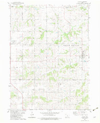
1982 Map of Lacona
USGS Topo · Published 1983About this map
Lacona sits at the confluence of several southern Iowa waterways, anchoring a rural landscape defined by the townships of White Breast, Liberty, and Otter Creek. This early 1980s topography documents a region where the legacy of rail and agriculture remains visible, specifically through the remaining Railroad Grade that once connected these farming communities. The settlement of Liberty Center serves the western portion of the map, situated near the Southeast Warren High Sch.
Find a feature on this map
24 named features on this map. Tap any name to fly to it.
Don’t see what you’re looking for? This feature index may not catch every label — zoom into the map to look around manually.
Map Details
Editions of this 1982 Lacona Map
This is the sole edition of this map. No revisions or reprints were ever made.
Other maps of this area

1910 · Milo
USGS Topo · 1:62,500

1918 · Chariton
USGS Topo · 1:62,500

1931 · Indianola
USGS Topo · 1:62,500

1950 · New Virginia
USGS Topo · 1:62,500

1952 · New Virginia
USGS Topo · 1:62,500

1954 · Des Moines
USGS Topo · 1:250,000

1956 · Des Moines
USGS Topo · 1:250,000

1957 · Des Moines
USGS Topo · 1:250,000

1965 · Milo
USGS Topo · 1:24,000
1965 · Beech
USGS Topo · 1:24,000