1950 Map of New Virginia
USGS Topo · Published 1978About this map
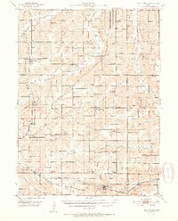
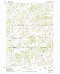
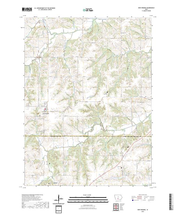
New Virginia serves as a primary hub within this mid-century survey of the rural landscape where Warren, Clarke, and Lucas counties meet. The region is defined by a dense network of country schools and churches, illustrating the established agrarian social structure of the era. Educational landmarks like Squaw Valley Sch, Indian Valley Sch, and Hawkeye Sch are scattered across the terrain, while spiritual centers such as Mt Tabor Ch and Bethel Chapel sit near their respective family burial grounds. To the south, the Chicago Burlington and Quincy railroad cuts through Woodburn and Ottawa, facilitating the movement of goods along Brush Creek and the White Breast Cr. The mapping of townships like Virginia, Fremont, and Jackson provides a clear view of how these interior Iowa communities were organized around small settlements and seasonal waterways like Squaw Creek and Otter Creek.
Find a feature on this map
72 named features on this map. Tap any name to fly to it.
Don’t see what you’re looking for? This feature index may not catch every label — zoom into the map to look around manually.
Map Details
Editions of this 1950 New Virginia Map
This is the sole edition of this map. No revisions or reprints were ever made.
Historical Maps of Osceola Through Time
8 maps found