
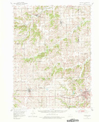
1951 Map of Osceola
USGS Topo · Published 1953About this map
Osceola serves as a major rail hub in the southern portion of this mid-century landscape, where the Chicago Burlington And Quincy railroad intersects with significant local landmarks like the Clarke County Hospital and the sprawling Maple Hill Cem. The town of Murray to the west and Truro to the north further anchor the regional economy, which is defined by a dense network of rural schoolhouses and country churches. The map reveals a transition between these settled towns and the agricultural backcountry, marked by dozens of numbered districts such as School No 5 and School No 9.
Find a feature on this map
52 named features on this map. Tap any name to fly to it.
Don’t see what you’re looking for? This feature index may not catch every label — zoom into the map to look around manually.
Map Details
Editions of this 1951 Osceola Map
2 editions found
Other maps of this area

1931 · Indianola
USGS Topo · 1:62,500

1950 · New Virginia
USGS Topo · 1:62,500

1951 · St. Charles
USGS Topo · 1:62,500

1951 · Afton
USGS Topo · 1:62,500

1952 · New Virginia
USGS Topo · 1:62,500

1952 · Winterset
USGS Topo · 1:62,500

1954 · Centerville
USGS Topo · 1:250,000

1954 · Omaha
USGS Topo · 1:250,000

1954 · Des Moines
USGS Topo · 1:250,000

1955 · Nebraska City
USGS Topo · 1:250,000