Old Maps of Estates West, Sergeant Bluff for Academic Research
Study the evolution of Estates West with 11 high-resolution historic maps. Whether you're teaching, researching, or modeling changes in land use, these maps provide essential visual documentation of urban, environmental, and geographic change.
- Analyze long-term change: Track patterns in development, transportation, and natural features.
- Ideal for environmental or urban studies: Support academic projects with primary historical map data.
- Use in the classroom or lab: Educators and researchers rely on these maps to bring historical context to life.
These maps are a powerful tool for teaching, research, and visualizing how Estates West has changed over the decades.
Estates West, Sergeant Bluff maps
(11)- 1955 Map of Sioux City, 1959 Print
 1955 Sioux City1959 Print · USGSThe Missouri River valley in the mid-fifties is captured here during a time of major engineering and social transition. Genealogists and historians can trace the foundations of Gavins Point Dam, tribal boundaries on the Santee Sioux Indian Reservation, and local landmarks like the Norfolk State Hospital.4 unique versions available
 - 1958 Map of Sioux City
 1958 Sioux City1958 Print · USGSThe Missouri River valley in the late fifties was a bustling intersection of tribal lands, rail corridors, and river towns. Genealogists can trace family roots through specific rural sites like Daisy Valley School, St Johns Church and School, and Yankton State Hospital.
 - 1959 Map of Sioux City
 1959 Sioux City1959 Print · USGSThe tri-state region surrounding the Missouri River is captured here in the late fifties, showing the convergence of Nebraska, South Dakota, and Iowa. Researchers can trace rural lineages through numerous country schoolhouses like Cemetery School and the many numbered Washington School districts.
 - 1964 Map of Sergeant Bluff, 1965 Print
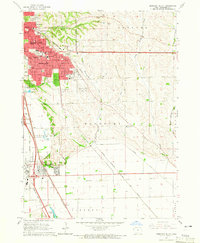 1964 Sergeant Bluff1965 Print · USGSSioux City and Sergeant Bluff are captured during a decade of significant suburban and institutional growth in the mid-1960s. Researchers can trace the development of Morningside College, find family plots in Graceland Park Cemetery, or locate old landmarks like Redeemer Chapel.3 unique versions available
 - 1986 Map of Sioux City South
 1986 Sioux City South1986 Print · USGSThe tri-state borderlands of Iowa, Nebraska, and South Dakota come into focus in the mid-1980s as a landscape of tribal lands and rail corridors. Researchers can trace the extensive boundaries of the Winnebago Indian Reservation and find local landmarks like Morningside College and Martin Field.2 unique versions available
 - 1993 Map of Sergeant Bluff, 1995 Print
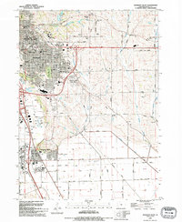 1993 Sergeant Bluff1995 Print · USGSThe Missouri River valley south of Sioux City shows a mix of educational growth and industrial transit in the early nineties. Researchers can trace the development of Sergeant Bluff and locate historic sites like Claypit Cem, Morningside College, and the Old Railroad Grade.
 - 2010 Map of Sergeant Bluff, 2010 Print
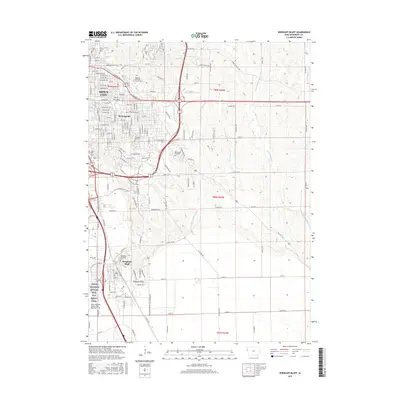
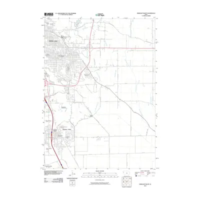 2010 Sergeant Bluff2010 Print · USGSCovers Estates West, including Sioux City, Sergeant Bluff, and other nearby areas
 - 2013 Map of Sergeant Bluff, 2013 Print
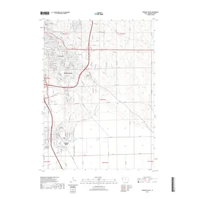
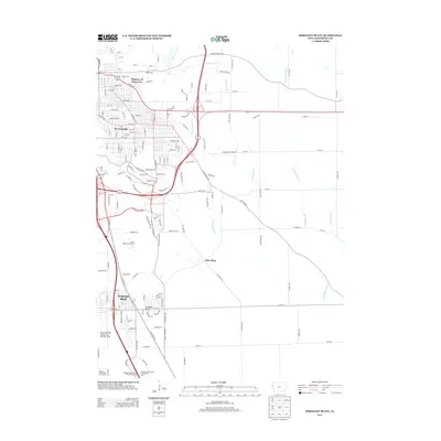 2013 Sergeant Bluff2013 Print · USGSCovers Estates West, including Sioux City, Sergeant Bluff, and other nearby areas
 - 2015 Map of Sergeant Bluff, 2015 Print
 2015 Sergeant Bluff2015 Print · USGSCovers Estates West, including Sioux City, Sergeant Bluff, and other nearby areas
 - 2018 Map of Sergeant Bluff, 2018 Print
 2018 Sergeant Bluff2018 Print · USGSCovers Estates West, including Sioux City, Sergeant Bluff, and other nearby areas
 - 2022 Map of Sergeant Bluff, 2022 Print
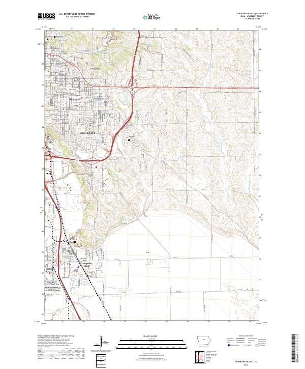 2022 Sergeant Bluff2022 Print · USGSWoodbury County in the 2020s shows the continued growth of Sioux City and its educational institutions. Genealogists can locate Woodbury Township Cemetery or Floyd Cemetery, while tracing changes near Sergeant Bluff and the airport.
End of results
Showing maps 1-11 of 11
Frequently asked questions
- What are the different types of historical maps available for Estates West?
- What is the oldest map of Estates West?
- Where can I purchase historical maps of Estates West for my home or office?
- Where can I download high-res historical maps of Estates West?
- Are there historical topographic maps available for Estates West?
- Is there historical aerial imagery available for Estates West?
- Where are historical maps of Estates West sourced from?