2020s Maps of Lancaster Township, Kansas
Explore 6 historic maps of Lancaster Township from the 2020s. These maps offer a rare glimpse into what life looked like during the 2020s — showing old roads, neighborhoods, homes, and landmarks that have changed or disappeared over time.
Whether you're researching your family's past, planning a metal detecting trip, or studying how Lancaster Township's landscape evolved across the 2020s, these high-resolution maps are a powerful tool for exploring the history of this region.
- Focus on a specific era: All maps on this page are from the 2020s, giving you a focused view of this time period.
- See what’s changed: Compare century-old streets, trails, and buildings to today's modern landscape using overlays and satellite layers.
- Research with precision: Use these maps for genealogy, historical research, land use analysis, or educational projects.
- View, download, or print: Maps are fully viewable online in high resolution, and can be downloaded or printed for your own records.
Start exploring Lancaster Township's history through authentic maps from the 2020s. This is your window into the past.
Lancaster Township, KS maps
(6)- 2022 Map of Bendena, 2022 Print
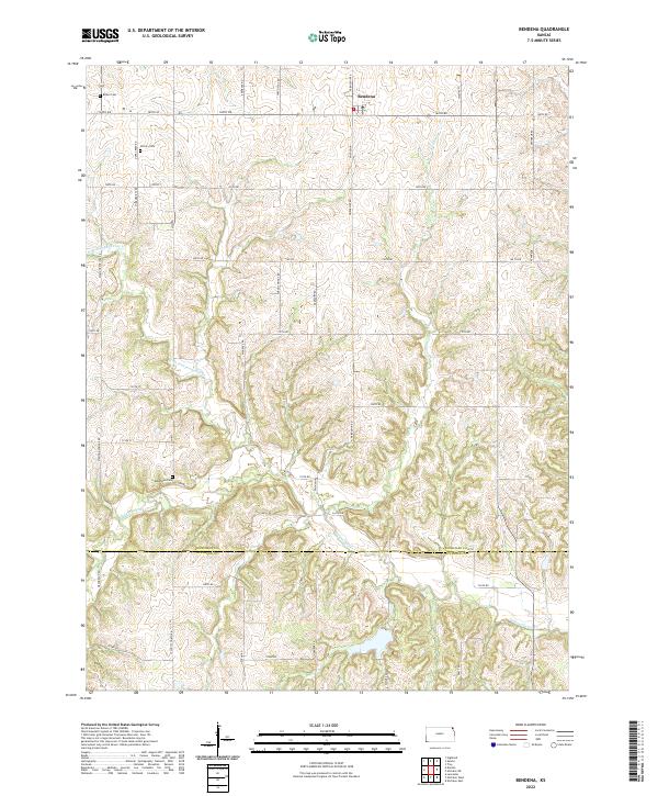 2022 Bendena2022 Print · USGSNortheastern Kansas farmland is mapped here in the early 2020s, showing the rural road network and township lines of Doniphan County. Genealogists can locate family sites and burial grounds like Victory Cem and Bittner Cem near the town of Bendena.
 - 2022 Map of Everest, 2022 Print
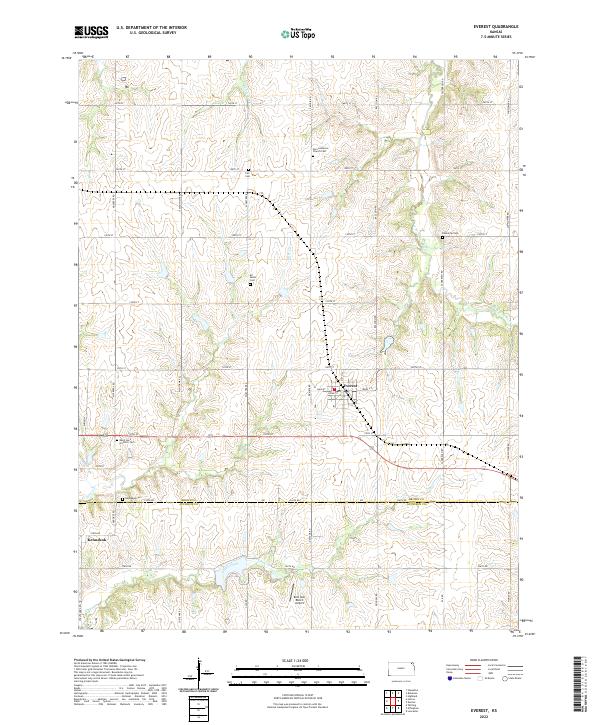 2022 Everest2022 Print · USGSEverest and the Brown-Atchison county line are shown here in the modern era, where agricultural traditions and local heritage remain deeply rooted in the landscape. Genealogists can trace family sites at Zion Lutheran Church Cem, Kennekuk Cem, and the old settlement of Kennekuk.
 - 2022 Map of Denton, 2022 Print
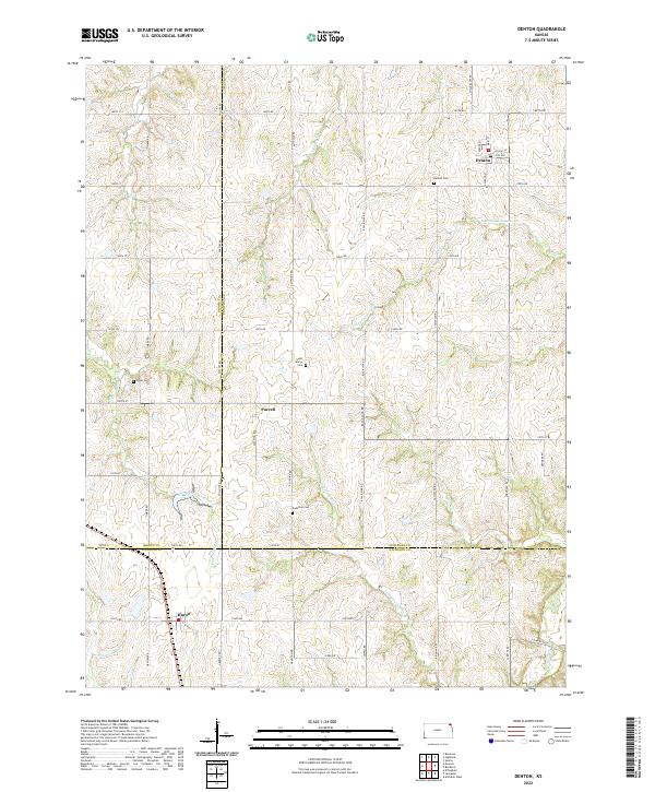 2022 Denton2022 Print · USGSNortheast Kansas farmland at the junction of three counties reveals a landscape of enduring rural settlements and family legacies. Genealogists can trace sites like Saint Mary's Cem and Anderson Cem near the small communities of Purcell and Denton.
 - 2022 Map of Lancaster, 2022 Print
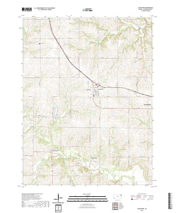 2022 Lancaster2022 Print · USGSIn the early twenty-first century, Atchison County maintains its rural agricultural roots. Researchers can trace family history at Old Huron Cem and Monrovia Cem, or explore the old crossroads at Farmington and Lancaster.
 - 2022 Map of Effingham, 2022 Print
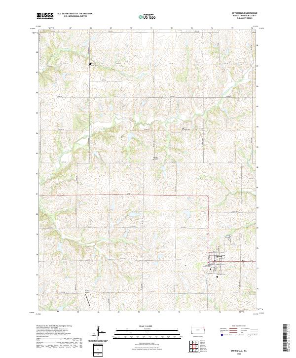 2022 Effingham2022 Print · USGSEffingham and the surrounding Atchison County townships are shown here in the 2020s, highlighting a landscape shaped by the Glacier Uplands. Genealogists and local historians can locate Saint Anns Catholic Cem, Forest Grove Cem, and the rural Strafuss Airport.
 - 2022 Map of Atchison West, 2022 Print
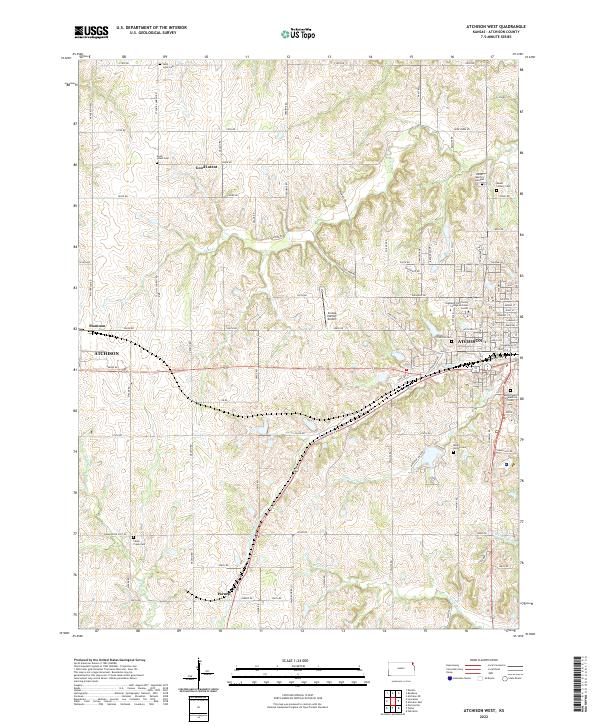 2022 Atchison West2022 Print · USGSAtchison and its western Kansas environs are documented here in the early twenty-first century as the city meets the prairie. Genealogists can trace numerous local burial grounds like Saint Louis Cem and Mount Vernon Cem, or locate landmarks such as Amelia Earhart Airport.
End of results
Showing maps 1-6 of 6
Top cities near Lancaster Township
- Atchison historical maps
- Horton historical maps
- Shannon historical maps
- Troy historical maps
- Nortonville historical maps
- Effingham historical maps
See more
Top neighborhoods of Lancaster Township
Frequently asked questions
- What are the different types of historical maps available for Lancaster Township?
- What is the oldest map of Lancaster Township?
- Where can I purchase historical maps of Lancaster Township for my home or office?
- Where can I download high-res historical maps of Lancaster Township?
- Are there historical topographic maps available for Lancaster Township?
- Is there historical aerial imagery available for Lancaster Township?
- Where are historical maps of Lancaster Township sourced from?