1800s (19th Century) Maps of Bronson, Kansas
Explore 2 historic maps of Bronson from the 1800s (19th Century). These maps offer a rare glimpse into what life looked like during the 1800s — showing old roads, neighborhoods, homes, and landmarks that have changed or disappeared over time.
Whether you're researching your family's past, planning a metal detecting trip, or studying how Bronson's landscape evolved across the 1800s, these high-resolution maps are a powerful tool for exploring the history of this region.
- Focus on a specific era: All maps on this page are from the 1800s, giving you a focused view of this time period.
- See what’s changed: Compare century-old streets, trails, and buildings to today's modern landscape using overlays and satellite layers.
- Research with precision: Use these maps for genealogy, historical research, land use analysis, or educational projects.
- View, download, or print: Maps are fully viewable online in high resolution, and can be downloaded or printed for your own records.
Start exploring Bronson's history through authentic maps from the 1800s. This is your window into the past.
Bronson, KS maps
(2)- 1886 Map of Iola
 1886 Iola1886 Print · USGSEastern Kansas was a bustling corridor of competing rail lines and river settlements during the mid-1880s. Genealogists and historians can trace the early footprints of Osage Mission, the growth of Iola, and vanished stops like Warnersburgh along the winding Neosho River.
 - 1893 Map of Iola
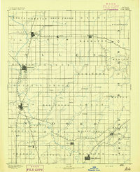 1893 Iola1893 Print · USGSSoutheast Kansas at the end of the nineteenth century is captured here as a thriving rail and river corridor. Genealogists and historians can trace the early development of Iola, Erie, and Humboldt or locate smaller settlements like Odense and Veitsburgh.2 unique versions available
End of results
Showing maps 1-2 of 2
Top cities near Bronson
- Mound City historical maps
- La Harpe historical maps
- Moran historical maps
- Blue Mound historical maps
- Uniontown historical maps
- Kincaid historical maps
See more
Frequently asked questions
- What are the different types of historical maps available for Bronson?
- What is the oldest map of Bronson?
- Where can I purchase historical maps of Bronson for my home or office?
- Where can I download high-res historical maps of Bronson?
- Are there historical topographic maps available for Bronson?
- Is there historical aerial imagery available for Bronson?
- Where are historical maps of Bronson sourced from?