2020s Maps of Brown County, Kansas
Explore 21 historic maps of Brown County from the 2020s. These maps offer a rare glimpse into what life looked like during the 2020s — showing old roads, neighborhoods, homes, and landmarks that have changed or disappeared over time.
Whether you're researching your family's past, planning a metal detecting trip, or studying how Brown County's landscape evolved across the 2020s, these high-resolution maps are a powerful tool for exploring the history of this region.
- Focus on a specific era: All maps on this page are from the 2020s, giving you a focused view of this time period.
- See what’s changed: Compare century-old streets, trails, and buildings to today's modern landscape using overlays and satellite layers.
- Research with precision: Use these maps for genealogy, historical research, land use analysis, or educational projects.
- View, download, or print: Maps are fully viewable online in high resolution, and can be downloaded or printed for your own records.
Start exploring Brown County's history through authentic maps from the 2020s. This is your window into the past.
Brown County, KS maps
(21)- 2021 Map of Big Lake, 2021 Print
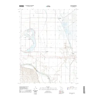 2021 Big Lake2021 Print · USGSCovers Brown County, including Big Lake, Fortescue, and other nearby areas
 - 2021 Map of Rulo, 2021 Print
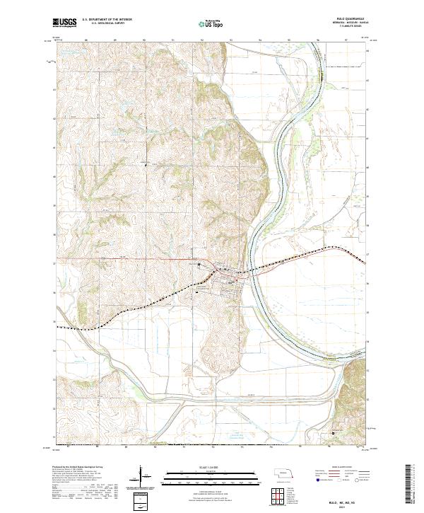 2021 Rulo2021 Print · USGSSoutheast Nebraska meets Missouri at the river bend during the early 2020s. Genealogists and local historians can trace the streets of Rulo and locate rural burial sites such as Heater Cem and Franklin Cem among the Missouri River bluffs.
 - 2021 Map of Salem, 2021 Print
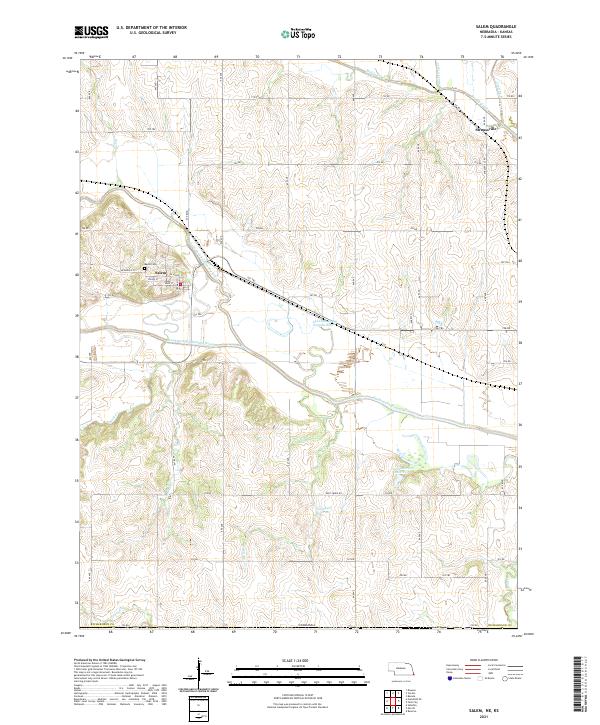 2021 Salem2021 Print · USGSThe river valleys of Richardson County come into focus in this recent survey of the Nebraska-Kansas border region. Genealogists and historians can trace the streets of Salem and Straussville, or locate family sites near Maple Cem and Wildcat Cr.
 - 2021 Map of Falls City, 2021 Print
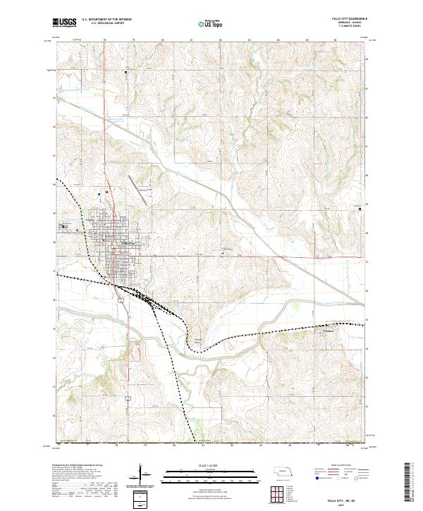 2021 Falls City2021 Print · USGSRichardson County at the start of the 2020s shows a landscape defined by the Big Nemaha River and its winding tributaries. Genealogists and local historians can locate the Richardson County Courthouse in Falls City or trace ancestors at Zion Cem and Silver Creek Cem.
 - 2021 Map of Humboldt SE, 2021 Print
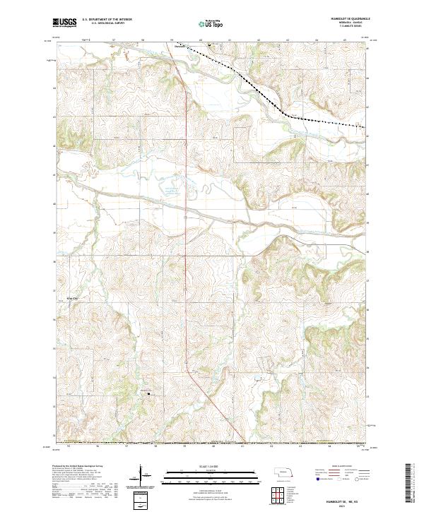 2021 Humboldt SE2021 Print · USGSRichardson County's river bottoms and rural uplands are shown in detail as they appeared in the early 2020s. Researchers can locate family heritage sites like Wild Rose Cem and Iliff Cem or trace the winding course of the North Fork Big Nemaha River.
 - 2022 Map of Morrill, 2022 Print
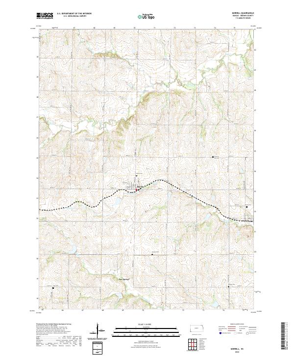 2022 Morrill2022 Print · USGSNortheastern Kansas farm country remains centered on the town of Morrill in this recent survey. Researchers can locate numerous local burial sites like Morrill Cem and Shelton Cem while tracing the waters of Terrapin Cr and Mulberry Cr.
 - 2022 Map of Reserve, 2022 Print
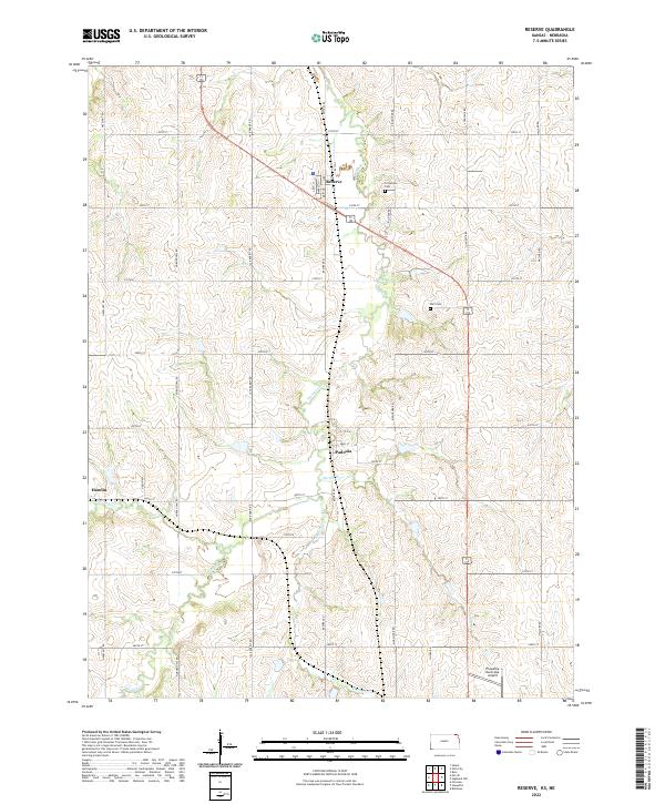 2022 Reserve2022 Print · USGSNorthern Brown County remains a landscape of quiet prairie hamlets and rural farmsteads in the early twenty-first century. Researchers can trace the layout of small communities like Reserve and Padonia, or locate family sites near Cornelison Cem and Hart Cem.
 - 2022 Map of Woodlawn, 2022 Print
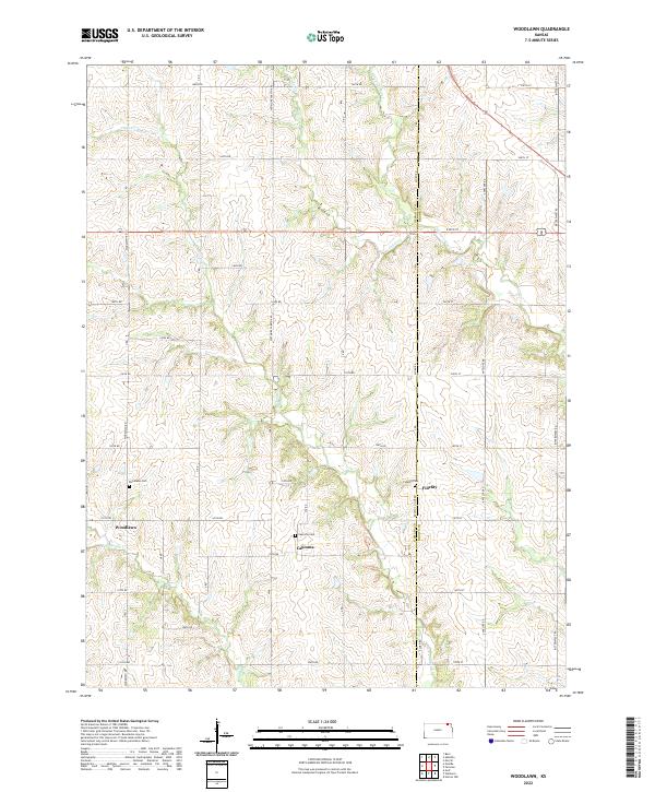 2022 Woodlawn2022 Print · USGSThe Nemaha and Brown County line comes alive in this modern survey of eastern Kansas prairie settlements. Genealogists and local historians can trace family ties at Woodlawn Cem and Capioma Cem or follow the early paths of the Delaware River.
 - 2022 Map of Sabetha, 2022 Print
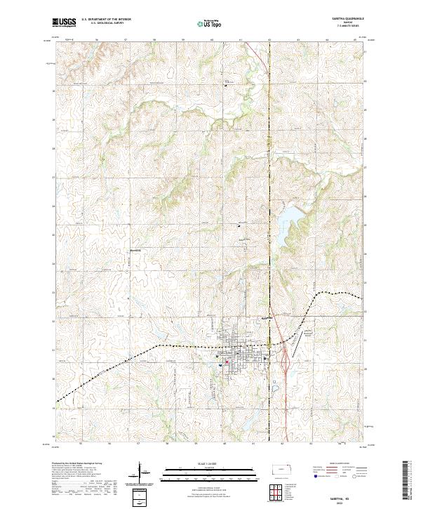 2022 Sabetha2022 Print · USGSSabetha sits on the Nemaha and Brown County line during this period of established agricultural growth. Genealogists can trace family roots at Albany Cem, Sabetha Cem, and the settlement at Berwick near the Delaware River.
 - 2022 Map of Everest, 2022 Print
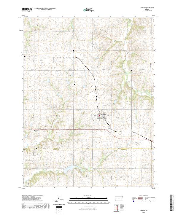 2022 Everest2022 Print · USGSEverest and the Brown-Atchison county line are shown here in the modern era, where agricultural traditions and local heritage remain deeply rooted in the landscape. Genealogists can trace family sites at Zion Lutheran Church Cem, Kennekuk Cem, and the old settlement of Kennekuk.
 - 2022 Map of Hiawatha, 2022 Print
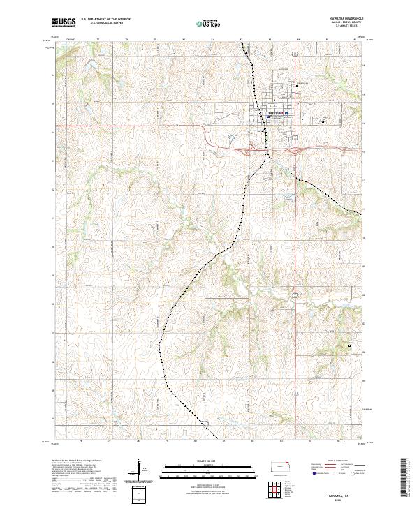 2022 Hiawatha2022 Print · USGSBrown County at the start of the 2020s shows a landscape of enduring agricultural patterns and established town grids. Researchers can trace rural property orientations along Jack Rabbit Rd or locate ancestral sites at Mount Hope Cem and Hiawatha Cem.
 - 2022 Map of Wetmore, 2022 Print
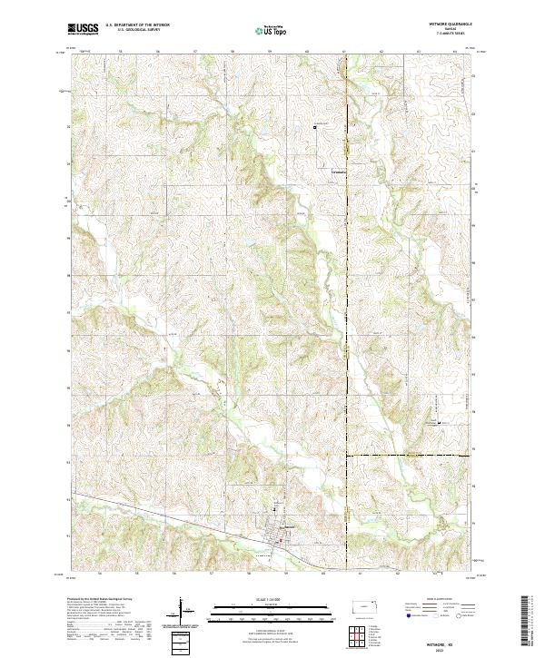 2022 Wetmore2022 Print · USGSNortheastern Kansas farm country is mapped here in the early twenty-first century, showing the borderlands of Nemaha, Brown, and Jackson counties. Local historians can trace family plots at Wetmore Cem and Granada Cem or follow the winding courses of Wolfley Cr and Muddy Cr.
 - 2022 Map of White Cloud, 2022 Print
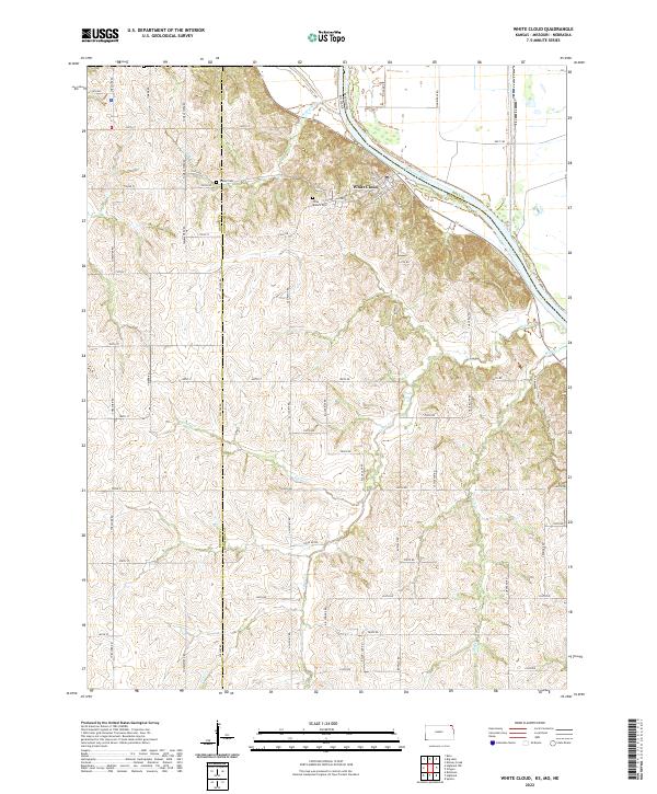 2022 White Cloud2022 Print · USGSThe riverside community of White Cloud and the rugged bluffs of the Missouri River valley are documented in this contemporary survey. Local researchers can trace family landmarks like Olive Branch Cem, Tesson Cem, and the high ridges of Chalk Bluff.
 - 2022 Map of Denton, 2022 Print
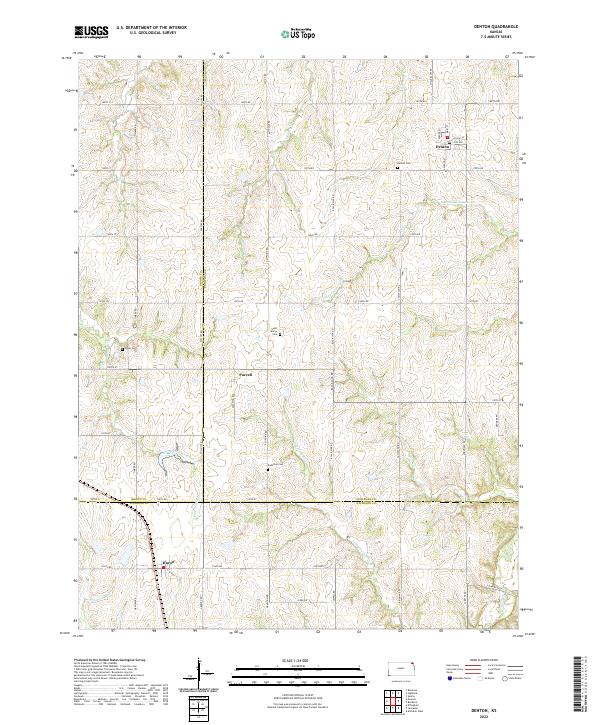 2022 Denton2022 Print · USGSNortheast Kansas farmland at the junction of three counties reveals a landscape of enduring rural settlements and family legacies. Genealogists can trace sites like Saint Mary's Cem and Anderson Cem near the small communities of Purcell and Denton.
 - 2022 Map of Highland NW, 2022 Print
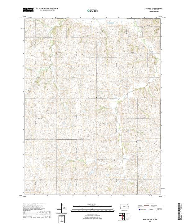 2022 Highland NW2022 Print · USGSBrown County, Kansas, is documented here in the early 2020s, showing a rural landscape defined by prairie drainages and family cemeteries. Genealogists can locate Laus Creek Cem, Pleasant Hill Cem, and Kenyon Cem along the quiet reaches of Noharts Cr.
 - 2022 Map of Robinson, 2022 Print
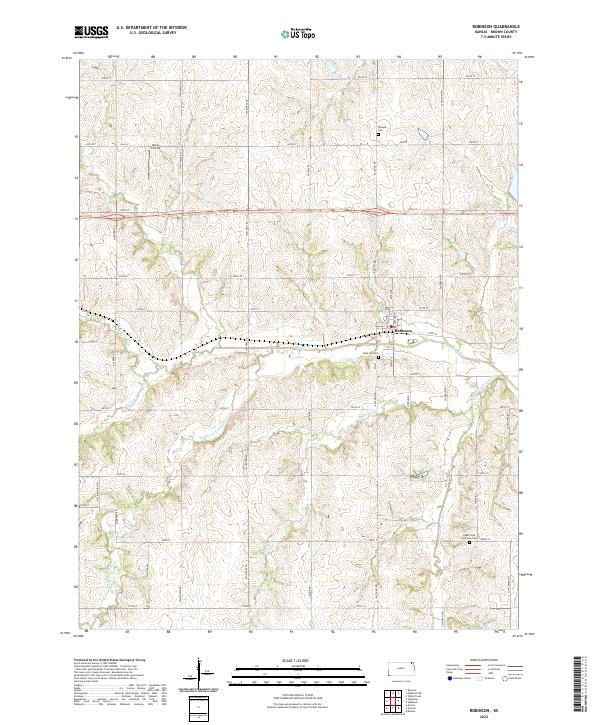 2022 Robinson2022 Print · USGSRobinson and the surrounding Brown County prairies are documented here in the early twenty-first century. Researchers can locate family landmarks including Ununda Cem, Rose Hill Cem, and the riverbanks along the Wolf River.
 - 2022 Map of Highland, 2022 Print
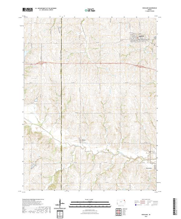 2022 Highland2022 Print · USGSHighland and the surrounding Doniphan County countryside appear here in the early twenty-first century, showcasing a landscape of established educational roots and river-valley farming. Genealogists and local researchers can trace the vicinity of Highland Community College, Oak Hill Cem, and the small community of Leona.
 - 2022 Map of Horton, 2022 Print
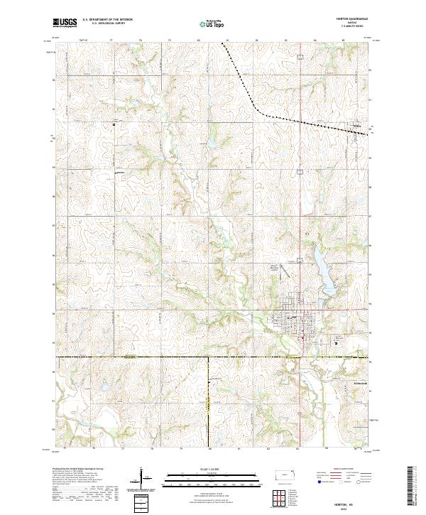 2022 Horton2022 Print · USGSHorton and its surrounding Kansas prairie townships appear here in the early twenty-first century as the tri-county corner of Brown, Jackson, and Atchison. Genealogists can locate family burial sites at Saint Peter's Cem and Wheatland Cem or trace the early paths of Mercier and Willis.
 - 2023 Map of Horton NW, 2023 Print
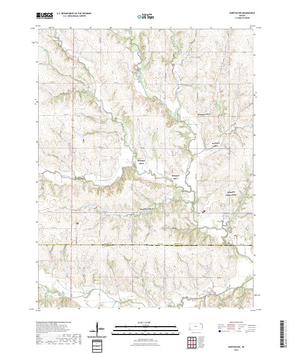 2023 Horton NW2023 Print · USGSThe Kickapoo reservation lands in Kansas are documented here in the early twenty-first century, showing the intersection of tribal locations and river valley topography. Researchers can pinpoint the Kickapoo Tribal Center and numerous community sites such as Kickapoo Site 6 along the Delaware River.
 - 2023 Map of Fairview, 2023 Print
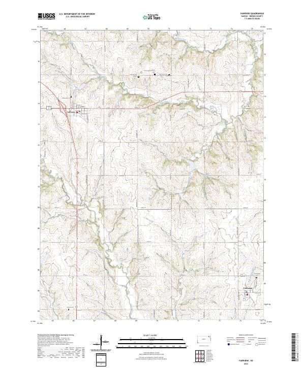 2023 Fairview2023 Print · USGSFairview and Powhattan anchor this Brown County landscape as it appeared in the early twenty-first century. Genealogists and local historians can locate numerous rural burial sites including Lambertson Cem, Old Fairview Cem, and Comet Cem.
 - 2023 Map of Big Lake, 2023 Print
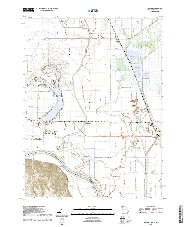 2023 Big Lake2023 Print · USGSThe Missouri River floodplain near the Nebraska border shows a landscape of former river channels and reclaimed marshlands in the early 2020s. Genealogists can locate rural burial grounds like Sauer Cem and Partlow Cem or trace the legacy of the BNSF Railway through Bigelow.
End of results
Showing maps 1-21 of 21
Top cities of Brown County
- Hiawatha historical maps
- Horton historical maps
- Everest historical maps
- Fairview historical maps
- Morrill historical maps
- Padonia historical maps
See more
Frequently asked questions
- What are the different types of historical maps available for Brown County?
- What is the oldest map of Brown County?
- Where can I purchase historical maps of Brown County for my home or office?
- Where can I download high-res historical maps of Brown County?
- Are there historical topographic maps available for Brown County?
- Is there historical aerial imagery available for Brown County?
- Where are historical maps of Brown County sourced from?