1950s Maps of Franklin County, Kansas
Explore 9 historic maps of Franklin County from the 1950s. These maps offer a rare glimpse into what life looked like during the 1950s — showing old roads, neighborhoods, homes, and landmarks that have changed or disappeared over time.
Whether you're researching your family's past, planning a metal detecting trip, or studying how Franklin County's landscape evolved across the 1950s, these high-resolution maps are a powerful tool for exploring the history of this region.
- Focus on a specific era: All maps on this page are from the 1950s, giving you a focused view of this time period.
- See what’s changed: Compare century-old streets, trails, and buildings to today's modern landscape using overlays and satellite layers.
- Research with precision: Use these maps for genealogy, historical research, land use analysis, or educational projects.
- View, download, or print: Maps are fully viewable online in high resolution, and can be downloaded or printed for your own records.
Start exploring Franklin County's history through authentic maps from the 1950s. This is your window into the past.
Franklin County, KS maps
(9)- 1950 Map of Lawrence
 1950 Lawrence1950 Print · USGSMid-century Kansas and Missouri come alive in this map of the river-valley corridors just as the interstate era was beginning. Researchers can trace the legacy of major rail lines like the Union Pacific RR and locate ancestral roots in towns from Lawrence to Harrisonville.
 - 1956 Map of Pomona, 1957 Print
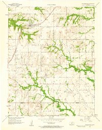
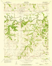 1956 Pomona1957 Print · USGSFranklin County's agricultural and rail landscape is captured here in the mid-1950s, centered on the oxbows of the Marais Des Cygnes River. Genealogists and local historians can trace old school districts like South Illinois Sch or follow the Atchison Topeka and Santa Fe line through Richter and Pomona.2 unique versions available
 - 1956 Map of Wellsville, 1957 Print
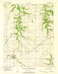
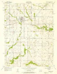 1956 Wellsville1957 Print · USGSWellsville was a thriving railroad and agricultural hub in the mid-1950s, centered on the Santa Fe and Topeka Atchison line. Genealogists and historians can trace rural family roots through the Rock Creek Sch and cemeteries like Walnut Creek Cem.2 unique versions available
 - 1956 Map of Ottawa North, 1957 Print
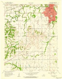
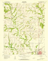 1956 Ottawa North1957 Print · USGSFranklin County in the mid-fifties shows a landscape of small rural schoolhouses and historic rail junctions. Genealogists can trace family roots through sites like Mt Evergreen Cem, Centropolis, and the Old Indian Boundary line.3 unique versions available
 - 1956 Map of Le Loup, 1957 Print
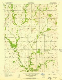 1956 Le Loup1957 Print · USGSThe rural landscape of Franklin County is captured here in the mid-1950s, where the railroad ties together farming communities and small country schools. Researchers can trace the Old Indian Boundary or locate historic sites like Indian Cem, Tauy Ch, and Le Loup.2 unique versions available
 - 1956 Map of Williamsburg, 1958 Print
 1956 Williamsburg1958 Print · USGSWilliamsburg and Silkville appear in the mid-fifties at a time when the railroad still anchored the life of these eastern Kansas townships. Genealogists can trace family sites at Mt Hope Cem and St Patricks Sch, or follow the diagonal of the Old Indian Boundary.3 unique versions available
 - 1956 Map of Ottawa South, 1958 Print
 1956 Ottawa South1958 Print · USGSOttawa and the surrounding Franklin County townships are captured here during a period of steady mid-century growth. Genealogists and local historians can trace rural schoolhouses like Valley View Sch, family landmarks such as Wycoff Community Hall, and several burial grounds including Highland Cemetery and Antioch Cem.4 unique versions available
 - 1956 Map of Lawrence, 1967 Print
 1956 Lawrence1967 Print · USGSEastern Kansas and the Missouri border country are captured here during the mid-century transition to the interstate era. Genealogists and local historians can trace family-named terrain like Summers Mound and the footprint of Sunflower Ordnance Works near Baldwin City.4 unique versions available
 - 1957 Map of Waverly, 1958 Print
 1957 Waverly1958 Print · USGSCoffey County in the late 1950s was a landscape defined by the prairie-spanning rails and rural crossroads. Local researchers can trace family landmarks like Boothe Hall, Rosemont Ch, and the historical path of the Old Indian Boundary.2 unique versions available
End of results
Showing maps 1-9 of 9
Top cities of Franklin County
- Ottawa historical maps
- Wellsville historical maps
- Centropolis historical maps
- Pomona historical maps
- Pomona historical maps
- Peoria historical maps
See more
Frequently asked questions
- What are the different types of historical maps available for Franklin County?
- What is the oldest map of Franklin County?
- Where can I purchase historical maps of Franklin County for my home or office?
- Where can I download high-res historical maps of Franklin County?
- Are there historical topographic maps available for Franklin County?
- Is there historical aerial imagery available for Franklin County?
- Where are historical maps of Franklin County sourced from?