1970s Maps of Gove City, Kansas
Explore 2 historic maps of Gove City from the 1970s. These maps offer a rare glimpse into what life looked like during the 1970s — showing old roads, neighborhoods, homes, and landmarks that have changed or disappeared over time.
Whether you're researching your family's past, planning a metal detecting trip, or studying how Gove City's landscape evolved across the 1970s, these high-resolution maps are a powerful tool for exploring the history of this region.
- Focus on a specific era: All maps on this page are from the 1970s, giving you a focused view of this time period.
- See what’s changed: Compare century-old streets, trails, and buildings to today's modern landscape using overlays and satellite layers.
- Research with precision: Use these maps for genealogy, historical research, land use analysis, or educational projects.
- View, download, or print: Maps are fully viewable online in high resolution, and can be downloaded or printed for your own records.
Start exploring Gove City's history through authentic maps from the 1970s. This is your window into the past.
Gove City, KS maps
(2)- 1972 Map of Orion NE, 1974 Print
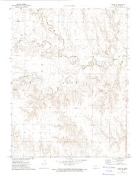 1972 Orion NE1974 Print · USGSGove County in the early 1970s displays a rural landscape shaped by the winding branches of Hackberry Creek. Researchers can trace the layout of Gove (Gove City) and locate local industrial sites like the Quarry or Gravel Pit along the prairie breaks.
 - 1972 Map of Gove, 1974 Print
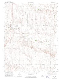 1972 Gove1974 Print · USGSThe High Plains of western Kansas are documented here in the early 1970s, centered on the community of Gove (Gove City). Genealogists and local historians can trace the rural landscape through the Gove Cem and the drainage of Hackberry Creek.
End of results
Showing maps 1-2 of 2
Top cities near Gove City
Top neighborhoods of Gove City
Frequently asked questions
- What are the different types of historical maps available for Gove City?
- What is the oldest map of Gove City?
- Where can I purchase historical maps of Gove City for my home or office?
- Where can I download high-res historical maps of Gove City?
- Are there historical topographic maps available for Gove City?
- Is there historical aerial imagery available for Gove City?
- Where are historical maps of Gove City sourced from?