Old Maps of Greeley County, Kansas for Genealogy
Trace your family roots with 135 historic maps of Greeley County. These high-res maps reveal old neighborhoods, homesites, landmarks, and streets — helping you uncover where your ancestors lived and how the area evolved over time.
- Explore historic neighborhoods: Identify where your relatives may have lived in the 1800s or 1900s.
- Compare maps over time: Trace the changes in streets, buildings, and landmarks for multi-generational research.
- Perfect for genealogy & ancestry research: Used by family historians and researchers to map out lineage and migration.
These maps are an incredible resource for exploring your personal connection to Greeley County's past.
Greeley County, KS maps
(135)- 1890 Map of Granada, 1962 Print
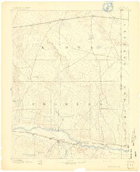
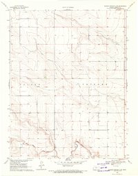
 1890 Granada1962 Print · USGSSoutheast Colorado at the close of the nineteenth century was a landscape of expanding steel and water. Researchers can trace early railroad developments along the Missouri Pacific Railroad and locate pioneer outposts like Ellis Ranch or Granada.
 - 1892 Map of Cheyenne Wells
 1892 Cheyenne Wells1892 Print · USGSEastern Colorado during the early frontier era is documented here as the railroad transformed the High Plains. Genealogists and historians can trace the vital iron link of the Union Pacific Railroad through settlements like Cheyenne Wells and Arapahoe.
 - 1892 Map of Granada
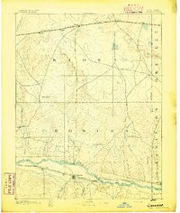
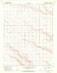
 1892 Granada1892 Print · USGSThe high plains of eastern Colorado and western Kansas meet here in the late nineteenth century during a period of rapid railroad expansion. Researchers can trace the dual tracks of the Missouri Pacific Railroad and the Arkansas River route, locating early ranching landmarks like Ellis Rancho and Watsons Rancho.
 - 1894 Map of Cheyenne Wells
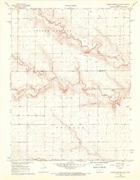
 1894 Cheyenne Wells1894 Print · USGSEastern Colorado in the late nineteenth century is a landscape of expansive ranchland defined by the Union Pacific Railroad. Researchers can trace early railroad settlements like Cheyenne Wells and Arapahoe or follow the courses of Ladder Creek and White Woman Creek.6 unique versions available
 - 1894 Map of Granada
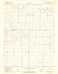
 1894 Granada1894 Print · USGSSoutheast Colorado and the Kansas borderlands appear here in the 1890s as the railroad and river systems reshaped the plains. Genealogists and historians can trace early holdings like Ellis Ranch and vanished rail stops from Arden to Adana.4 unique versions available
 - 1954 Map of Lamar, 1964 Print
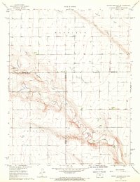
 1954 Lamar1964 Print · USGSSoutheastern Colorado and the Kansas borderlands appear here in the mid-fifties, dominated by the vital Arkansas River irrigation network. Researchers can trace the development of river towns like Lamar and La Junta alongside the Amity Cemetery and several major reservoirs.3 unique versions available
 - 1955 Map of Scott City, 1969 Print
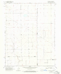
 1955 Scott City1969 Print · USGSWestern Kansas in the mid-fifties is captured here as a landscape of rural schoolhouses and significant rail corridors. Family historians can trace the locations of Skyline and Beaver Creek Schools or follow the Union Pacific line through Oakley and Sharon Springs.4 unique versions available
 - 1958 Map of Lamar
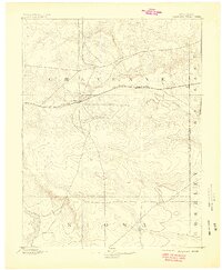
 1958 Lamar1958 Print · USGSThe High Plains of Eastern Colorado and Western Kansas in the late fifties reveal a landscape tied to the Arkansas River and the rails. Trace the heritage of the river valley through Fort Lyon, the Atchison Topeka and Santa Fe RR, and rural landmarks like Kendrick Church.2 unique versions available
 - 1958 Map of Scott City
 1958 Scott City1958 Print · USGSWestern Kansas at the peak of the post-war era reveals a landscape of high-plains agriculture and vital rail junctions. Genealogists and historians can trace old country school sites like Prairie Bell School, the landmark Chalk Pyramids, and small stops along the Union Pacific and Missouri Pacific.
 - 1968 Map of Sharon Springs 3 NE, 1969 Print
 1968 Sharon Springs 3 NE1969 Print · USGSWestern Kansas ranching and farm lands are captured here in the late sixties, where the high plains meet the Colorado border. Researchers can trace land use through a network of water sources including South Ladder Creek and numerous Well sites across Colony and Weskan.2 unique versions available
 - 1968 Map of Sharon Springs 4 NW, 1969 Print
 1968 Sharon Springs 4 NW1969 Print · USGSWestern Kansas high plains and the winding branches of the local creek system are captured here in the late sixties. Researchers can trace the Bethany Cem and the complex confluence of Middle Ladder Creek and Sharon Springs Creek.2 unique versions available
 - 1968 Map of Sharon Springs 3 NW, 1969 Print
 1968 Sharon Springs 3 NW1969 Print · USGSThe High Plains of western Kansas in the late sixties reveal a landscape of vast townships and scattered prairie homesteads. Genealogists can locate Stockholm Cem and trace the meandering paths of South Fork Middle Ladder Creek through the townships of Weskan and Colony.2 unique versions available
 - 1968 Map of Sharon Springs 4 NE, 1969 Print
 1968 Sharon Springs 4 NE1969 Print · USGSThe high plains of Western Kansas appear here in the late sixties, where the deep incisions of Ladder Creek break the flat horizon. Researchers can trace the rural infrastructure of the day, from the West Bethany Ch to local industrial sites like a Sandpit and Gravel Pit.2 unique versions available
 - 1968 Map of Towner SE, 1971 Print
 1968 Towner SE1971 Print · USGSThe high plains along the Colorado-Kansas border are captured here in the late sixties, showing the vast township divisions of the prairie. Local researchers can trace the course of Wild Horse Creek and locate early infrastructure like the cross-country Pipeline and named tracts like Richland.
 - 1968 Map of Towner, 1971 Print
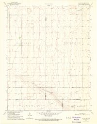
 1968 Towner1971 Print · USGSThe Colorado-Kansas state line is captured here in the late sixties as a landscape of isolated rail towns and prairie settlements. Genealogists and historians can locate the Towner Cem or trace the path of the Missouri Pacific through Towner and Colokan.
 - 1969 Map of Cheyenne Wells 4 NE, 1971 Print
 1969 Cheyenne Wells 4 NE1971 Print · USGSThe Colorado and Kansas borderlands meet in the late sixties along the winding path of South Ladder Creek. Genealogists and researchers can trace township boundaries and find family-named landmarks like Wells or the remote Colony and Weskan districts.3 unique versions available
 - 1969 Map of Cheyenne Wells 4 SE, 1971 Print
 1969 Cheyenne Wells 4 SE1971 Print · USGSHigh plains life at the Colorado and Kansas border is captured here during the late sixties. Genealogists and local historians can trace the rural landscape near Colony, locating the local Cem and the winding path of White Woman Creek.3 unique versions available
 - 1970 Map of Selkirk SW, 1971 Print
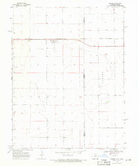
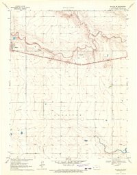
 1970 Selkirk SW1971 Print · USGSGreeley and Hamilton counties meet in this western Kansas landscape surveyed during the late 1960s. Researchers can trace the section-line roads and administrative divisions of Harrison and Richland townships across this high plains terrain.
 - 1970 Map of Sharon Springs 4 SE, 1971 Print
 1970 Sharon Springs 4 SE1971 Print · USGSWestern Kansas townships near the Greeley and Wichita county line are captured here in the early 1970s. Local researchers can locate family landmarks like St Theresa Ch, a community Cem, and the drainage of Ladder Creek in the townships of Tribune and Leoti.2 unique versions available
 - 1970 Map of Sharon Springs 3 SE, 1971 Print
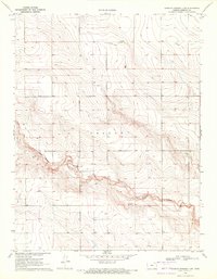
 1970 Sharon Springs 3 SE1971 Print · USGSGreeley County is captured in the early 1970s as a quiet agricultural expanse defined by the townships of Colony and Tribune. Genealogists and historians can trace old property boundaries near White Woman Creek and locate early industrial sand and gravel pits.2 unique versions available
 - 1970 Map of Sharon Springs 4 SW, 1971 Print
 1970 Sharon Springs 4 SW1971 Print · USGSGreeley County in the early seventies shows a landscape of wide-open townships and a growing energy footprint. Genealogists and local historians can locate early industrial sites like the Gravel Pit and numerous resource markers such as a Gas Well or Well scattered across Tribune.2 unique versions available
 - 1970 Map of Selkirk SE, 1971 Print
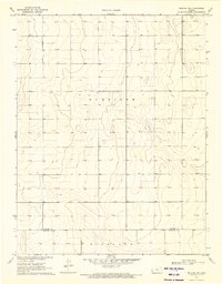
 1970 Selkirk SE1971 Print · USGSFour Kansas counties converge in the High Plains during the early seventies, revealing a landscape of large-scale agriculture and early energy development. Genealogists and historians can locate a rural Cem and trace the paths of a Pipeline and scattered Oil Wells.
 - 1970 Map of Selkirk, 1971 Print
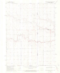
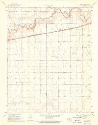 1970 Selkirk1971 Print · USGSThe High Plains of western Kansas are captured here in the early 1970s, centered on the railroad siding of Selkirk. Genealogists and historians can trace the Missouri Pacific rail line, find the local cemetery, and follow the path of White Woman Creek.
 - 1970 Map of Sharon Springs 3 SW, 1972 Print
 1970 Sharon Springs 3 SW1972 Print · USGSWestern Kansas rangeland in the early 1970s is defined here by the winding course of White Woman Creek and the high ground of Colony. Researchers can trace local industry and land use through labels for a Gravel Pit, Sandpit, and a remote Landing Strip.2 unique versions available
 - 1970 Map of Selkirk NW, 1972 Print
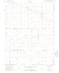
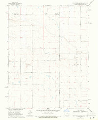
 1970 Selkirk NW1972 Print · USGSGreeley County at the start of the 1970s centered on the rail-driven economy of the High Plains. You can trace the Missouri Pacific line through Tribune and Whitelaw or locate rural landmarks like the Pringle Ranch Landing Field and local Gravel Pits.
Showing maps 1-25 of 135
Frequently asked questions
- What are the different types of historical maps available for Greeley County?
- What is the oldest map of Greeley County?
- Where can I purchase historical maps of Greeley County for my home or office?
- Where can I download high-res historical maps of Greeley County?
- Are there historical topographic maps available for Greeley County?
- Is there historical aerial imagery available for Greeley County?
- Where are historical maps of Greeley County sourced from?