1800s (19th Century) Maps of Hamilton, Kansas
Explore 3 historic maps of Hamilton from the 1800s (19th Century). These maps offer a rare glimpse into what life looked like during the 1800s — showing old roads, neighborhoods, homes, and landmarks that have changed or disappeared over time.
Whether you're researching your family's past, planning a metal detecting trip, or studying how Hamilton's landscape evolved across the 1800s, these high-resolution maps are a powerful tool for exploring the history of this region.
- Focus on a specific era: All maps on this page are from the 1800s, giving you a focused view of this time period.
- See what’s changed: Compare century-old streets, trails, and buildings to today's modern landscape using overlays and satellite layers.
- Research with precision: Use these maps for genealogy, historical research, land use analysis, or educational projects.
- View, download, or print: Maps are fully viewable online in high resolution, and can be downloaded or printed for your own records.
Start exploring Hamilton's history through authentic maps from the 1800s. This is your window into the past.
Hamilton, KS maps
(3)- 1885 Map of Eureka
 1885 Eureka1885 Print · USGSGreenwood County comes alive in the mid-1880s as a hub for competing rail lines and prairie settlements. Genealogists and collectors can trace early family sites near Eureka, Severy, and Piedmont, or follow the winding courses of the Fall River and Spring Creek.
 - 1888 Map of Eureka
 1888 Eureka1888 Print · USGSGreenwood County during the 1880s was a bustling intersection of rail and river commerce as the prairie was organized into formal townships. Researchers can trace the development of early settlements like Eureka and Severy along the path of the Atchison Topeka and Santa Fe Railroad.
 - 1894 Map of Eureka
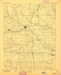 1894 Eureka1894 Print · USGSGreenwood County comes alive in the late nineteenth century as three major railroads transform the prairie into a network of cattle towns and rail hubs. Genealogists can trace family roots in early settlements like Piedmont, Hamilton, and the now-quiet Cave Springs.5 unique versions available
End of results
Showing maps 1-3 of 3
Top cities near Hamilton
- Eureka historical maps
- Madison historical maps
- Toronto historical maps
- Quincy historical maps
- Virgil historical maps
Frequently asked questions
- What are the different types of historical maps available for Hamilton?
- What is the oldest map of Hamilton?
- Where can I purchase historical maps of Hamilton for my home or office?
- Where can I download high-res historical maps of Hamilton?
- Are there historical topographic maps available for Hamilton?
- Is there historical aerial imagery available for Hamilton?
- Where are historical maps of Hamilton sourced from?