Old Maps of Pawnee County, Kansas
Explore 37 old maps of Pawnee County, spanning from 1889 to today. These high-resolution historic maps reveal how streets, neighborhoods, landmarks, and natural features evolved over time — perfect for genealogy, metal detecting, research, and local history exploration.
What you can do with these maps:
- See how Pawnee County changed over time: Compare historical maps to modern-day views to trace roads, homesites, rail lines & more.
- View detailed metadata: Each map includes creators, publishers, year, scale, and archive source.
- Overlay maps with satellite & LiDAR: Visualize the past alongside modern tools to explore terrain & human change.
- Trusted historical sources: Maps sourced from the USGS, Library of Congress, and other archives.
- Access maps your way: View online, download high-res files, or order prints for personal or research use.
Start exploring old maps of Pawnee County to uncover forgotten places, hidden landmarks, and the deep history beneath your feet.
Pawnee County, KS maps
(37)- 1889 Map of Larned, 1957 Print
 1889 Larned1957 Print · USGSCovers Pawnee County, including Larned, Garfield, and other nearby areas
 - 1889 Map of Kinsley, 1962 Print
 1889 Kinsley1962 Print · USGSCovers Pawnee County, including Kinsley, Greensburg, and other nearby areas
 - 1891 Map of Great Bend
 1891 Great Bend1891 Print · USGSCovers Pawnee County, including Great Bend, Ellinwood, and other nearby areas
 - 1891 Map of Larned
 1891 Larned1891 Print · USGSCovers Pawnee County, including Larned, Garfield, and other nearby areas5 unique versions available
 - 1892 Map of Ness
 1892 Ness1892 Print · USGSCovers Pawnee County, including Ness City, Jetmore, and other nearby areas
 - 1892 Map of Kinsley
 1892 Kinsley1892 Print · USGSCovers Pawnee County, including Kinsley, Greensburg, and other nearby areas
 - 1893 Map of Great Bend
 1893 Great Bend1893 Print · USGSCovers Pawnee County, including Great Bend, Ellinwood, and other nearby areas5 unique versions available
 - 1894 Map of Kinsley
 1894 Kinsley1894 Print · USGSCovers Pawnee County, including Kinsley, Greensburg, and other nearby areas8 unique versions available
 - 1894 Map of Ness
 1894 Ness1894 Print · USGSCovers Pawnee County, including Ness City, Jetmore, and other nearby areas5 unique versions available
 - 1955 Map of Great Bend, 1966 Print
 1955 Great Bend1966 Print · USGSCovers Pawnee County, including Hays, Great Bend, and other nearby areas4 unique versions available
 - 1955 Map of Pratt, 1968 Print
 1955 Pratt1968 Print · USGSCovers Pawnee County, including Dodge City, Pratt, and other nearby areas3 unique versions available
 - 1957 Map of Great Bend
 1957 Great Bend1957 Print · USGSCovers Pawnee County, including Hays, Great Bend, and other nearby areas
 - 1958 Map of Great Bend
 1958 Great Bend1958 Print · USGSCovers Pawnee County, including Hays, Great Bend, and other nearby areas2 unique versions available
 - 1959 Map of Pratt
 1959 Pratt1959 Print · USGSCovers Pawnee County, including Dodge City, Pratt, and other nearby areas2 unique versions available
 - 1960 Map of Pawnee Rock, 1961 Print
 1960 Pawnee Rock1961 Print · USGSCovers Pawnee County, including Great Bend, Buffalo Township, and other nearby areas2 unique versions available
 - 1969 Map of Radium, 1971 Print
 1969 Radium1971 Print · USGSCovers Pawnee County, including Radium, Ray, and other nearby areas
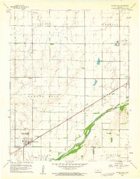
 - 1970 Map of Fort Larned, 1971 Print
 1970 Fort Larned1971 Print · USGSCovers Pawnee County, including Hamburg, Frizell, and other nearby areas
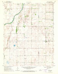
 - 1970 Map of Rozel, 1971 Print
 1970 Rozel1971 Print · USGSCovers Pawnee County, including Rozel, United States, and other nearby areas
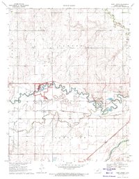
 - 1970 Map of Sanford, 1971 Print
 1970 Sanford1971 Print · USGSCovers Pawnee County, including Sanford, Bert Wettar, and other nearby areas
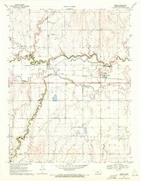
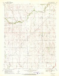
 - 1970 Map of Burdett, 1971 Print
 1970 Burdett1971 Print · USGSCovers Pawnee County, including Burdett, Hodgeman County, and other nearby areas
 - 1970 Map of Rush Center SW, 1972 Print
 1970 Rush Center SW1972 Print · USGSCovers Pawnee County, including Rush County, United States, and other nearby areas
 - 1970 Map of Bazine SE, 1972 Print
 1970 Bazine SE1972 Print · USGSCovers Pawnee County, including Hodgeman County, Ness County, and other nearby areas
 - 1970 Map of Albert SE, 1972 Print
 1970 Albert SE1972 Print · USGSCovers Pawnee County, including Barton County, Rush County, and other nearby areas
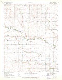
 - 1970 Map of Larned, 1972 Print
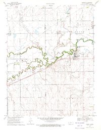
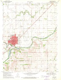 1970 Larned1972 Print · USGSCovers Pawnee County, including Larned, United States, and other nearby areas
 - 1970 Map of Ash Valley, 1972 Print
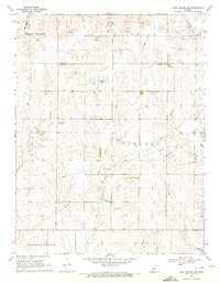
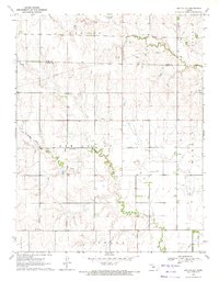 1970 Ash Valley1972 Print · USGSCovers Pawnee County, including Ash Valley, Rush County, and other nearby areas
Showing maps 1-25 of 37
Top cities of Pawnee County
- Larned historical maps
- Burdett historical maps
- Garfield historical maps
- Rozel historical maps
- Ash Valley historical maps
Frequently asked questions
- What are the different types of historical maps available for Pawnee County?
- What is the oldest map of Pawnee County?
- Where can I purchase historical maps of Pawnee County for my home or office?
- Where can I download high-res historical maps of Pawnee County?
- Are there historical topographic maps available for Pawnee County?
- Is there historical aerial imagery available for Pawnee County?
- Where are historical maps of Pawnee County sourced from?