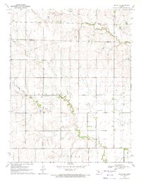
1970 Map of Ash Valley
USGS Topo · Published 1972About this map
Ash Valley serves as the central point of interest in this western Kansas landscape, which is defined by the subtle drainage patterns of Dry Walnut Creek to the north and Ash Creek to the south. The area reflects a transition in transportation and utility infrastructure at the start of the 1970s. The presence of an Old Railroad Grade running through the northwestern sector indicates a shift away from earlier rail dependency, while several Pipeline corridors trace the modernization of the region's energy economy. Genealogists and local historians will find value in the precise location of the Ash Valley Cem, situated along the winding course of the local creek. The map also delineates the jurisdictional boundary between Rush Co and Pawnee Co, illustrating how these administrative lines bisect the rural townships of Banner, Garfield, and Ash Valley.
Find a feature on this map
16 named features on this map. Tap any name to fly to it.
Don’t see what you’re looking for? This feature index may not catch every label — zoom into the map to look around manually.
Map Details
Editions of this 1970 Ash Valley Map
This is the sole edition of this map. No revisions or reprints were ever made.
Other maps of this area

1889 · Larned
USGS Topo · 1:125,000

1891 · Larned
USGS Topo · 1:125,000

1955 · Great Bend
USGS Topo · 1:250,000

1957 · Great Bend
USGS Topo · 1:250,000

1958 · Great Bend
USGS Topo · 1:250,000
1965 · Albert
USGS Topo · 1:24,000

1966 · Rush Center
USGS Topo · 1:24,000
1966 · Timken
USGS Topo · 1:24,000

1970 · Fort Larned
USGS Topo · 1:24,000
1970 · Sanford
USGS Topo · 1:24,000