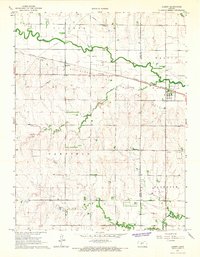
1965 Map of Albert
USGS Topo · Published 1967About this map
Walnut Creek meanders across this Central Kansas landscape, defining a fertile corridor through the townships of Pioneer, Otis-Albert, and Walnut. The Atchison Topeka and Santa Fe railroad parallels the waterway, serving the elevators and homes of Albert and Shaffer. This era represents a period of significant energy development, evidenced by the extensive Gas Field and scattered Oil Wells that dot the topography south of the creek. Rural life is anchored by community landmarks such as Walnut View Sch and Elm Grove Sch, while the Peace Ch and St Paul Ch remain as central gathering points. The map also records specialized infrastructure of the mid-1960s, including a Compressor Station and a private Landing Strip, reflecting the integration of industrial and agricultural land uses near the Rush Co and Barton Co line.
Find a feature on this map
24 named features on this map. Tap any name to fly to it.
Don’t see what you’re looking for? This feature index may not catch every label — zoom into the map to look around manually.
Map Details
Editions of this 1965 Albert Map
This is the sole edition of this map. No revisions or reprints were ever made.
Other maps of this area

1889 · Larned
USGS Topo · 1:125,000

1891 · Great Bend
USGS Topo · 1:125,000

1891 · Larned
USGS Topo · 1:125,000

1893 · Great Bend
USGS Topo · 1:125,000

1896 · Russell
USGS Topo · 1:125,000

1896 · Hays
USGS Topo · 1:125,000

1955 · Great Bend
USGS Topo · 1:250,000

1957 · Great Bend
USGS Topo · 1:250,000

1958 · Great Bend
USGS Topo · 1:250,000

1960 · Pawnee Rock
USGS Topo · 1:24,000