2020s Maps of Pratt County, Kansas
Explore 24 historic maps of Pratt County from the 2020s. These maps offer a rare glimpse into what life looked like during the 2020s — showing old roads, neighborhoods, homes, and landmarks that have changed or disappeared over time.
Whether you're researching your family's past, planning a metal detecting trip, or studying how Pratt County's landscape evolved across the 2020s, these high-resolution maps are a powerful tool for exploring the history of this region.
- Focus on a specific era: All maps on this page are from the 2020s, giving you a focused view of this time period.
- See what’s changed: Compare century-old streets, trails, and buildings to today's modern landscape using overlays and satellite layers.
- Research with precision: Use these maps for genealogy, historical research, land use analysis, or educational projects.
- View, download, or print: Maps are fully viewable online in high resolution, and can be downloaded or printed for your own records.
Start exploring Pratt County's history through authentic maps from the 2020s. This is your window into the past.
Pratt County, KS maps
(24)- 2022 Map of Coats, 2022 Print
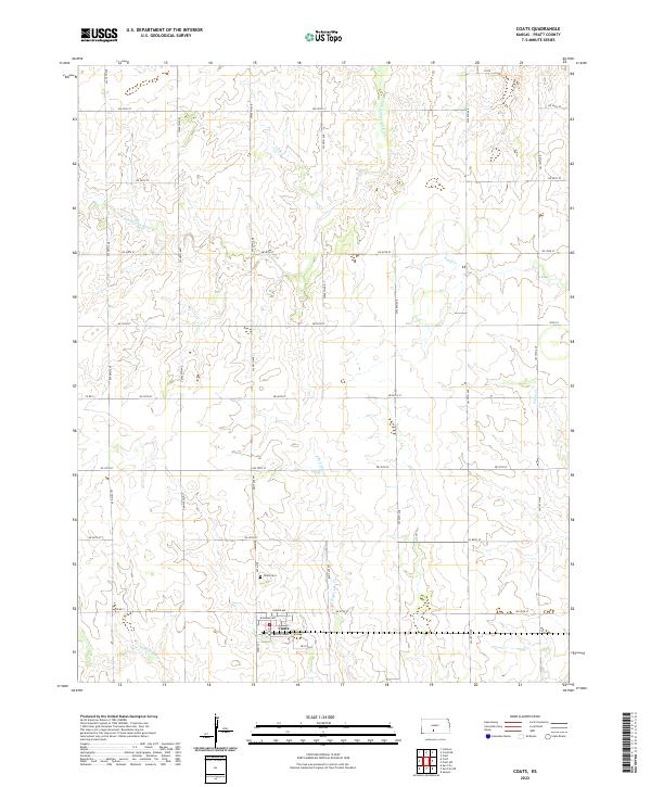 2022 Coats2022 Print · USGSThe rural landscape of Pratt County comes into focus here during the early twenty-first century, centered on the small community of Coats. Researchers can trace local landmarks and family sites including the Coats Cem and follow the paths of the S Fork Ninnescah River and Sand Cr.
 - 2022 Map of Haviland, 2022 Print
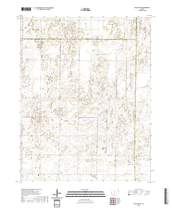
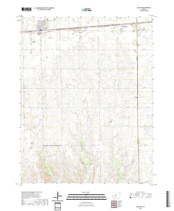 2022 Haviland2022 Print · USGSKiowa County communities like Haviland and Wellsford anchor this recent look at the agricultural plains of southern Kansas. Researchers can trace local landmarks such as Barclay College, the Gail Ballard Airport, and the rural Boles Cem.
 - 2022 Map of Sawyer, 2022 Print
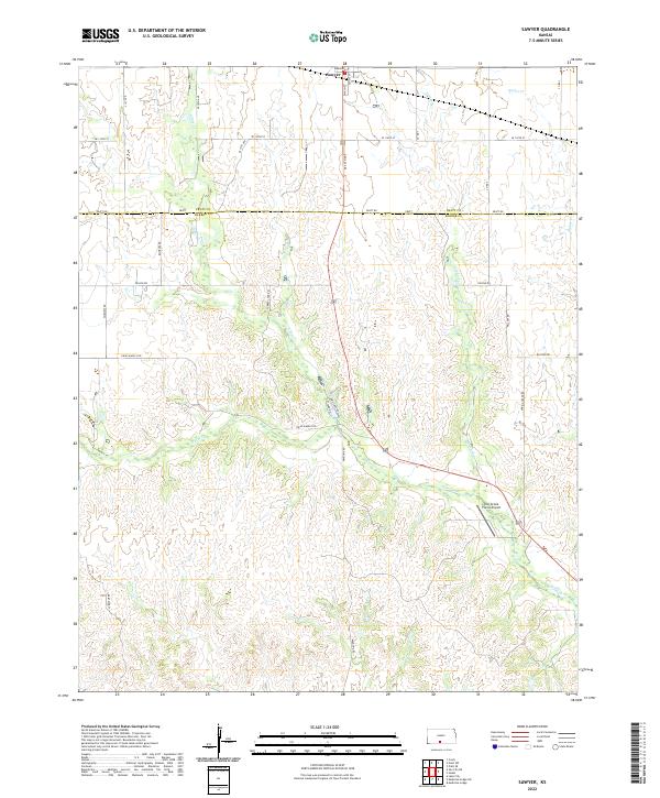 2022 Sawyer2022 Print · USGSSawyer and the high plains of southern Kansas are captured here as they appeared in 2022, just north of the Barber County line. Researchers can trace the winding course of Elm Creek and locate local landmarks like Elm Creek Farms Airport and the streets of Sawyer.
 - 2022 Map of Coats NE, 2022 Print
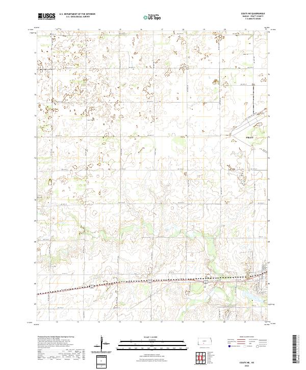 2022 Coats NE2022 Print · USGSThe outskirts of Pratt and the surrounding rural prairie come into focus in the early 2020s. Researchers can trace land plots across the S Fork Ninnescah River or locate landmarks like Pilot Knob and the Pratt Municipal Airport.
 - 2022 Map of Isabel, 2022 Print
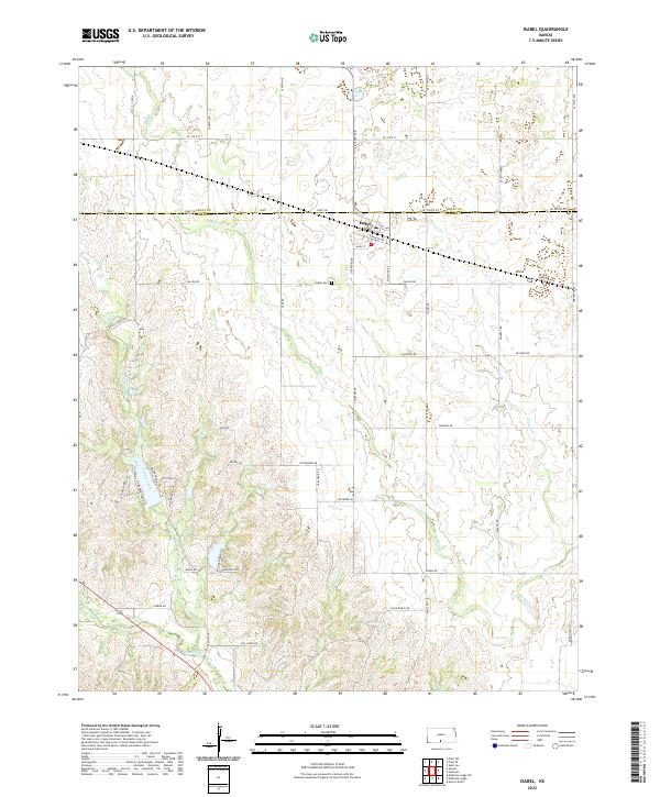 2022 Isabel2022 Print · USGSBarber County ranching and farmland are surveyed here in 2022, centered on the community of Isabel. Researchers can trace the local landscape through the Isabel Cem and winding watercourses like Sand Creek and Amber Creek.
 - 2022 Map of Pratt SE, 2022 Print
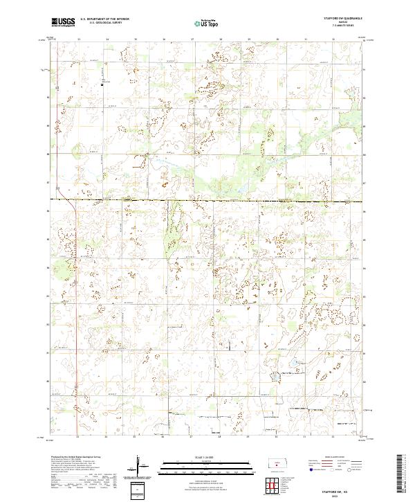
 2022 Pratt SE2022 Print · USGSPratt County at the start of the 2020s remains a landscape of precise agricultural geometry and winding prairie streams. Researchers can trace the path of Painter Cr across the section lines or follow local travel routes like Co Rd O and Se 40th St.
 - 2022 Map of Croft, 2022 Print
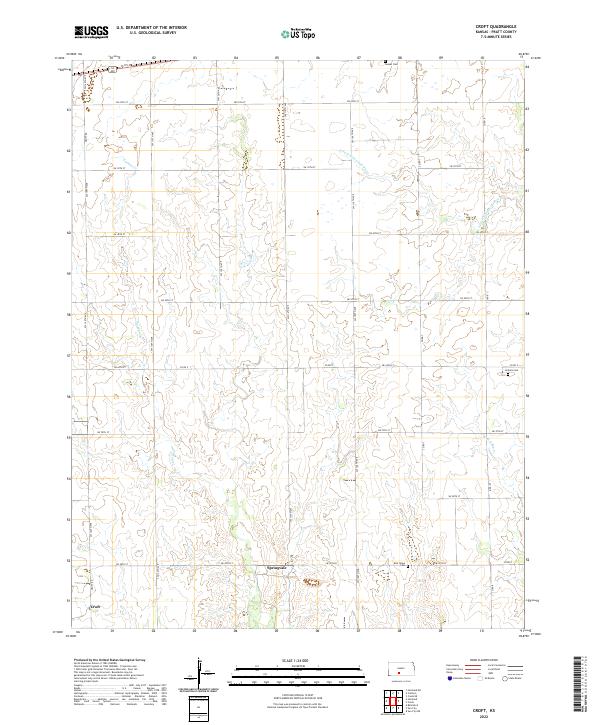 2022 Croft2022 Print · USGSPratt County agricultural life is captured here in the early twenty-first century, showing the enduring grid of section roads and rural settlements. Genealogists can trace family landmarks at East Slope Cem, Sunset Cem, and the small community of Springvale.
 - 2022 Map of Hopewell, 2022 Print
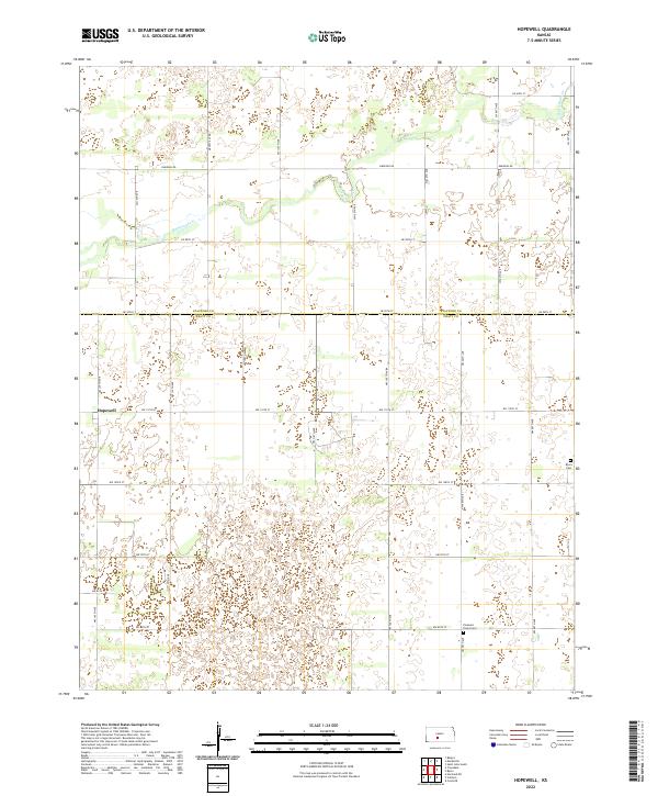 2022 Hopewell2022 Print · USGSThe Kansas plains north of Pratt are captured in this 2022 survey, showing the agricultural grid and the winding Rattlesnake Cr. Genealogists and historians can locate rural landmarks like Pleasant Plains Cem and Byers Cem near the small settlement of Hopewell.
 - 2022 Map of Cunningham, 2022 Print
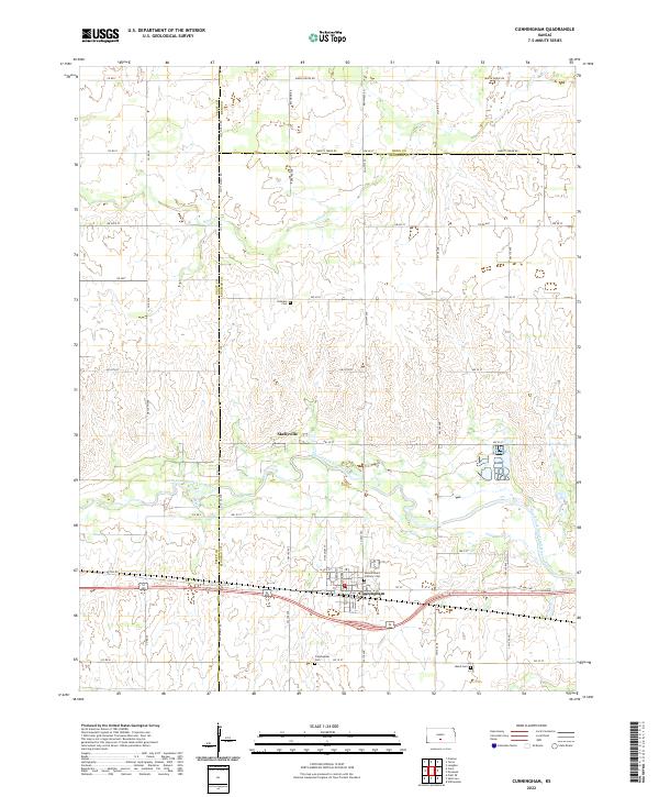 2022 Cunningham2022 Print · USGSThe rural landscape around Cunningham is captured here in the early twenty-first century as the South Fork Ninnescah River winds through southern Kansas. Researchers can trace family history at Dresden Cem and Maud Cem or locate the small settlement of Skellyville.
 - 2022 Map of Trousdale, 2022 Print
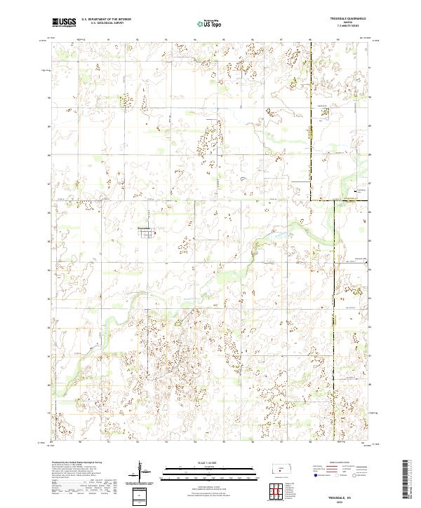 2022 Trousdale2022 Print · USGSThe High Plains of central Kansas are captured here in the early twenty-first century, showing the rural crossroads of Trousdale. Researchers can locate local burial grounds at Prattsburg Cem and Hopewell Cem or trace the path of Rattlesnake Cr.
 - 2022 Map of Byers, 2022 Print
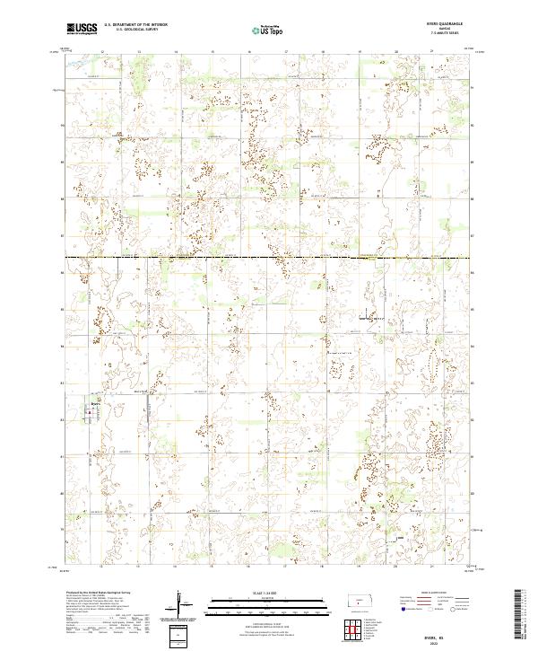 2022 Byers2022 Print · USGSByers and the surrounding prairie land on the Pratt and Stafford county line are captured here in the early 2020s. Researchers can trace the local street grid of Byers or locate the airfield at Moore Field near the gentle curve of Rattlesnake Cr.
 - 2022 Map of Cairo, 2022 Print
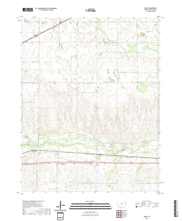 2022 Cairo2022 Print · USGSPratt County agricultural lands are captured in the early twenty-first century, showing the enduring grid of section roads and river drainage. Local historians can locate the Cairo Cem and the small settlements of Cairo and Waldeck along the South Fork Ninnescah River.
 - 2022 Map of Nashville, 2022 Print
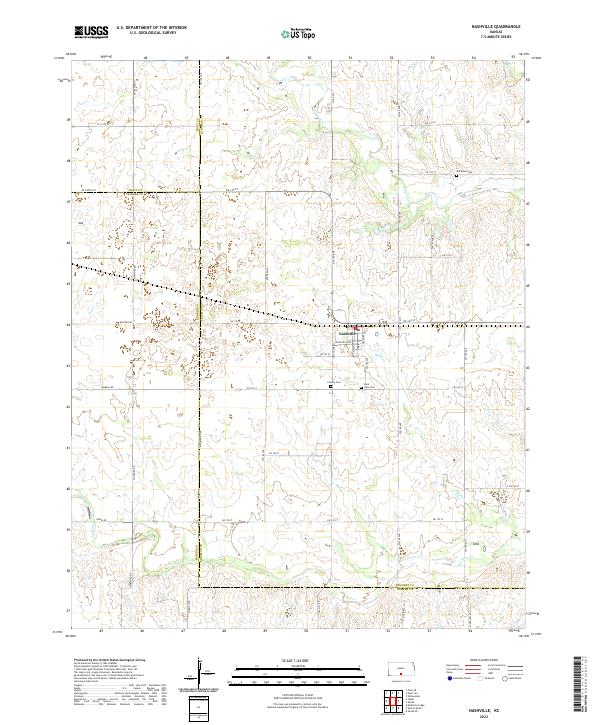 2022 Nashville2022 Print · USGSNashville and the surrounding prairie of Kingman and Barber counties are captured here in the early twenty-first century. Genealogists can trace local family ties through landmarks like Old Bross Cem, Liberty Cem, and the drainage of Skunk Cr.
 - 2022 Map of Preston, 2022 Print
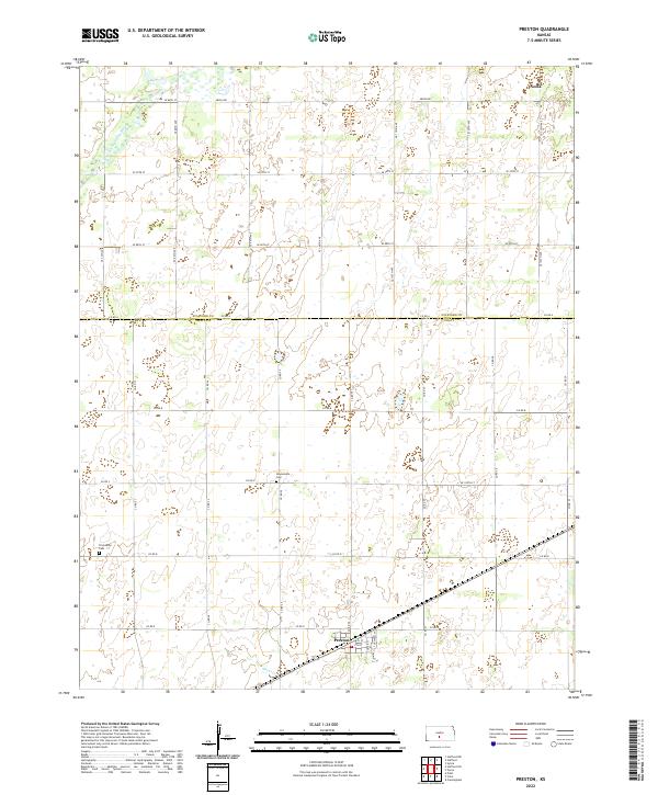 2022 Preston2022 Print · USGSThe rural border of Stafford and Pratt Counties comes into focus in this contemporary survey of the Kansas plains. Researchers can trace the layout of Preston, locate the remote Haynesville Cem, and follow the path of the N Fork Ninnescah River.
 - 2022 Map of Turon, 2022 Print
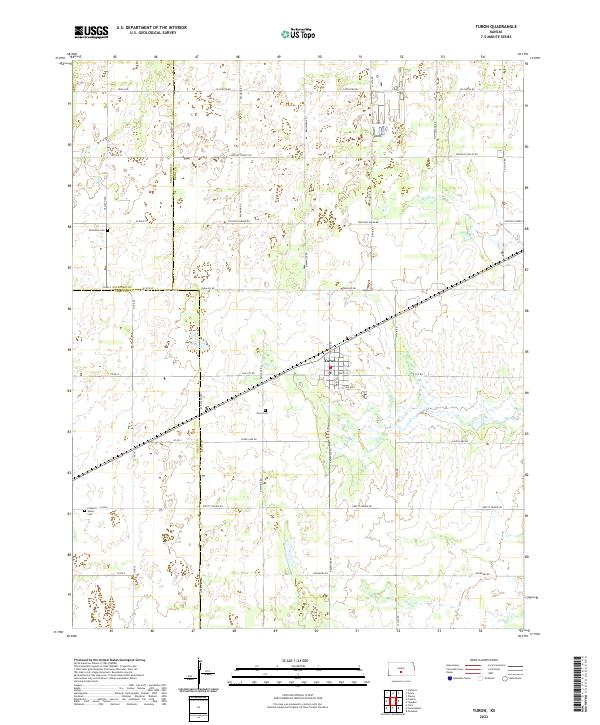 2022 Turon2022 Print · USGSThe intersection of Reno, Stafford, and Pratt counties comes to life in this recent survey of the Kansas prairie. Genealogists can trace local heritage through the Old Neola Cem and Turon Cem, while exploring the rural routes like Salt Marsh Rd.
 - 2022 Map of Belvidere, 2022 Print
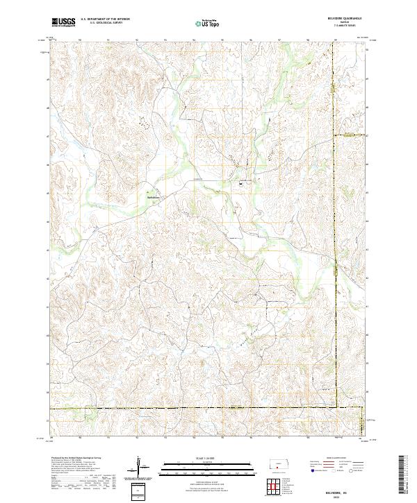 2022 Belvidere2022 Print · USGSBelvidere and the surrounding ranchlands of south-central Kansas are captured here in the early 2020s. Researchers can trace the winding Medicine Lodge River or locate family history at the Belvidere Cemetery and the central settlement of Belvidere.
 - 2022 Map of Cullison, 2022 Print
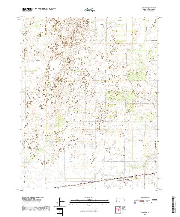 2022 Cullison2022 Print · USGSCullison and the surrounding Pratt County prairie are documented here in the early twenty-first century, showing the enduring grid of the High Plains. Genealogists and local historians can trace the townsite at Cullison, including Main St and W Central Ave.
 - 2022 Map of Sun City, 2022 Print
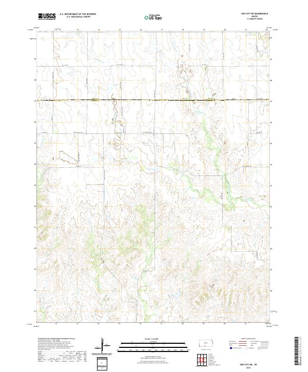
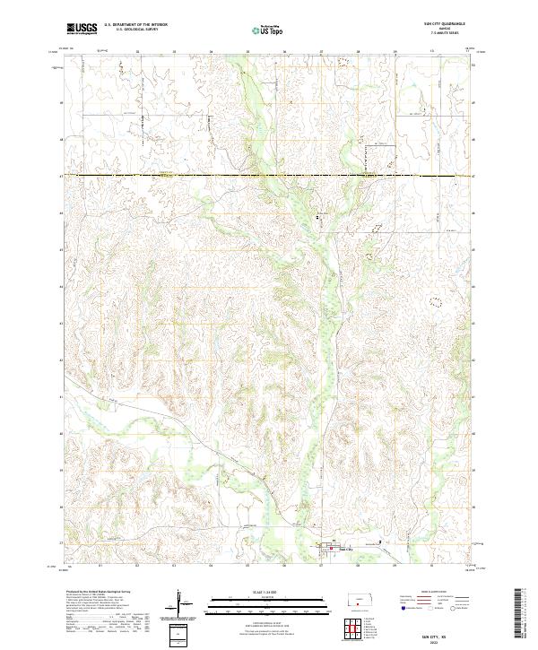 2022 Sun City2022 Print · USGSThe Barber County plains meet the Medicine Lodge River in the early 2020s, revealing a landscape shaped by water and tradition. Genealogists can locate family sites at Sunnyside Cem and Chinn Cem or trace the early industrial footprint of Elm Mills.
 - 2022 Map of Saint Leo, 2022 Print
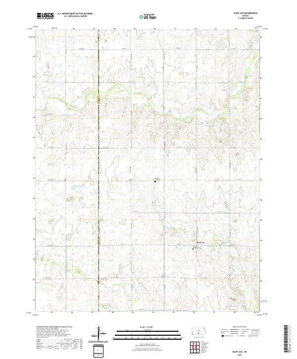 2022 Saint Leo2022 Print · USGSKingman and Pratt Counties appear here in the modern era as a landscape of grid-patterned agriculture and prairie drainage. Genealogists and local historians can locate Saint Leo and family sites near the Saint Leo Catholic Cem or West Point Cem.
 - 2022 Map of Pratt, 2022 Print
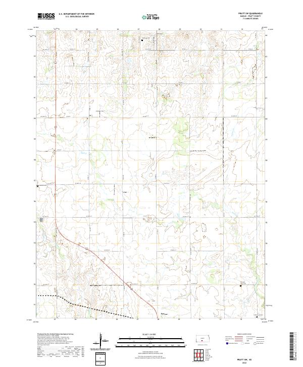
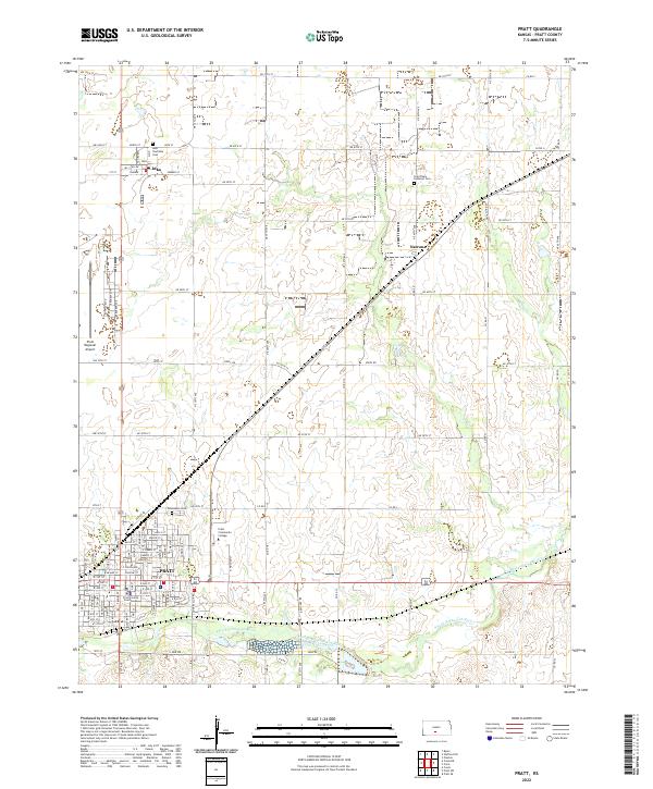 2022 Pratt2022 Print · USGSPratt and its surrounding agricultural townships are documented here in the early 2020s. Researchers can locate family plots at Iuka Township Cem or trace the civic footprint of the Pratt County Courthouse and Pratt Community College.
 - 2022 Map of Stafford SW, 2022 Print
 2022 Stafford SW2022 Print · USGSThe Kansas plains at the Stafford and Pratt county line appear here in the early twenty-first century, showcasing a landscape of section roads and river bends. Genealogists and local historians can locate the Rose Valley Cem and follow the path of the N Fork Ninnescah River.
 - 2022 Map of Sun City NE, 2022 Print
 2022 Sun City NE2022 Print · USGSBarber and Pratt counties are mapped here in the early 2020s, showing a landscape defined by the branching tributaries of the Elm Creek system. Genealogists and researchers can trace the course of Cottonwood Cr and Sand Cr or follow rural routes like Nw Elm Mills Rd.
 - 2022 Map of Pratt SW, 2022 Print
 2022 Pratt SW2022 Print · USGSAgricultural land south of Pratt reveals a deeply rooted rural community during the early twenty-first century. Genealogists and local historians can trace family ties at several burial sites, including Saratoga Cem, Ludwick Cem, and Pleasant View Cem.
 - 2022 Map of Haviland NE, 2022 Print
 2022 Haviland NE2022 Print · USGSSouth-central Kansas prairie life is captured in this recent survey of the Kiowa and Edwards county lines. Genealogists and local historians can locate Providence Cem, Haviland Cem, and the natural waters of Lost Lake.
End of results
Showing maps 1-24 of 24
Top cities of Pratt County
- Pratt historical maps
- Iuka historical maps
- Preston historical maps
- Sawyer historical maps
- Coats historical maps
- Cullison historical maps
See more
Frequently asked questions
- What are the different types of historical maps available for Pratt County?
- What is the oldest map of Pratt County?
- Where can I purchase historical maps of Pratt County for my home or office?
- Where can I download high-res historical maps of Pratt County?
- Are there historical topographic maps available for Pratt County?
- Is there historical aerial imagery available for Pratt County?
- Where are historical maps of Pratt County sourced from?