1900s (20th Century) Maps of Pratt County, Kansas
Explore 30 historic maps of Pratt County from the 1900s (20th Century). These maps offer a rare glimpse into what life looked like during the 1900s — showing old roads, neighborhoods, homes, and landmarks that have changed or disappeared over time.
Whether you're researching your family's past, planning a metal detecting trip, or studying how Pratt County's landscape evolved across the 1900s, these high-resolution maps are a powerful tool for exploring the history of this region.
- Focus on a specific era: All maps on this page are from the 1900s, giving you a focused view of this time period.
- See what’s changed: Compare century-old streets, trails, and buildings to today's modern landscape using overlays and satellite layers.
- Research with precision: Use these maps for genealogy, historical research, land use analysis, or educational projects.
- View, download, or print: Maps are fully viewable online in high resolution, and can be downloaded or printed for your own records.
Start exploring Pratt County's history through authentic maps from the 1900s. This is your window into the past.
Pratt County, KS maps
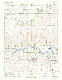
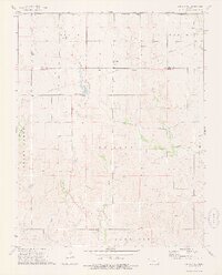
(30)- 1955 Map of Pratt, 1968 Print
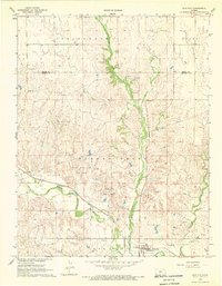
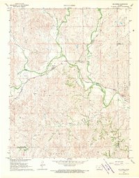
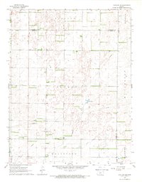
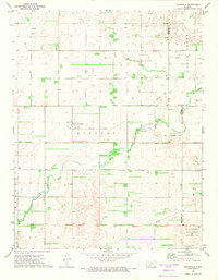
 1955 Pratt1968 Print · USGSSouth-central Kansas during the mid-fifties presents a landscape of sprawling oil fields and critical rail junctions. Researchers can trace the paths of the Atchison Topeka and Santa Fe railroad or locate local landmarks like the Blue Ridge Community House and Camp Carlisle.3 unique versions available
 - 1959 Map of Pratt
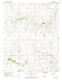
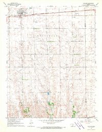
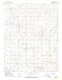
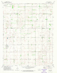
 1959 Pratt1959 Print · USGSSouth-central Kansas thrived as a rail and agricultural hub in the late fifties, where the Arkansas River meets a vast grid of section roads. Researchers can trace the path of the Missouri Pacific railroad through settlements like Turon and Stafford, or locate family landmarks like the Prairie Oak School.2 unique versions available
 - 1966 Map of Cunningham, 1968 Print
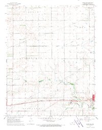
 1966 Cunningham1968 Print · USGSMid-century Kingman County centers on the thriving town of Cunningham and the river-fed agricultural lands of the Cunningham Valley. Researchers can trace the Atchison Topeka and Santa Fe rail line and locate old community landmarks like Skellyville and Dresden Cem.
 - 1966 Map of St Leo, 1968 Print
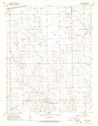
 1966 St Leo1968 Print · USGSThe rural landscapes of Kingman County come into focus during the mid-1960s, showing the agricultural heartland at the confluence of the Chikaskia River and its North Fork. Genealogists and researchers can pinpoint the St Leo settlement, the West Point Cem, and scattered Gravel Pits marking the local industry of the day.
 - 1967 Map of Cairo, 1969 Print
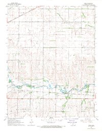 1967 Cairo1969 Print · USGSPratt County in the late sixties shows a landscape of river-valley agriculture and emerging energy production. Researchers can trace the routes of the Chicago Rock Island and Pacific and find local landmarks like Cairo Cem and the Fish Hatchery.
 - 1968 Map of Pratt SW, 1969 Print
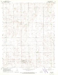
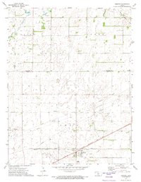
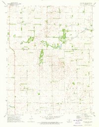
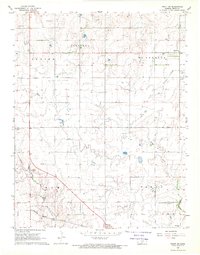 1968 Pratt SW1969 Print · USGSPratt County in the late sixties reveals a landscape of railroad towns and emerging energy fields. Trace family roots and local history through the Atchison Topeka and Santa Fe line, Saratoga Cem, and the Glendale Sch.
 - 1968 Map of Sun City, 1969 Print
 1968 Sun City1969 Print · USGSSun City and the Barber County cattle country are captured in the late sixties as the local economy balanced rail transport with a growing energy sector. Genealogists and researchers can trace the Medicine Lodge River and find Chinn Cem, Sunnyside Cem, and the Sun City Oil Field.
 - 1968 Map of Pratt, 1969 Print
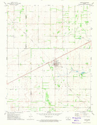
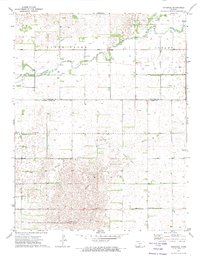
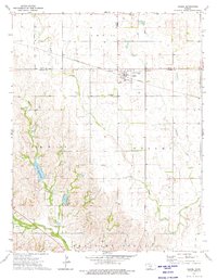
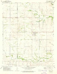
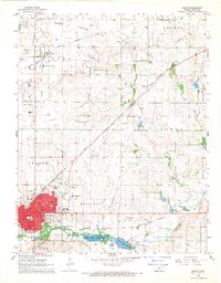 1968 Pratt1969 Print · USGSMid-century Pratt and the northern settlement of Iuka thrive at the intersection of two major railroads and a growing energy sector. Genealogists and historians can trace local institutions like Greenlawn Cemetery, St Pauls Cem, and several area schools including Liberty Jr High.
 - 1968 Map of Cullison, 1970 Print
 1968 Cullison1970 Print · USGSCullison and the surrounding Pratt County townships are captured here in the late sixties during a period of steady energy production. Genealogists and historians can locate the Sunset Cem, trace the CHICAGO ROCK ISLAND AND PACIFIC rail line, and find dozens of early Oil Well sites.
 - 1968 Map of Coats, 1970 Print
 1968 Coats1970 Print · USGSPratt County in the late sixties reveals a landscape shaped by the rail and river economy of the Kansas plains. Genealogists and historians can locate the Coats Cem, trace the Atchison Topeka and Santa Fe rail line, and identify early industrial sites like the Silica Pit.
 - 1968 Map of Belvidere, 1970 Print
 1968 Belvidere1970 Print · USGSThe rail-and-river corridor of southeastern Kiowa County comes alive in the late sixties, centered on the settlement of Belvidere. Local historians can trace the Atchison Topeka and Santa Fe line as it follows the Medicine Lodge River past the Belvidere Cem and into the Glick Oil and Gas Field.
 - 1968 Map of Haviland, 1970 Print
 1968 Haviland1970 Print · USGSThe Kiowa and Pratt County line in the late sixties shows a landscape of prairie settlements and growing energy infrastructure. Researchers can trace the Chicago Rock Island and Pacific rail line and locate Wellsford Cem and Boles Cem.
 - 1968 Map of Coats NE, 1970 Print
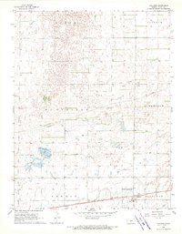
 1968 Coats NE1970 Print · USGSThe western outskirts of Pratt and the surrounding townships come alive in the late sixties. Genealogists and researchers can trace the Chicago Rock Island and Pacific rail line past the Skyline Sch and the Pratt Airport.
 - 1968 Map of Croft, 1970 Print
 1968 Croft1970 Print · USGSPratt County's rural townships are captured here in the late sixties, highlighting the vital rail corridors and creek-fed ranchlands of the Kansas prairie. Genealogists can locate Sunset Cem and East Slope Cem or trace the early paths of Springvale and Cullison.
 - 1968 Map of Haviland NE, 1970 Print
 1968 Haviland NE1970 Print · USGSKiowa and Pratt counties are captured here in the late sixties, showing a transition between vast ranch lands and active energy development. Genealogists and local historians can locate family plots at Providence Cem and Wellsford Cem or trace the extent of the Fruit Oil and Gas Field.2 unique versions available
 - 1968 Map of Pratt SE, 1970 Print
 1968 Pratt SE1970 Print · USGSAgricultural and industrial life intersect on the Kansas prairie in the late 1960s. Researchers can trace land use through the Chitwood Oil Field, locate the Ashton Community Hall, and follow the course of the Chikaskia River across the plains.
 - 1971 Map of Turon, 1974 Print
 1971 Turon1974 Print · USGSTuron thrived as a dual-railroad junction in the early seventies, where the Chicago Rock Island and Missouri Pacific lines intersected. Researchers can locate family plots at Neola Cem and Pleasant Valley Cem or trace the historical Old Indian Treaty Boundary.
 - 1971 Map of Preston, 1974 Print
 1971 Preston1974 Print · USGSThe Kansas prairie at the Pratt and Stafford county line is captured here in the early seventies, centered on the rail junction at Preston. Researchers can trace the Old Indian Treaty Boundary or locate rural burials at Haynesville Cem and Friendship Cem.
 - 1971 Map of Trousdale, 1974 Print
 1971 Trousdale1974 Print · USGSThe prairie landscape of Trousdale was deeply shaped by energy production and early transit corridors by the 1970s. Genealogists and historians can trace family roots at Prattsburg Cem or locate the historic Old Indian Treaty Boundary.
 - 1971 Map of Byers, 1974 Print
 1971 Byers1974 Print · USGSThe rural expanse of the Kansas plains is captured here during the early 1970s, as energy production and traditional settlements intersected. Researchers can trace the Old Indian Treaty Boundary and locate community landmarks like Antrim Ch and the Byers town site.
 - 1971 Map of Hopewell, 1974 Print
 1971 Hopewell1974 Print · USGSThe Kansas prairie south of Macksville is captured here in the early seventies as energy exploration and wildlife conservation reshaped the plains. Trace local lineage at Hopewell Cem and Pleasant Plain Ch, or follow the path of the Old Railroad Grade.
 - 1971 Map of Stafford SW, 1974 Print
 1971 Stafford SW1974 Print · USGSStafford and Pratt counties in the early 1970s reveal a landscape defined by energy production and historical borders. Researchers can trace the Old Indian Treaty Boundary and locate family history at Rose Valley Cem or the local Fish Hatchery.
 - 1973 Map of Sun City NE, 1975 Print
 1973 Sun City NE1975 Print · USGSBarber and Pratt Counties are captured here in the early 1970s, featuring the prominent Old Indian Treaty Boundary. Genealogists and historians can trace the course of Turkey Creek past Macadoo Dam and locate numerous mid-century Oil Wells.
 - 1973 Map of Isabel, 1975 Print
 1973 Isabel1975 Print · USGSIsabel and the surrounding Kansas prairie are captured here in the early seventies as the local rail-and-creek economy thrived. Genealogists and local historians can trace the Atchison Topeka and Santa Fe rail line, find Isabel Cem, and explore the banks of Lake Arrowhead.
 - 1973 Map of Nashville, 1975 Print
 1973 Nashville1975 Print · USGSNashville and the surrounding prairie were deeply connected to the rail and river systems in the early 1970s. Genealogists can trace family roots at Nashville Cem and St John Cem, or follow the historic Old Indian Treaty Boundary across the landscape.
Showing maps 1-25 of 30
Top cities of Pratt County
- Pratt historical maps
- Iuka historical maps
- Preston historical maps
- Sawyer historical maps
- Coats historical maps
- Cullison historical maps
See more
Frequently asked questions
- What are the different types of historical maps available for Pratt County?
- What is the oldest map of Pratt County?
- Where can I purchase historical maps of Pratt County for my home or office?
- Where can I download high-res historical maps of Pratt County?
- Are there historical topographic maps available for Pratt County?
- Is there historical aerial imagery available for Pratt County?
- Where are historical maps of Pratt County sourced from?