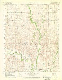
1968 Map of Sun City
USGS Topo · Published 1969About this map
Sun City serves as the focal point for this landscape in the late 1960s, situated at the junction of the Atchison Topeka and Santa Fe railroad and the Medicine Lodge River. The mapping reveals a rural Kansas environment heavily defined by its natural drainage systems, including Turkey Creek, Elk Creek, and Mulberry Creek. To the north and west, the economy transitions from river-valley agriculture to energy extraction, marked by the Moffett West Oil Field, Sun City Oil Field, and the Turkey Creek East Gas Field. Local heritage is preserved in the location of family and community sites like Chinn Cem and Sunnyside Cem, while the Turkey Creek Camp suggests a recreational use of the riparian corridors. The boundary between Pratt and Barber counties bisects the northern section of the sheet, illustrating the administrative divisions of this high-plains terrain.
Find a feature on this map
23 named features on this map. Tap any name to fly to it.
Don’t see what you’re looking for? This feature index may not catch every label — zoom into the map to look around manually.
Map Details
Editions of this 1968 Sun City Map
This is the sole edition of this map. No revisions or reprints were ever made.
Other maps of this area

1889 · Kinsley
USGS Topo · 1:125,000

1891 · Medicine Lodge
USGS Topo · 1:125,000

1892 · Kinsley
USGS Topo · 1:125,000

1892 · Coldwater
USGS Topo · 1:125,000

1892 · Pratt
USGS Topo · 1:125,000

1893 · Medicine Lodge
USGS Topo · 1:125,000

1894 · Kinsley
USGS Topo · 1:125,000

1894 · Pratt
USGS Topo · 1:125,000

1955 · Pratt
USGS Topo · 1:250,000

1959 · Pratt
USGS Topo · 1:250,000