Old Maps of Barber County, Kansas
Explore 224 old maps of Barber County, spanning from 1889 to today. These high-resolution historic maps reveal how streets, neighborhoods, landmarks, and natural features evolved over time — perfect for genealogy, metal detecting, research, and local history exploration.
What you can do with these maps:
- See how Barber County changed over time: Compare historical maps to modern-day views to trace roads, homesites, rail lines & more.
- View detailed metadata: Each map includes creators, publishers, year, scale, and archive source.
- Overlay maps with satellite & LiDAR: Visualize the past alongside modern tools to explore terrain & human change.
- Trusted historical sources: Maps sourced from the USGS, Library of Congress, and other archives.
- Access maps your way: View online, download high-res files, or order prints for personal or research use.
Start exploring old maps of Barber County to uncover forgotten places, hidden landmarks, and the deep history beneath your feet.
Barber County, KS maps
(224)- 1889 Map of Anthony
 1889 Anthony1889 Print · USGSSouthern Kansas prairie life centered on the rising rail hubs of Anthony and Harper during this late-century expansion. Genealogists and historians can trace original townites and early rail stops like Crystal Springs, New Kiowa, and Ruella.
 - 1891 Map of Medicine Lodge
 1891 Medicine Lodge1891 Print · USGSBarber County appears here during the late nineteenth-century rail expansion, centered on the growth of the Medicine Lodge river valley. Genealogists and researchers can trace early town sites and river crossings like Sun City, Lake City, and the Atchison Topeka and Santa Fe Railroad line.
 - 1891 Map of Anthony
 1891 Anthony1891 Print · USGSSouthern Kansas is captured here in the late nineteenth century as the railroads solidified the prairie's town-and-country layout. Trace the development of early rail hubs like Anthony, Harper, and Hazelton alongside landmarks such as Pilot Knob.6 unique versions available
 - 1892 Map of Coldwater
 1892 Coldwater1892 Print · USGSComanche County during the late nineteenth-century settlement boom shows a network of emerging prairie towns and cattle-shipping rail lines. Genealogists can trace early homestead locations near Coldwater, Nescatunga, and along the banks of Mule Creek.5 unique versions available
 - 1893 Map of Medicine Lodge
 1893 Medicine Lodge1893 Print · USGSBarber County and the Medicine Lodge River valley are shown here in the early nineties, during the peak of late-frontier settlement. Researchers can locate early township centers and rail stops like Elm Mills, Sun City, and Medicine Lodge.5 unique versions available
 - 1955 Map of Woodward, 1967 Print
 1955 Woodward1967 Print · USGSNorthwest Oklahoma and the bordering plains are captured during the mid-sixties, showing a landscape defined by river valleys and massive water projects. Researchers can trace family roots in towns like Woodward and Alva or locate landmarks such as the Western Oklahoma State Hospital and Kegelman AF.3 unique versions available
 - 1955 Map of Pratt, 1968 Print
 1955 Pratt1968 Print · USGSSouth-central Kansas during the mid-fifties presents a landscape of sprawling oil fields and critical rail junctions. Researchers can trace the paths of the Atchison Topeka and Santa Fe railroad or locate local landmarks like the Blue Ridge Community House and Camp Carlisle.3 unique versions available
 - 1958 Map of Woodward
 1958 Woodward1958 Print · USGSNorthwest Oklahoma and the neighboring panhandle borders are shown here during a period of steady mid-century growth. Researchers can trace the rail networks of the Atchison Topeka and Santa Fe and locate landmarks like the Western Oklahoma State Hospital and Port Supply Reservoir.2 unique versions available
 - 1959 Map of Pratt
 1959 Pratt1959 Print · USGSSouth-central Kansas thrived as a rail and agricultural hub in the late fifties, where the Arkansas River meets a vast grid of section roads. Researchers can trace the path of the Missouri Pacific railroad through settlements like Turon and Stafford, or locate family landmarks like the Prairie Oak School.2 unique versions available
 - 1968 Map of Capron
 1968 Capron1968 Print · USGSWoods County and Alfalfa County meet along the Kansas border in the late sixties, where the railroad and winding creeks shaped rural life. Genealogists and local historians can locate the Capron Cem and trace the Atchison Topeka and Santa Fe tracks through Capron and Loder Siding.3 unique versions available
 - 1968 Map of Sun City SW, 1969 Print
 1968 Sun City SW1969 Print · USGSBarber County’s energy and rail landscape is caught in detail during the late sixties, highlighting the intersection of the Medicine Lodge River and industrial growth. Researchers can trace the Atchison Topeka and Santa Fe rail line alongside the Sun City Oil and Gas Field and landmarks like Memorial Bridge.2 unique versions available
 - 1968 Map of Sun City, 1969 Print
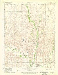 1968 Sun City1969 Print · USGSSun City and the Barber County cattle country are captured in the late sixties as the local economy balanced rail transport with a growing energy sector. Genealogists and researchers can trace the Medicine Lodge River and find Chinn Cem, Sunnyside Cem, and the Sun City Oil Field.
 - 1968 Map of Wilmore SE, 1970 Print
 1968 Wilmore SE1970 Print · USGSComanche County was a landscape of active energy extraction and winding prairie streams in the late sixties. Genealogists and researchers can trace the drainage of Mule Creek and locate early infrastructure like the Glick Oil and Gas Field and Baker Canyon.
 - 1968 Map of Belvidere, 1970 Print
 1968 Belvidere1970 Print · USGSThe rail-and-river corridor of southeastern Kiowa County comes alive in the late sixties, centered on the settlement of Belvidere. Local historians can trace the Atchison Topeka and Santa Fe line as it follows the Medicine Lodge River past the Belvidere Cem and into the Glick Oil and Gas Field.
 - 1969 Map of Tegarden NE, 1971 Print
 1969 Tegarden NE1971 Print · USGSNear the Oklahoma-Kansas border in the late sixties, this rural landscape centers on the winding Salt Fork Arkansas River. Genealogists and local historians can locate community pillars like Cedar Grove Ch, Winchester, and the Greenleaf Sch.
 - 1969 Map of Amorita, 1971 Print
 1969 Amorita1971 Print · USGSAlfalfa County's borderlands are captured here in the late sixties, where the Medicine Lodge River winds through a landscape of farming and oil extraction. Local historians can trace the Old Railroad Grade and find family sites at the Byron-Amorita Cem or near the small town of Byron.
 - 1969 Map of Burlington, 1971 Print
 1969 Burlington1971 Print · USGSBurlington sat at a critical railroad juncture near the Kansas-Oklahoma border in the late sixties. Researchers can trace the path of the Atchison Topeka and Santa Fe railroad and locate the Apostolic Cemetery and Apostolic Church.
 - 1969 Map of Tegarden NW, 1971 Print
 1969 Tegarden NW1971 Print · USGSThe Oklahoma-Kansas border country comes into focus in the late sixties, showing the rural townships of Woods County. Genealogists and explorers can locate Ewing Cemetery and Fulkner Cave, or trace the winding paths of Yellowstone Creek and Greenleaf Creek.
 - 1969 Map of Alva NW, 1971 Print
 1969 Alva NW1971 Print · USGSThe Oklahoma-Kansas borderlands in the late sixties come into focus here, showing a landscape shaped by the Salt Fork Arkansas River. Genealogists and local historians can locate Fairview Cem and the Fritzlen terrain near Driftwood Creek.
 - 1970 Map of Freedom NE, 1972 Print
 1970 Freedom NE1972 Print · USGSThe Oklahoma-Kansas state line area in the early seventies shows a landscape of drainage creeks and rural industry. Researchers can trace the development of the plains via local landmarks like Yellowstone Creek, several Gas Wells, and the Landing Strip.
 - 1972 Map of Sharon South, 1975 Print
 1972 Sharon South1975 Print · USGSBarber County in the early 1970s shows a landscape where prairie agriculture meets the energy industry. Researchers can trace the Atchison Topeka and Santa Fe rails through Sharon or find family roots at Sharon Cem and Bethel Ch.
 - 1972 Map of Kiowa, 1975 Print
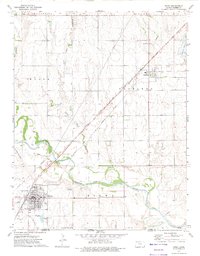 1972 Kiowa1975 Print · USGSBarber County at the start of the 1970s shows a landscape defined by the Medicine Lodge River and major rail lines. Researchers can trace family history through Riverview Cemetery and locate historical landmarks like the Old Indian Treaty Boundary.
 - 1972 Map of Corwin, 1975 Print
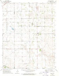 1972 Corwin1975 Print · USGSSouthern Kansas in the early 1970s is captured here at the intersection of rail history and the energy industry. Genealogists and historians can trace the Old Indian Treaty Boundary and explore local landmarks like Corwin and Hargis Lake.
 - 1972 Map of Crisfield, 1975 Print
 1972 Crisfield1975 Print · USGSThe rail-driven settlement of Crisfield and the southern Kansas prairie are captured here in the early 1970s. Trace the path of the Atchison Topeka and Santa Fe railroad alongside local landmarks like Crisfield Cem and Gravel Pits.
 - 1973 Map of Hardtner NW, 1975 Print
 1973 Hardtner NW1975 Print · USGSBarber County was a landscape of energy and faith in the early 1970s, as oil rigs operated alongside rural community centers. Genealogists and historians can locate Lodi Cem and Union Ch among the many sites of the Eagle Oil and Gas Field.
Showing maps 1-25 of 224
Top cities of Barber County
- Medicine Lodge historical maps
- Kiowa historical maps
- Sharon historical maps
- Hardtner historical maps
- Hazelton historical maps
- Isabel historical maps
See more
Frequently asked questions
- What are the different types of historical maps available for Barber County?
- What is the oldest map of Barber County?
- Where can I purchase historical maps of Barber County for my home or office?
- Where can I download high-res historical maps of Barber County?
- Are there historical topographic maps available for Barber County?
- Is there historical aerial imagery available for Barber County?
- Where are historical maps of Barber County sourced from?