2020s Maps of Maize, Kansas
Explore 2 historic maps of Maize from the 2020s. These maps offer a rare glimpse into what life looked like during the 2020s — showing old roads, neighborhoods, homes, and landmarks that have changed or disappeared over time.
Whether you're researching your family's past, planning a metal detecting trip, or studying how Maize's landscape evolved across the 2020s, these high-resolution maps are a powerful tool for exploring the history of this region.
- Focus on a specific era: All maps on this page are from the 2020s, giving you a focused view of this time period.
- See what’s changed: Compare century-old streets, trails, and buildings to today's modern landscape using overlays and satellite layers.
- Research with precision: Use these maps for genealogy, historical research, land use analysis, or educational projects.
- View, download, or print: Maps are fully viewable online in high resolution, and can be downloaded or printed for your own records.
Start exploring Maize's history through authentic maps from the 2020s. This is your window into the past.
Maize, KS maps
(2)- 2022 Map of Maize, 2022 Print
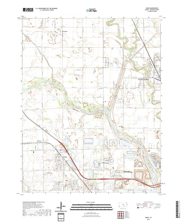 2022 Maize2022 Print · USGSMaize and the Wichita outskirts are captured here in the early 2020s as suburban growth meets the Arkansas River valley. Researchers can trace local landmarks like the Maize Cem, Maize Airport, and the varied waterways of Big Slough and Wilson Lake.
 - 2023 Map of Wichita West, 2023 Print
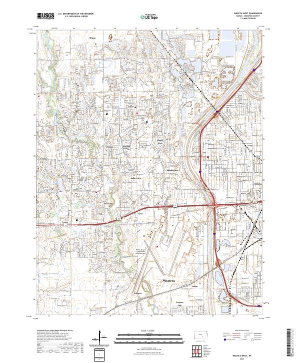 2023 Wichita West2023 Print · USGSWestern Wichita and the surrounding suburban reaches are captured here in the early 2020s as residential growth meets major aviation hubs. Genealogists and local historians can trace developments like Westlink Village or locate family sites near Resthaven Cem and the Arkansas River.
End of results
Showing maps 1-2 of 2
Top cities near Maize
- Wichita historical maps
- Derby historical maps
- Haysville historical maps
- Park City historical maps
- Bel Aire historical maps
- Valley Center historical maps
See more
Frequently asked questions
- What are the different types of historical maps available for Maize?
- What is the oldest map of Maize?
- Where can I purchase historical maps of Maize for my home or office?
- Where can I download high-res historical maps of Maize?
- Are there historical topographic maps available for Maize?
- Is there historical aerial imagery available for Maize?
- Where are historical maps of Maize sourced from?