Old Maps of Topeka, Kansas
Explore 55 old maps of Topeka, spanning from 1889 to today. These high-resolution historic maps reveal how streets, neighborhoods, landmarks, and natural features evolved over time — perfect for genealogy, metal detecting, research, and local history exploration.
What you can do with these maps:
- See how Topeka changed over time: Compare historical maps to modern-day views to trace roads, homesites, rail lines & more.
- View detailed metadata: Each map includes creators, publishers, year, scale, and archive source.
- Overlay maps with satellite & LiDAR: Visualize the past alongside modern tools to explore terrain & human change.
- Trusted historical sources: Maps sourced from the USGS, Library of Congress, and other archives.
- Access maps your way: View online, download high-res files, or order prints for personal or research use.
Start exploring old maps of Topeka to uncover forgotten places, hidden landmarks, and the deep history beneath your feet.
Topeka, KS maps
(55)- 1889 Map of Burlingame
 1889 Burlingame1889 Print · USGSOsage and Shawnee Counties are seen here during the peak of late-Victorian rail expansion and coal-country growth. Genealogists and local historians can trace early township boundaries and the development of rail hubs like Osage City, Burlingame, and the settlement of Arvonia.
 - 1889 Map of Topeka
 1889 Topeka1889 Print · USGSEastern Kansas in the late nineteenth century was a landscape of rapid rail expansion and tribal land boundaries. Genealogists can trace family roots through the Pottawatomie Indian Reservation or old settlements like Holton, Rossville, and Agency.
 - 1894 Map of Burlingame
 1894 Burlingame1894 Print · USGSOsage County was a thriving rail and coal hub in the late nineteenth century, dominated by the intersecting tracks of major regional carriers. Researchers can trace the development of early Kansas towns like Scranton, Carbondale, and the river community of Quenemo.4 unique versions available
 - 1894 Map of Topeka
 1894 Topeka1894 Print · USGSTopeka and its northern reaches are captured here in the late nineteenth century, during a pivotal era of rail expansion and settlement. Local historians can trace the early layouts of Topeka and Silver Lake alongside the Pottawatomie Indian Reservation.5 unique versions available
 - 1947 Map of Lawrence, 1954 Print
 1947 Lawrence1954 Print · USGSEastern Kansas and western Missouri thrive in the late 1940s, showing a landscape defined by major river valleys and a dense railway network. Genealogists can trace family settlements from Lawrence to Greenwood and locate landmarks like Olathe Navy and Lake Lotawana.
 - 1950 Map of Kansas City
 1950 Kansas City1950 Print · USGSMid-century Kansas and Missouri are captured here during a period of industrial growth and shifting transportation. Genealogists and historians can trace rail lines like the Wabash RR or locate ancestral homes near the Potawatomi Indian Reservation and Horton.
 - 1950 Map of Lawrence
 1950 Lawrence1950 Print · USGSMid-century Kansas and Missouri come alive in this map of the river-valley corridors just as the interstate era was beginning. Researchers can trace the legacy of major rail lines like the Union Pacific RR and locate ancestral roots in towns from Lawrence to Harrisonville.
 - 1950 Map of Topeka, 1960 Print
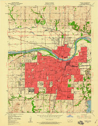 1950 Topeka1960 Print · USGSMid-century Topeka was a thriving rail hub and institutional center, bisected by the Kansas River and a massive network of steel. Genealogists and historians can trace local institutions like Washburn University and the Winter Veterans Hospital, or locate family plots in Mount Hope Fairlawn Cemetery.3 unique versions available
 - 1950 Map of Grantville, 1964 Print
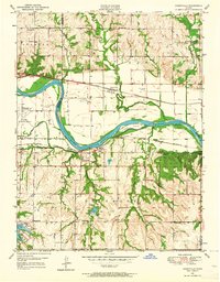 1950 Grantville1964 Print · USGSThe Kansas River valley at mid-century shows a landscape of busy rail lines and scattered rural schoolhouses. Researchers can trace the legacy of Grantville and Tecumseh along the Union Pacific tracks or locate the Frog Hatchery and Bethel Cem.4 unique versions available
 - 1951 Map of Grantville
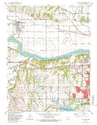
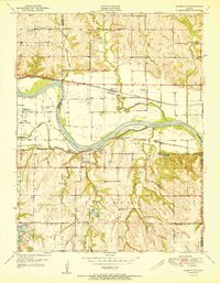 1951 Grantville1951 Print · USGSThe Kansas River valley in the early fifties shows a landscape of busy rail lines and rural school districts across the Shawnee and Jefferson county lines. Trace family roots at the Grantville Cem or locate former landmarks like Dawson Sch and the Power Plant at Tecumseh.2 unique versions available
 - 1951 Map of Topeka
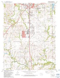
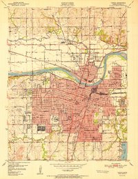 1951 Topeka1951 Print · USGSTopeka at the start of the fifties is a bustling capital hub defined by its river-valley railroads and expanding state institutions. Genealogists and historians can locate family homes near the State Capitol, Washburn University, or the sprawling Winter Veterans Hospital.2 unique versions available
 - 1952 Map of Auburn, 1953 Print
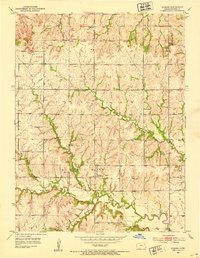 1952 Auburn1953 Print · USGSThe rural landscape of southwest Shawnee County is captured here in the early fifties, centered on the river-fed valley of Auburn. Genealogists can trace the location of numerous country schools like Sixmile Sch and old burial grounds including Elevation Cem.4 unique versions available
 - 1952 Map of Silver Lake, 1953 Print
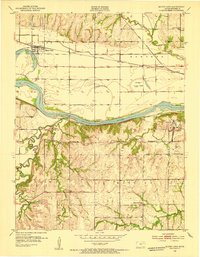 1952 Silver Lake1953 Print · USGSThe Kansas River valley west of Topeka is documented here just after the war, showing a landscape shaped by river transport and rail. You can trace the sites of rural schools like Golden Rule Sch, aviation at Shenk Landing Field, and the Union Pacific line serving Silver Lake.4 unique versions available
 - 1954 Map of Kansas City
 1954 Kansas City1954 Print · USGSThe Missouri-Kansas borderlands flourished in the post-war era as river commerce and rail networks converged at the Missouri River. Genealogists and historians can trace the foundations of Kansas City and smaller rural hubs like Hiawatha or Sabetha.
 - 1955 Map of Wakarusa, 1956 Print
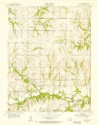
 1955 Wakarusa1956 Print · USGSMid-century Shawnee County is caught in transition as massive military expansion and modern highways meet traditional prairie life. Genealogists can locate family burial sites like Foster Cem and trace rural closures at Williamsport Sch (Abandoned).4 unique versions available
 - 1955 Map of Richland, 1956 Print
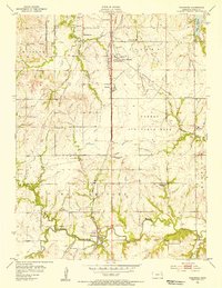
 1955 Richland1956 Print · USGSRichland and the surrounding prairie of eastern Shawnee County are captured here in the mid-1950s. Genealogists and local historians can trace rural family life through landmarks like Richland Cem, Salem Ch, and the Lyons Sch.3 unique versions available
 - 1956 Map of Kansas City, 1967 Print
 1956 Kansas City1967 Print · USGSThe Kansas-Missouri border region thrived during the mid-fifties, centered on the growing metropolitan cores and the busy river valleys. Researchers can trace the layout of significant government sites like Fort Leavenworth and the Lake City Army Ammunition Plant.4 unique versions available
 - 1956 Map of Lawrence, 1967 Print
 1956 Lawrence1967 Print · USGSEastern Kansas and the Missouri border country are captured here during the mid-century transition to the interstate era. Genealogists and local historians can trace family-named terrain like Summers Mound and the footprint of Sunflower Ordnance Works near Baldwin City.4 unique versions available
 - 1960 Map of Kansas City
 1960 Kansas City1960 Print · USGSMid-century Kansas and Missouri meet at the river forks, showing a sprawling rail-and-river economy during the 1950s growth era. Genealogists and researchers can trace tribal lands like the Kickapoo Indian Reservation or follow the early interstate corridors through Saint Joseph and Independence.3 unique versions available
 - 1961 Map of Lawrence
 1961 Lawrence1961 Print · USGSThe Kansas-Missouri borderland shows its mid-century transition from a rail-dependent agricultural region to a suburbanizing landscape. Genealogists can trace family footprints through numerous Cem sites and distinctive terrain landmarks like Graves Mound and Summers Mound.
 - 1983 Map of Silver Lake, 1984 Print
 1983 Silver Lake1984 Print · USGSSilver Lake and the western edges of Topeka are captured here in the early eighties as suburban growth meets the Kansas River valley. Researchers can trace the grounds of the Menninger Foundation, locate the Wanamaker Sch, and follow the Union Pacific line through Menoken.
 - 1983 Map of Wakarusa, 1984 Print
 1983 Wakarusa1984 Print · USGSIn the early 1980s, the southern outskirts of the Kansas capital were defined by military aviation and major transportation corridors. Researchers can trace the layout of FORBES FIELD, follow the Kansas Toll Road Turnpike, and locate rural landmarks like Berryton and Yocum Cem.
 - 1983 Map of Topeka, 1984 Print
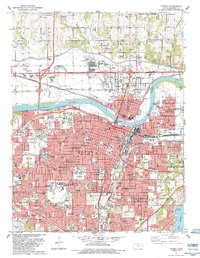 1983 Topeka1984 Print · USGSTopeka during the early eighties shows a dense capital city thriving along the Kansas River and its major rail corridors. Researchers can locate specific institutions like Washburn University, the Capitol, and historic sites such as Mount Hope Cemetery.
 - 1983 Map of Grantville, 1984 Print
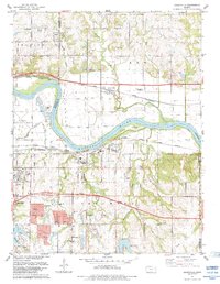 1983 Grantville1984 Print · USGSThe Kansas River valley east of Topeka shows a landscape of busy rail lines and river islands in the early 1980s. Researchers can locate specific family history sites like Grantville Cem, North Fairview Sch, and the riverside settlement of Tecumseh.
 - 1983 Map of Lawrence, 1984 Print
 1983 Lawrence1984 Print · USGSEastern Kansas in the early eighties shows a landscape of growing reservoirs and historic rail towns. Genealogists and historians can trace routes through Topeka and Ottawa, or locate smaller sites like Highland Cem and the settlement of Vassar.
Showing maps 1-25 of 55
Top cities near Topeka
- Menoken historical maps
- Carbondale historical maps
- Kanwaka Township historical maps
- Silver Lake historical maps
- Auburn historical maps
- Meriden historical maps
See more
Top neighborhoods of Topeka
- North Topeka historical maps
- Oakland historical maps
- Highland Park historical maps
- Terra Heights historical maps
- Belmont historical maps
- Mathews Park historical maps
See more
Frequently asked questions
- What are the different types of historical maps available for Topeka?
- What is the oldest map of Topeka?
- Where can I purchase historical maps of Topeka for my home or office?
- Where can I download high-res historical maps of Topeka?
- Are there historical topographic maps available for Topeka?
- Is there historical aerial imagery available for Topeka?
- Where are historical maps of Topeka sourced from?