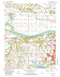
1983 Map of Silver Lake
USGS Topo · Published 1984About this map
Silver Lake sits north of the winding Kansas River, serving as a focal point for the eponymous township in the early 1980s. The landscape is defined by the river’s broad floodplain and the agricultural plains that stretch toward the northern horizon, where the Union Pacific railroad parallels the waterway. This area reveals the westward expansion of Topeka, marked by institutional landmarks such as the Menninger Foundation and the Kansas Museum of History.
Find a feature on this map
37 named features on this map. Tap any name to fly to it.
Don’t see what you’re looking for? This feature index may not catch every label — zoom into the map to look around manually.
Map Details
Editions of this 1983 Silver Lake Map
This is the sole edition of this map. No revisions or reprints were ever made.
Other maps of this area

1889 · Burlingame
USGS Topo · 1:125,000

1889 · Topeka
USGS Topo · 1:125,000

1894 · Burlingame
USGS Topo · 1:125,000

1894 · Topeka
USGS Topo · 1:125,000

1947 · Lawrence
USGS Topo · 1:250,000

1950 · Kansas City
USGS Topo · 1:250,000

1950 · Lawrence
USGS Topo · 1:250,000

1950 · Topeka
USGS Topo · 1:24,000

1951 · Topeka
USGS Topo · 1:24,000

1952 · Auburn
USGS Topo · 1:24,000