Old Maps of Topeka, Kansas
Explore 25 old maps of Topeka, spanning from 1889 to today. These high-resolution historic maps reveal how streets, neighborhoods, landmarks, and natural features evolved over time — perfect for genealogy, metal detecting, research, and local history exploration.
What you can do with these maps:
- See how Topeka changed over time: Compare historical maps to modern-day views to trace roads, homesites, rail lines & more.
- View detailed metadata: Each map includes creators, publishers, year, scale, and archive source.
- Overlay maps with satellite & LiDAR: Visualize the past alongside modern tools to explore terrain & human change.
- Trusted historical sources: Maps sourced from the USGS, Library of Congress, and other archives.
- Access maps your way: View online, download high-res files, or order prints for personal or research use.
Start exploring old maps of Topeka to uncover forgotten places, hidden landmarks, and the deep history beneath your feet.
Topeka, KS maps
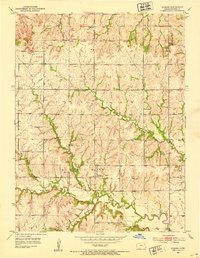
(25)- 1889 Map of Burlingame
 1889 Burlingame1889 Print · USGSCovers Topeka, including Osage City, Dover, and other nearby areas
 - 1889 Map of Topeka
 1889 Topeka1889 Print · USGSCovers Topeka, including Holton, Rock Creek, and other nearby areas
 - 1894 Map of Burlingame
 1894 Burlingame1894 Print · USGSCovers Topeka, including Osage City, Dover, and other nearby areas5 unique versions available
 - 1894 Map of Topeka
 1894 Topeka1894 Print · USGSCovers Topeka, including Holton, Rock Creek, and other nearby areas5 unique versions available
 - 1947 Map of Lawrence, 1954 Print
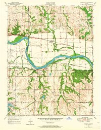
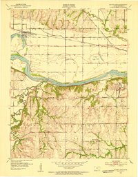
 1947 Lawrence1954 Print · USGSCovers Topeka, including Kansas City, Overland Park, and other nearby areas
 - 1950 Map of Kansas City
 1950 Kansas City1950 Print · USGSCovers Topeka, including Kansas City, Overland Park, and other nearby areas
 - 1950 Map of Lawrence
 1950 Lawrence1950 Print · USGSCovers Topeka, including Kansas City, Overland Park, and other nearby areas
 - 1950 Map of Topeka, 1960 Print
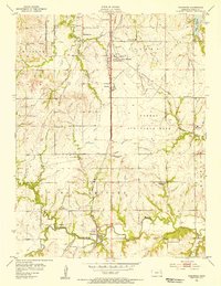
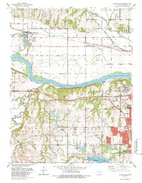
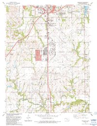
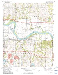
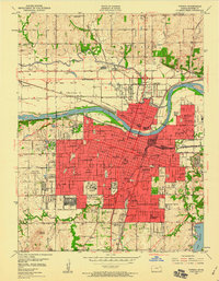 1950 Topeka1960 Print · USGSCovers Topeka, including Menoken, Oakland, and other nearby areas3 unique versions available
 - 1950 Map of Grantville, 1964 Print
 1950 Grantville1964 Print · USGSCovers Topeka, including Kanwaka Township, Tecumseh, and other nearby areas4 unique versions available
 - 1951 Map of Grantville
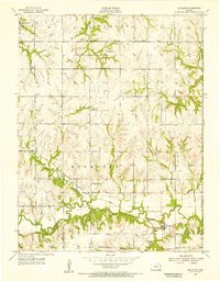
 1951 Grantville1951 Print · USGSCovers Topeka, including Kanwaka Township, Tecumseh, and other nearby areas2 unique versions available
 - 1951 Map of Topeka
 1951 Topeka1951 Print · USGSCovers Topeka, including Menoken, Oakland, and other nearby areas2 unique versions available
 - 1952 Map of Auburn, 1953 Print
 1952 Auburn1953 Print · USGSCovers Topeka, including Auburn, Shawnee County, and other nearby areas4 unique versions available
 - 1952 Map of Silver Lake, 1953 Print
 1952 Silver Lake1953 Print · USGSCovers Topeka, including Silver Lake, Kiro, and other nearby areas4 unique versions available
 - 1954 Map of Kansas City
 1954 Kansas City1954 Print · USGSCovers Topeka, including Kansas City, Overland Park, and other nearby areas
 - 1955 Map of Wakarusa, 1956 Print
 1955 Wakarusa1956 Print · USGSCovers Topeka, including Berryton, Wakarusa, and other nearby areas4 unique versions available
 - 1955 Map of Richland, 1956 Print
 1955 Richland1956 Print · USGSCovers Topeka, including Kanwaka Township, Watson, and other nearby areas3 unique versions available
 - 1956 Map of Kansas City, 1967 Print
 1956 Kansas City1967 Print · USGSCovers Topeka, including Kansas City, Overland Park, and other nearby areas4 unique versions available
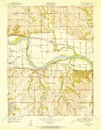
 - 1956 Map of Lawrence, 1967 Print
 1956 Lawrence1967 Print · USGSCovers Topeka, including Kansas City, Overland Park, and other nearby areas4 unique versions available
 - 1960 Map of Kansas City
 1960 Kansas City1960 Print · USGSCovers Topeka, including Kansas City, Overland Park, and other nearby areas3 unique versions available
 - 1961 Map of Lawrence
 1961 Lawrence1961 Print · USGSCovers Topeka, including Kansas City, Overland Park, and other nearby areas
 - 1983 Map of Silver Lake, 1984 Print
 1983 Silver Lake1984 Print · USGSCovers Topeka, including Silver Lake, Kiro, and other nearby areas
 - 1983 Map of Wakarusa, 1984 Print
 1983 Wakarusa1984 Print · USGSCovers Topeka, including Berryton, Wakarusa, and other nearby areas
 - 1983 Map of Topeka, 1984 Print
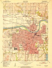
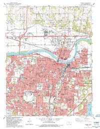 1983 Topeka1984 Print · USGSCovers Topeka, including Menoken, Oakland, and other nearby areas
 - 1983 Map of Grantville, 1984 Print
 1983 Grantville1984 Print · USGSCovers Topeka, including Kanwaka Township, Tecumseh, and other nearby areas
 - 1983 Map of Lawrence, 1984 Print
 1983 Lawrence1984 Print · USGSCovers Topeka, including Lawrence, Ottawa, and other nearby areas
End of results
Showing maps 1-25 of 25
Top cities near Topeka
- Menoken historical maps
- Carbondale historical maps
- Kanwaka Township historical maps
- Silver Lake historical maps
- Auburn historical maps
- Meriden historical maps
See more
Top neighborhoods of Topeka
- Highland Park historical maps
- Mathews Park historical maps
- North Topeka historical maps
- Oakland historical maps
- Terra Heights historical maps
- Belmont historical maps
See more
Frequently asked questions
- What are the different types of historical maps available for Topeka?
- What is the oldest map of Topeka?
- Where can I purchase historical maps of Topeka for my home or office?
- Where can I download high-res historical maps of Topeka?
- Are there historical topographic maps available for Topeka?
- Is there historical aerial imagery available for Topeka?
- Where are historical maps of Topeka sourced from?