1940s Maps of Victory Junction, Kansas City
Explore 2 historic maps of Victory Junction from the 1940s. These maps offer a rare glimpse into what life looked like during the 1940s — showing old roads, neighborhoods, homes, and landmarks that have changed or disappeared over time.
Whether you're researching your family's past, planning a metal detecting trip, or studying how Victory Junction's landscape evolved across the 1940s, these high-resolution maps are a powerful tool for exploring the history of this region.
- Focus on a specific era: All maps on this page are from the 1940s, giving you a focused view of this time period.
- See what’s changed: Compare century-old streets, trails, and buildings to today's modern landscape using overlays and satellite layers.
- Research with precision: Use these maps for genealogy, historical research, land use analysis, or educational projects.
- View, download, or print: Maps are fully viewable online in high resolution, and can be downloaded or printed for your own records.
Start exploring Victory Junction's history through authentic maps from the 1940s. This is your window into the past.
Victory Junction, Kansas City maps
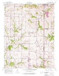
(2)- 1940 Map of Bonner Springs
 1940 Bonner Springs1940 Print · USGSThe Kansas and Missouri rivers converge near these busy rail corridors just before the Second World War. Researchers can trace rural life through dozens of named schools like Mission Sch and the community center at Elm Grove Community Hall.3 unique versions available
 - 1949 Map of Basehor, 1976 Print
 1949 Basehor1976 Print · USGSLeavenworth County agriculture and industry meet at the mid-century as the outskirts of Kansas City begin to stir. Genealogists can locate family sites like Holy Angels Cemetery, Little Stranger Church, and the grounds of the Kansas State Penitentiary.
End of results
Showing maps 1-2 of 2
Frequently asked questions
- What are the different types of historical maps available for Victory Junction?
- What is the oldest map of Victory Junction?
- Where can I purchase historical maps of Victory Junction for my home or office?
- Where can I download high-res historical maps of Victory Junction?
- Are there historical topographic maps available for Victory Junction?
- Is there historical aerial imagery available for Victory Junction?
- Where are historical maps of Victory Junction sourced from?