Old Maps of Kino, Kentucky for Genealogy
Trace your family roots with 10 historic maps of Kino. These high-res maps reveal old neighborhoods, homesites, landmarks, and streets — helping you uncover where your ancestors lived and how the area evolved over time.
- Explore historic neighborhoods: Identify where your relatives may have lived in the 1800s or 1900s.
- Compare maps over time: Trace the changes in streets, buildings, and landmarks for multi-generational research.
- Perfect for genealogy & ancestry research: Used by family historians and researchers to map out lineage and migration.
These maps are an incredible resource for exploring your personal connection to Kino's past.
Kino, KY maps
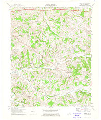
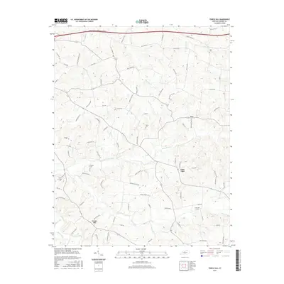
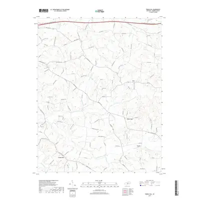
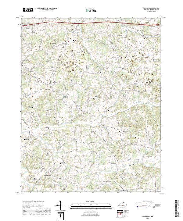
(10)- 1953 Map of Temple Hill, 1954 Print
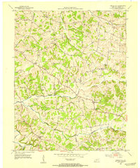 1953 Temple Hill1954 Print · USGSBarren County's rural communities are captured here in the early fifties, showing a landscape defined by small-scale farming and local parishes. Researchers can trace family history through sites like Forest Seminary Sch, Eighty Eight, and the Peden Cem.2 unique versions available
 - 1956 Map of Corbin, 1966 Print
 1956 Corbin1966 Print · USGSThe Kentucky and Tennessee borderlands are captured here in the mid-fifties, showing the region's shift toward modern interstate travel and reservoir development. Genealogists and historians can trace old community lines near Albany and Monticello or locate early rail junctions along the Southern and Tennessee Central lines.3 unique versions available
 - 1958 Map of Corbin
 1958 Corbin1958 Print · USGSThe Upper Cumberland borderlands appear in the late 1950s as massive reservoirs and early atomic-era growth reshape the region. Trace family roots and vanished landmarks near Lake Cumberland, Oak Ridge, and the Cumberland National Forest.
 - 1973 Map of Temple Hill, 1975 Print
 1973 Temple Hill1975 Print · USGSTemple Hill and the surrounding Barren County countryside are captured here in the early 1970s as modern infrastructure began to reshape the rural landscape. Genealogists and local historians can trace family-named sites like Barbour Cem, the remote Saltpeter Cave, and country schools including Eastern Sch.2 unique versions available
 - 1985 Map of Tompkinsville, 1986 Print
 1985 Tompkinsville1986 Print · USGSThe Kentucky-Tennessee borderlands come into focus in the mid-1980s, showcasing a landscape of river-fed valleys and rural crossroads. Genealogists and local historians can trace family locations from Glasgow and Edmonton to the distinctively named Eighty Eight, Bugtussle, and Akersville.2 unique versions available
 - 2010 Map of Temple Hill, 2010 Print
 2010 Temple Hill2010 Print · USGSCovers Kino, including Temple Hill, Eighty Eight, and other nearby areas
 - 2013 Map of Temple Hill, 2013 Print
 2013 Temple Hill2013 Print · USGSCovers Kino, including Temple Hill, Eighty Eight, and other nearby areas
 - 2016 Map of Temple Hill, 2016 Print
 2016 Temple Hill2016 Print · USGSCovers Kino, including Temple Hill, Eighty Eight, and other nearby areas
 - 2019 Map of Temple Hill, 2019 Print
 2019 Temple Hill2019 Print · USGSCovers Kino, including Temple Hill, Eighty Eight, and other nearby areas
 - 2022 Map of Temple Hill, 2022 Print
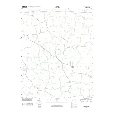
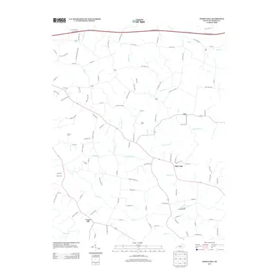
 2022 Temple Hill2022 Print · USGSBarren County, Kentucky, remains a land of quiet crossroads and family legacies in this recent topographic survey. Genealogists can trace hundreds of family names through sites like Wells - Bailey Cem and the settlement of Eighty Eight.
End of results
Showing maps 1-10 of 10
Top cities near Kino
- Glasgow historical maps
- Tompkinsville historical maps
- Cave City historical maps
- Horse Cave historical maps
- Edmonton historical maps
- Fountain Run historical maps
Frequently asked questions
- What are the different types of historical maps available for Kino?
- What is the oldest map of Kino?
- Where can I purchase historical maps of Kino for my home or office?
- Where can I download high-res historical maps of Kino?
- Are there historical topographic maps available for Kino?
- Is there historical aerial imagery available for Kino?
- Where are historical maps of Kino sourced from?