2020s Maps of Boyle County, Kentucky
Explore 8 historic maps of Boyle County from the 2020s. These maps offer a rare glimpse into what life looked like during the 2020s — showing old roads, neighborhoods, homes, and landmarks that have changed or disappeared over time.
Whether you're researching your family's past, planning a metal detecting trip, or studying how Boyle County's landscape evolved across the 2020s, these high-resolution maps are a powerful tool for exploring the history of this region.
- Focus on a specific era: All maps on this page are from the 2020s, giving you a focused view of this time period.
- See what’s changed: Compare century-old streets, trails, and buildings to today's modern landscape using overlays and satellite layers.
- Research with precision: Use these maps for genealogy, historical research, land use analysis, or educational projects.
- View, download, or print: Maps are fully viewable online in high resolution, and can be downloaded or printed for your own records.
Start exploring Boyle County's history through authentic maps from the 2020s. This is your window into the past.
Boyle County, KY maps
(8)- 2022 Map of Junction City, 2022 Print
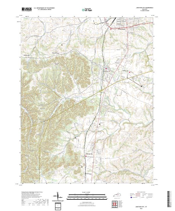 2022 Junction City2022 Print · USGSBoyle and Lincoln counties meet in this 2022 survey, showcasing the enduring rural communities and rolling terrain south of the state's central bluegrass region. Researchers can trace family names at Gray Cem or Sandidge Cem and locate local landmarks like Stuart Powell Field.
 - 2022 Map of Stanford, 2022 Print
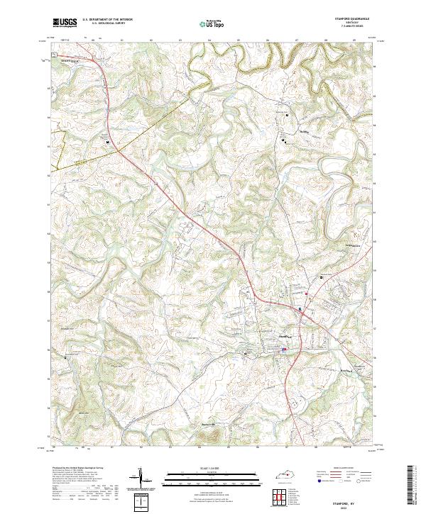 2022 Stanford2022 Print · USGSStanford and the rural corridors of Lincoln County are captured in this contemporary survey of the Kentucky Bluegrass. Researchers can trace family history through numerous landmarks like Blackerby Cem and the small settlements of Boneyville and Rowland.
 - 2022 Map of Mackville, 2022 Print
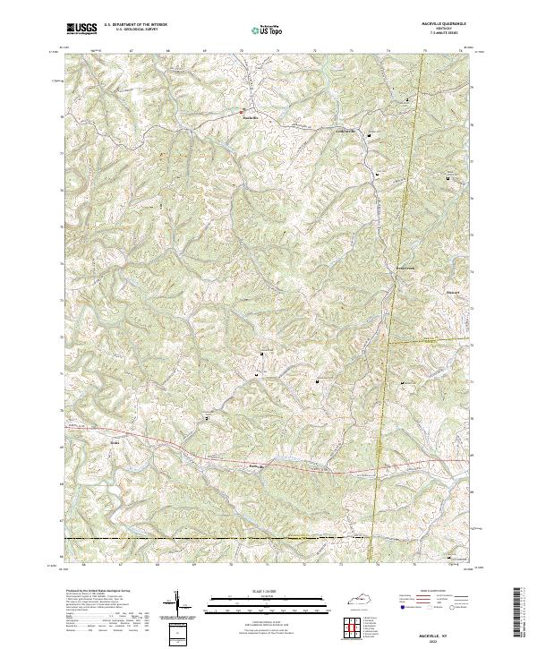 2022 Mackville2022 Print · USGSThis rural portion of Washington County in the 2020s remains a landscape of ridge-top roads and family cemeteries. Genealogists and local historians can trace legacy sites like Cocanougher Cem and Holderman Cem near the historic crossroads of Texas and Mackville.
 - 2022 Map of Bryantsville, 2022 Print
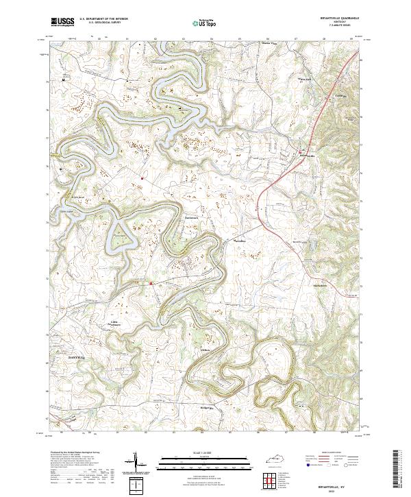 2022 Bryantsville2022 Print · USGSThe rolling Garrard County landscape south of the Kentucky River is documented in this modern survey. Researchers can trace old family sites and rural settlements like Little Needmore, Davistown, and several burial grounds including Sallee Cem.
 - 2022 Map of Perryville, 2022 Print
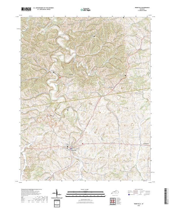 2022 Perryville2022 Print · USGSBoyle and Mercer Counties appear here in the early 2020s, showing a landscape deeply rooted in its local history and geography. Genealogists can trace family landmarks across the quadrangle, including the Perryville National Cem, Dixville, and Patterson Family Cem.
 - 2022 Map of Danville, 2022 Print
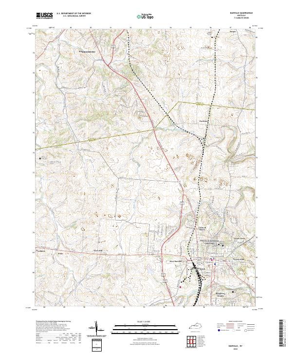 2022 Danville2022 Print · USGSCentral Kentucky's college town and county seat are captured in the early 2020s, showing the modern footprint of Danville and Harrodsburg. Researchers can trace local lineages at Bellevue Cem or locate the historic grounds of Centre College.
 - 2022 Map of Parksville, 2022 Print
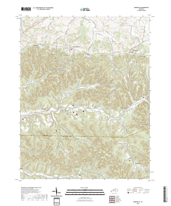 2022 Parksville2022 Print · USGSBoyle and Casey Counties are documented here in the early twenty-first century, showing a landscape shaped by the Knobs and deep hollows. Researchers can locate numerous family burial grounds like Mitchell Cem and Purdom Cem or trace the early paths of Forkland and Butchertown.
 - 2022 Map of Gravel Switch, 2022 Print
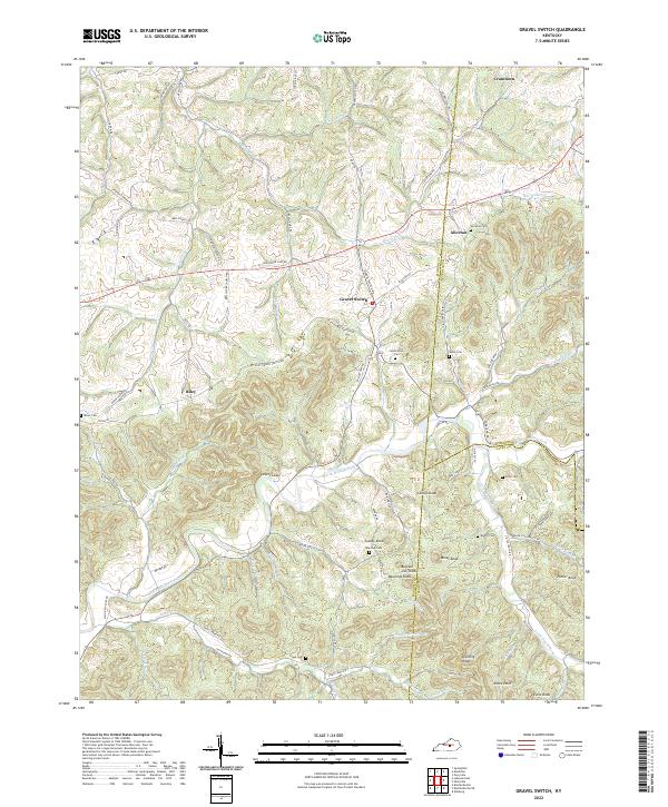 2022 Gravel Switch2022 Print · USGSMarion County and the surrounding tri-county border lands are captured here in the early 2020s, showcasing a landscape of high knobs and creek valleys. Researchers can locate family landmarks like Rollertown Cem, Rawlings Knob, and the small settlement of Gravel Switch.
End of results
Showing maps 1-8 of 8
Top cities of Boyle County
Frequently asked questions
- What are the different types of historical maps available for Boyle County?
- What is the oldest map of Boyle County?
- Where can I purchase historical maps of Boyle County for my home or office?
- Where can I download high-res historical maps of Boyle County?
- Are there historical topographic maps available for Boyle County?
- Is there historical aerial imagery available for Boyle County?
- Where are historical maps of Boyle County sourced from?