2020s Maps of Caldwell County, Kentucky
Explore 15 historic maps of Caldwell County from the 2020s. These maps offer a rare glimpse into what life looked like during the 2020s — showing old roads, neighborhoods, homes, and landmarks that have changed or disappeared over time.
Whether you're researching your family's past, planning a metal detecting trip, or studying how Caldwell County's landscape evolved across the 2020s, these high-resolution maps are a powerful tool for exploring the history of this region.
- Focus on a specific era: All maps on this page are from the 2020s, giving you a focused view of this time period.
- See what’s changed: Compare century-old streets, trails, and buildings to today's modern landscape using overlays and satellite layers.
- Research with precision: Use these maps for genealogy, historical research, land use analysis, or educational projects.
- View, download, or print: Maps are fully viewable online in high resolution, and can be downloaded or printed for your own records.
Start exploring Caldwell County's history through authentic maps from the 2020s. This is your window into the past.
Caldwell County, KY maps
(15)- 2022 Map of Marion, 2022 Print
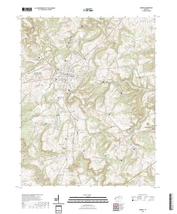 2022 Marion2022 Print · USGSMarion and the surrounding Kentucky hillsides are captured in this recent survey, showcasing the area's deep-rooted community network. Genealogists can trace family burial sites across the landscape, including Crooked Creek Baptist Church Cem, Crayne Cem, and Baker Cem.
 - 2022 Map of Fredonia, 2022 Print
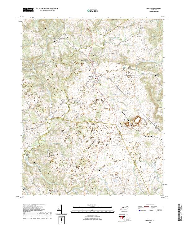 2022 Fredonia2022 Print · USGSCaldwell County's rural crossroads and family homesteads are preserved in this recent survey of the Kentucky Pennyroyal region. Researchers can trace land ties and lineage through numerous sites like Old Rushing Cem, Mexico, and the distinctive The Knob.
 - 2022 Map of Eddyville, 2022 Print
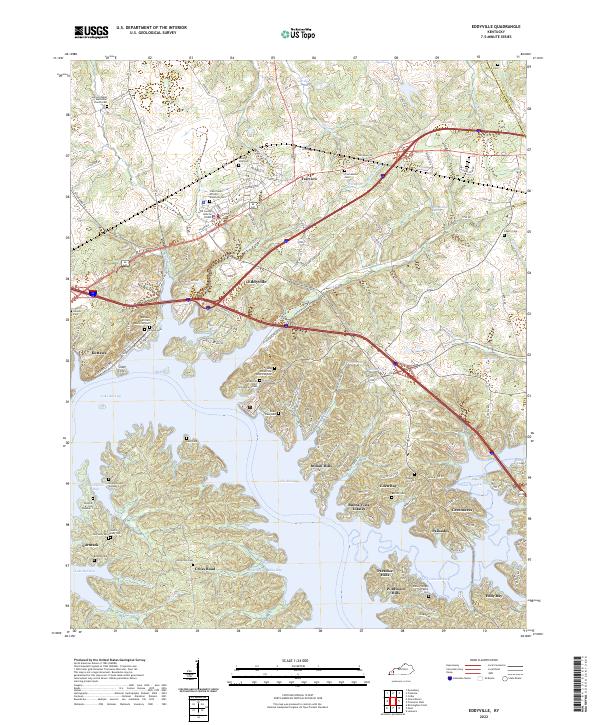 2022 Eddyville2022 Print · USGSLyon County's shoreline and settlements come into sharp focus in this 2022 survey as they wrap around the fingers of Lake Barkley. Local historians can trace numerous burial sites like the Kuttawa African American Cem or find local landmarks such as Silver Cliffs and the Lyon County Judicial Center.
 - 2022 Map of Gracey, 2022 Print
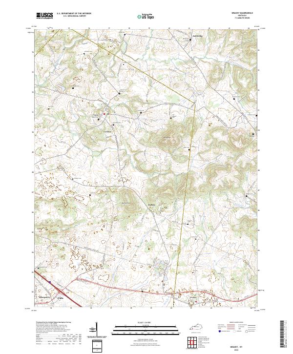 2022 Gracey2022 Print · USGSThe crossroads of Christian and Trigg Counties come into focus in this recent survey of Western Kentucky's farming country. Family historians can trace numerous rural burial sites like Bainbridge Grove Cem and Childress Cem near the banks of Horse Cr.
 - 2022 Map of Dalton, 2022 Print
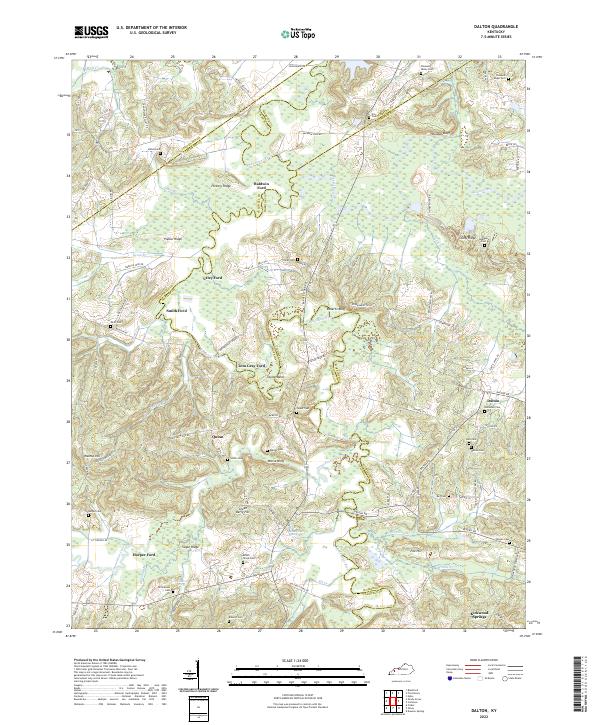 2022 Dalton2022 Print · USGSWestern Kentucky's river-driven geography is on full display in this modern survey of the Tradewater River corridor. Researchers can trace ancestral connections through numerous rural burial grounds like Holloman Cem and historic river crossings such as Utley Ford or Tom Gray Ford.
 - 2022 Map of Dawson Springs SW, 2022 Print
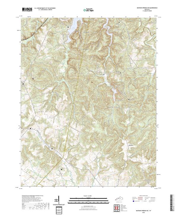 2022 Dawson Springs SW2022 Print · USGSChristian and Caldwell counties are shown here in the early 2020s, centered on the wooded ridges and the waters of Lake Beshear. Researchers can locate numerous family-named landmarks and burial sites like Rogers Cem, Irvin Cem, and Newsom Cem.
 - 2022 Map of Princeton East, 2022 Print
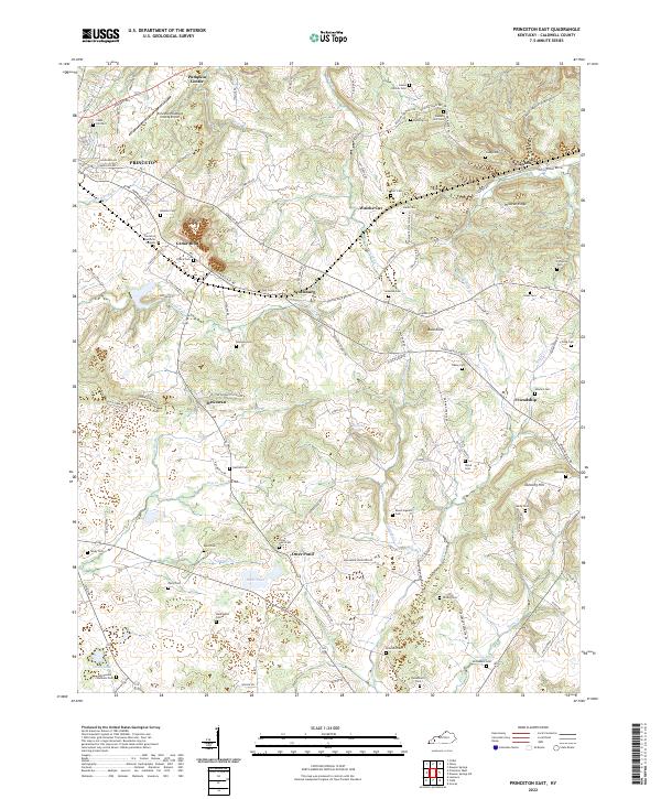 2022 Princeton East2022 Print · USGSCaldwell County's rural heartland is preserved in this recent survey, showcasing a landscape of small farm communities and family history. Trace ancestral roots at Wadlington Cem or McConnell Cem, and explore old transport routes along Old Railroad Bed Rd near Scottsburg.
 - 2022 Map of Olney, 2022 Print
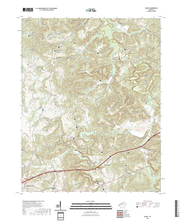 2022 Olney2022 Print · USGSCaldwell County, Kentucky, near the Tradewater River, maintained its rural character into the twenty-first century. Genealogists can trace family names across dozens of sites like Prospect Cem, McNealy Cem, and the small crossroads of Needmore.
 - 2022 Map of Cobb, 2022 Print
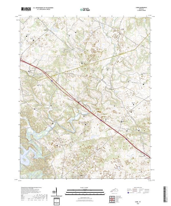 2022 Cobb2022 Print · USGSTrigg and Caldwell Counties in the early 2020s remain defined by a deep network of family homesteads and rural crossroads. Researchers can trace dozens of family burial sites such as Sugar Jim Mitchell Cem and Dyer - Brandon Cem.
 - 2022 Map of Lamasco, 2022 Print
 2022 Lamasco2022 Print · USGSLyon and Trigg Counties are shown here as the modern lakefront economy meets deep-rooted Kentucky heritage. Researchers can trace family history through dozens of remote sites like the Cunningham Trigg Furnace Cem, Trigg Furnace, and Hurricane Church.
 - 2022 Map of Providence, 2022 Print
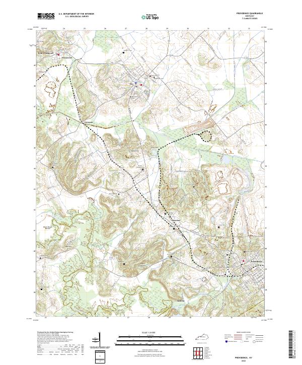 2022 Providence2022 Print · USGSProvidence and the surrounding Webster County coalfields are captured here in the early twenty-first century. Researchers can trace historic industrial sites like the Othawia Mine or locate family burial plots at Odd Fellows Cem and New Hopewell Cem.
 - 2022 Map of Crider, 2022 Print
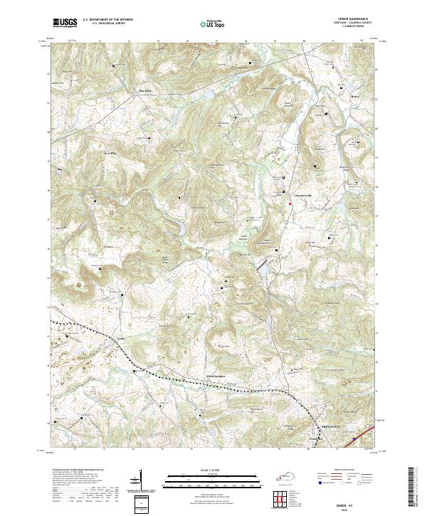 2022 Crider2022 Print · USGSCaldwell County's rural landscape is captured here in the early twenty-first century, showing a region deeply rooted in family land and faith. Researchers can trace dozens of burial sites like Donaldson Baptist Church Cem and the Winn Cem near the P & L RR.
 - 2022 Map of Princeton West, 2022 Print
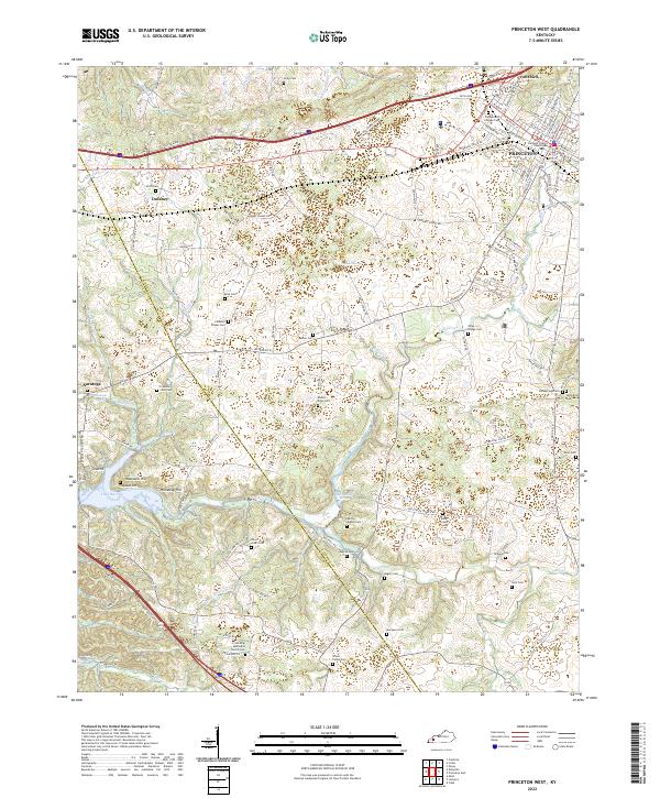 2022 Princeton West2022 Print · USGSCaldwell County's western reaches appear in the early 2020s as a landscape where rural crossroads and modern infrastructure meet the shores of Lake Barkley. Researchers can trace deep local roots through family-named landmarks like Scott Cem, Dulaney, and the Friendship Methodist Church Cem.
 - 2022 Map of Dawson Springs, 2022 Print
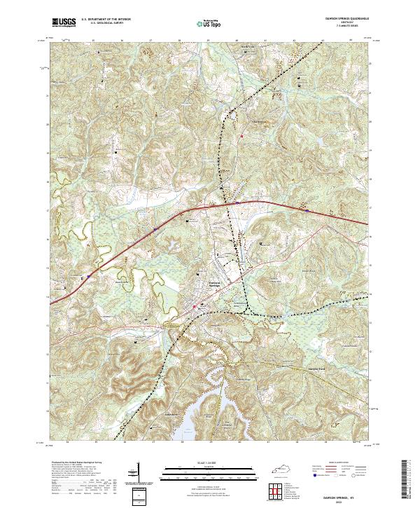 2022 Dawson Springs2022 Print · USGSDawson Springs and the surrounding river valleys are captured here in the early twenty-first century as the region manages its complex water and rail networks. Genealogists can locate numerous family burial sites like Walnut Grove Cem and Piney Grove Cem near the shores of Lake Beshear.
 - 2022 Map of Shady Grove, 2022 Print
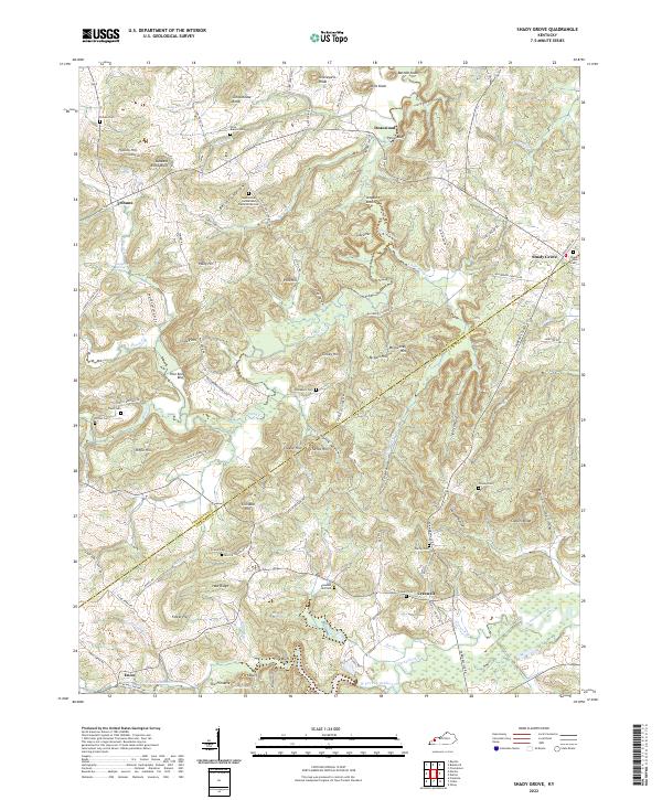 2022 Shady Grove2022 Print · USGSCrittenden and Caldwell Counties are depicted in this 2020s survey of western Kentucky's hilly borderlands. Genealogists can trace family names through numerous burial sites including Sugar Grove Cumberland Presbyterian Cemetery and Wilson Cemetery.
End of results
Showing maps 1-15 of 15
Top cities of Caldwell County
Frequently asked questions
- What are the different types of historical maps available for Caldwell County?
- What is the oldest map of Caldwell County?
- Where can I purchase historical maps of Caldwell County for my home or office?
- Where can I download high-res historical maps of Caldwell County?
- Are there historical topographic maps available for Caldwell County?
- Is there historical aerial imagery available for Caldwell County?
- Where are historical maps of Caldwell County sourced from?