Old Maps of Gregoryville, Kentucky for Academic Research
Study the evolution of Gregoryville with 11 high-resolution historic maps. Whether you're teaching, researching, or modeling changes in land use, these maps provide essential visual documentation of urban, environmental, and geographic change.
- Analyze long-term change: Track patterns in development, transportation, and natural features.
- Ideal for environmental or urban studies: Support academic projects with primary historical map data.
- Use in the classroom or lab: Educators and researchers rely on these maps to bring historical context to life.
These maps are a powerful tool for teaching, research, and visualizing how Gregoryville has changed over the decades.
Gregoryville, KY maps
(11)- 1950 Map of Grahn, 1952 Print
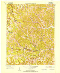 1950 Grahn1952 Print · USGSCarter County's rugged karst hills are captured here in the early fifties, showing a landscape defined by deep hollows and narrow creek bottoms. Researchers can trace the Chesapeake and Ohio rail line past the Aden Tunnel, find family roots at Littleton Cem, or locate the Clay Mines near Grahn.
 - 1957 Map of Huntington, 1966 Print
 1957 Huntington1966 Print · USGSThe industrial heart of the Ohio River valley is captured here in the mid-sixties, showing the growth of Huntington and Ashland. Researchers can trace the extensive rail networks of the Chesapeake and Ohio RR and locate sites like the Chief Cornstalk Hunting Ground.3 unique versions available
 - 1960 Map of Huntington
 1960 Huntington1960 Print · USGSThe tri-state river valley thrived in the late fifties as a hub of heavy industry and Appalachian rail transit. Genealogists and historians can trace the connection between river towns like Ashland and Portsmouth or locate family homesteads near Coleman Ridge.
 - 1962 Map of Grahn, 1964 Print
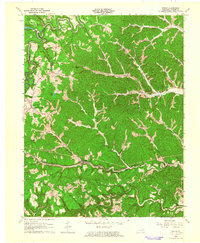 1962 Grahn1964 Print · USGSCarter County's rugged karst landscape and rail corridors are captured here in the early sixties. Genealogists and hikers can trace family sites like Littleton Cem or explore the early layout of Carter Caves State Park and the village of Grahn.
 - 1970 Map of Grahn, 1972 Print
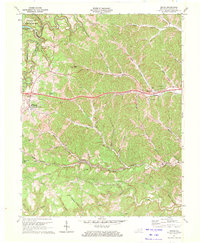 1970 Grahn1972 Print · USGSCarter County in the early seventies shows a landscape defined by the winding paths of the Chesapeake and Ohio railroad and rugged mining operations. Researchers can trace rural life through the Aden Tunnel, the Bledsoe Cem, and the old Pleasant Valley Sch.2 unique versions available
 - 1982 Map of Morehead, 1983 Print
 1982 Morehead1983 Print · USGSThe foothills of northeastern Kentucky come alive in the early eighties, showcasing a landscape defined by timber, limestone caves, and major reservoirs. Local researchers can trace the development of Morehead State University or locate old crossings at Plummers Mill and Salt Lick.
 - 2010 Map of Grahn, 2010 Print
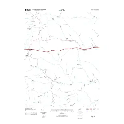
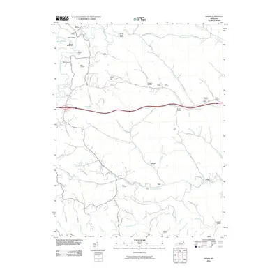 2010 Grahn2010 Print · USGSCovers Gregoryville, including Grahn, Counts Crossroads, and other nearby areas
 - 2013 Map of Grahn, 2013 Print
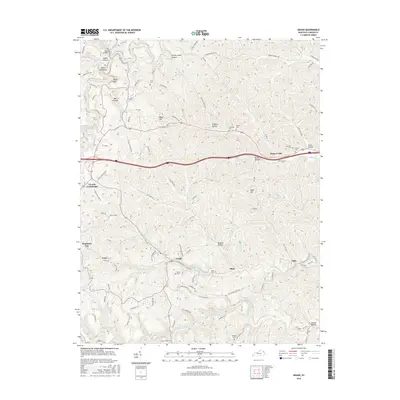
 2013 Grahn2013 Print · USGSCovers Gregoryville, including Grahn, Counts Crossroads, and other nearby areas
 - 2016 Map of Grahn, 2016 Print
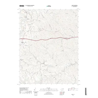
 2016 Grahn2016 Print · USGSCovers Gregoryville, including Grahn, Counts Crossroads, and other nearby areas
 - 2019 Map of Grahn, 2019 Print
 2019 Grahn2019 Print · USGSCovers Gregoryville, including Grahn, Counts Crossroads, and other nearby areas
 - 2022 Map of Grahn, 2022 Print
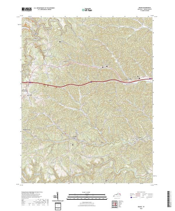 2022 Grahn2022 Print · USGSEastern Kentucky's rugged valleys and hilltops come alive in this 2022 study of the Carter County landscape. Researchers can trace family history through sites like Everman Cem and follow the path of the Chesapeake and Ohio Railway through Grahn.
End of results
Showing maps 1-11 of 11
Top cities near Gregoryville
Frequently asked questions
- What are the different types of historical maps available for Gregoryville?
- What is the oldest map of Gregoryville?
- Where can I purchase historical maps of Gregoryville for my home or office?
- Where can I download high-res historical maps of Gregoryville?
- Are there historical topographic maps available for Gregoryville?
- Is there historical aerial imagery available for Gregoryville?
- Where are historical maps of Gregoryville sourced from?