Old Maps of Bennettstown, Kentucky for Academic Research
Study the evolution of Bennettstown with 12 high-resolution historic maps. Whether you're teaching, researching, or modeling changes in land use, these maps provide essential visual documentation of urban, environmental, and geographic change.
- Analyze long-term change: Track patterns in development, transportation, and natural features.
- Ideal for environmental or urban studies: Support academic projects with primary historical map data.
- Use in the classroom or lab: Educators and researchers rely on these maps to bring historical context to life.
These maps are a powerful tool for teaching, research, and visualizing how Bennettstown has changed over the decades.
Bennettstown, KY maps
(12)- 1951 Map of Herndon, 1953 Print
 1951 Herndon1953 Print · USGSThe Kentucky and Tennessee borderlands are captured here in the early fifties during the expansion of the Fort Campbell Military Reservation. Local historians can trace old homesteads and landmarks like Flat Lick Ch, Bennettstown, and South Christian Sch.
 - 1956 Map of Nashville, 1971 Print
 1956 Nashville1971 Print · USGSThe Tennessee-Kentucky borderlands come into focus in the mid-1960s as major reservoir projects transformed the Cumberland and Tennessee river valleys. Researchers can trace the rail networks of the Louisville and Nashville and visit sites like Fort Campbell and Fort Donelson National Military Park.2 unique versions available
 - 1957 Map of Herndon, 1960 Print
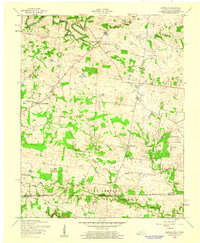 1957 Herndon1960 Print · USGSSouthern Christian County was undergoing a major shift in the late fifties as military expansion met traditional farming life. Researchers can trace family sites like Double Barn Cem and South Christian Sch alongside the growing Fort Campbell Military Reservation.
 - 1957 Map of Herndon, 1964 Print
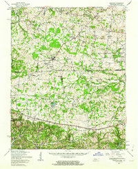 1957 Herndon1964 Print · USGSSpanning the Kentucky and Tennessee line in the late fifties, this area shows the massive Fort Campbell Military Reservation during its Cold War peak. Genealogists can trace family landmarks like Double Barn Cem and the rural crossroads at Roaring Spring.
 - 1959 Map of Nashville
 1959 Nashville1959 Print · USGSMiddle Tennessee and Southern Kentucky come into focus during the late fifties, showing the region's transition into a modern transportation and military hub. Researchers can trace the sprawling Fort Campbell Military Reservation or locate historic rail stops along the Tennessee Central Ry and Illinois Central RR.
 - 1978 Map of Herndon
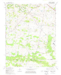 1978 Herndon1978 Print · USGSThe Kentucky-Tennessee borderlands south of Hopkinsville are captured here in the late seventies as military activity and rural life converged. Genealogists can locate family names at Major Cem or Garrott Cem and trace the defunct Old Railroad Grade near Howel.2 unique versions available
 - 1980 Map of Hopkinsville, 1983 Print
 1980 Hopkinsville1983 Print · USGSThe Kentucky and Tennessee borderlands appear here at the start of the 1980s, centered on the massive Fort Campbell Military Reservation. Trace the impact of the Cumberland River impoundment at Lake Barkley or locate rail hubs like Guthrie and Elkton.
 - 2010 Map of Herndon, 2010 Print
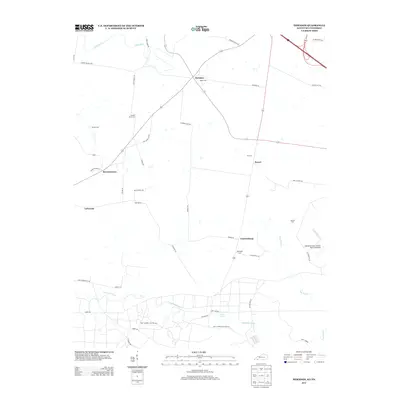
 2010 Herndon2010 Print · USGSCovers Bennettstown, including LaFayette, Garrettsburg, and other nearby areas
 - 2013 Map of Herndon, 2013 Print
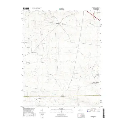
 2013 Herndon2013 Print · USGSCovers Bennettstown, including LaFayette, Garrettsburg, and other nearby areas
 - 2016 Map of Herndon, 2016 Print
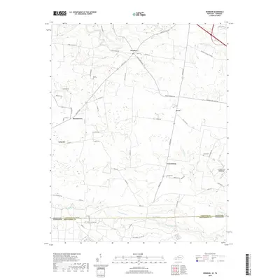
 2016 Herndon2016 Print · USGSCovers Bennettstown, including LaFayette, Garrettsburg, and other nearby areas
 - 2019 Map of Herndon, 2019 Print
 2019 Herndon2019 Print · USGSCovers Bennettstown, including LaFayette, Garrettsburg, and other nearby areas
 - 2022 Map of Herndon, 2022 Print
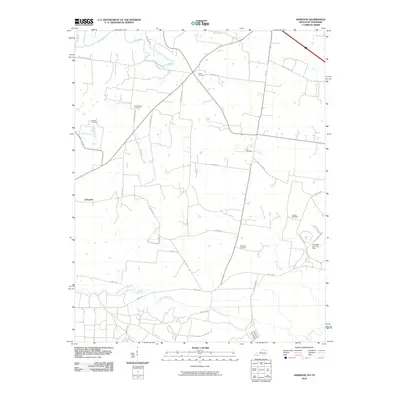
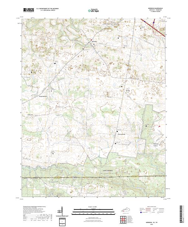 2022 Herndon2022 Print · USGSChristian County, Kentucky, and Montgomery County, Tennessee, meet here in this modern survey of the rural borderlands. Genealogists and local historians can locate numerous family burial grounds like Double Barn Cem and Dixon Cem, or trace the boundary of the Fort Campbell Military Res.
End of results
Showing maps 1-12 of 12
Top cities near Bennettstown
- Clarksville historical maps
- Hopkinsville historical maps
- Oak Grove historical maps
- Cadiz historical maps
- Dover historical maps
- LaFayette historical maps
Frequently asked questions
- What are the different types of historical maps available for Bennettstown?
- What is the oldest map of Bennettstown?
- Where can I purchase historical maps of Bennettstown for my home or office?
- Where can I download high-res historical maps of Bennettstown?
- Are there historical topographic maps available for Bennettstown?
- Is there historical aerial imagery available for Bennettstown?
- Where are historical maps of Bennettstown sourced from?