Old Maps of Clark County, Kentucky for Genealogy
Trace your family roots with 79 historic maps of Clark County. These high-res maps reveal old neighborhoods, homesites, landmarks, and streets — helping you uncover where your ancestors lived and how the area evolved over time.
- Explore historic neighborhoods: Identify where your relatives may have lived in the 1800s or 1900s.
- Compare maps over time: Trace the changes in streets, buildings, and landmarks for multi-generational research.
- Perfect for genealogy & ancestry research: Used by family historians and researchers to map out lineage and migration.
These maps are an incredible resource for exploring your personal connection to Clark County's past.
Clark County, KY maps
(79)- 1892 Map of Richmond
 1892 Richmond1892 Print · USGSMadison and Clark counties are mapped here in the late nineteenth century, centered on the growing railroad hub of Richmond. Genealogists can trace family land and travel routes through historic crossings like Boonesboro, river towns like Ford, and high points such as Combs Mtn.
 - 1892 Map of Beattyville
 1892 Beattyville1892 Print · USGSThe Kentucky River and its headwaters define this late nineteenth-century survey of the rugged Cumberland Plateau. Researchers can trace the early industrial sites of Estill Furnace and Fitchburg Furnace alongside the path of the Kentucky Union Railroad.6 unique versions available
 - 1897 Map of Richmond
 1897 Richmond1897 Print · USGSMadison and Clark counties are mapped here during a decade of rapid railroad expansion and river-based commerce. Genealogists can trace family names and extinct locales from Boonesboro to the industrial Stone Quarry and the hub at Winchester.5 unique versions available
 - 1927 Map of Lexington
 1927 Lexington1927 Print · USGSCentral Kentucky's Bluegrass region in the late twenties was a landscape of influential pikes and rural rail junctions. Genealogists can trace family-named settlements like Mattoxtown and Uttingertown or find local landmarks like Antioch Ch.
 - 1929 Map of Lexington
 1929 Lexington1929 Print · USGSThe heart of the Kentucky Bluegrass comes to life in the late twenties, centered on the growing urban hubs of Lexington and Paris. Researchers can locate ancestral crossroads and rural institutions like Russell Cave Sch, Antioch Ch, and the grounds of Elmendorf.2 unique versions available
 - 1950 Map of Levee, 1954 Print
 1950 Levee1954 Print · USGSThe foothills of the Cumberland Plateau come alive in this mid-century survey of the Montgomery and Powell county line. Genealogists and historians can trace family locations near the Westbend Ch, Willoughby Cem, and the community of Indian Fields.
 - 1952 Map of Union City, 1953 Print
 1952 Union City1953 Print · USGSMadison County in the early fifties is captured here just as rural life centered on the local ridges and creek valleys. Genealogists can trace family roots through landmarks like Union City, Flatwoods Cem, and Old Cain Springs Ch.4 unique versions available
 - 1952 Map of Palmer, 1953 Print
 1952 Palmer1953 Print · USGSThe Kentucky River meanders through the limestone ridges of Estill, Madison, and Clark Counties during the early fifties. Genealogists can trace family landmarks and schools including The Bend Sch, the Alexander Sch, and dozens of family plots like the Gatman Cem.3 unique versions available
 - 1952 Map of Clintonville, 1953 Print
 1952 Clintonville1953 Print · USGSFayette County in the early 1950s is a landscape of established rail lines and significant military activity at the Lexington Signal Depot. Researchers can trace the layout of rural communities like Uttingertown and Old Pine Grove, along with historic sites like Little Zion Ch and Briar Hill Sch.
 - 1952 Map of Austerlitz, 1953 Print
 1952 Austerlitz1953 Print · USGSThe northern outskirts of Winchester and the rural Bourbon-Clark county line are captured here in the early fifties. Genealogists and historians can trace the paths of the Louisville and Nashville railroad and locate landmarks like Thatchers Mill or Pretty Run Sch.
 - 1952 Map of Levee, 1954 Print
 1952 Levee1954 Print · USGSThe Montgomery County foothills in the early fifties show a landscape of deep hollows and high points. Genealogists can trace family names and local sites from Kiddville to Camargo, including the Westbend School and the McKee Boy Scout Camp.
 - 1952 Map of Ford, 1954 Print
 1952 Ford1954 Print · USGSThe Kentucky River corridor and its surrounding uplands appear here in the early fifties, showing a landscape defined by sharp river bends and family-run farms. Genealogists can trace rural roots through Durbin Memorial Ch and family plots like Younger Cem and Evans Cem.
 - 1952 Map of Winchester, 1954 Print
 1952 Winchester1954 Print · USGSIn the early fifties, Winchester flourished as a rail hub where the Chesapeake and Ohio met the Louisville and Nashville. Genealogists can locate rural institutions like the Julius Rosenwald Sch, Old Stone Ch, and the outlying settlement of Flanagan near the Kentucky River.
 - 1952 Map of Sideview, 1954 Print
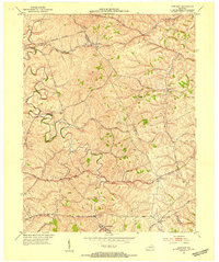 1952 Sideview1954 Print · USGSThe rolling hills of Clark and Montgomery counties are captured in the early fifties, showing a rural landscape of tight-knit communities. Family researchers can trace ancestral locations through names like Mason Cem, Sewell Shop, and Wades Mill.
 - 1952 Map of Hedges, 1954 Print
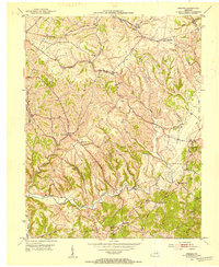 1952 Hedges1954 Print · USGSCentral Kentucky’s rural landscape is captured here in the early fifties as small farming communities thrived alongside major rail lines. Genealogists and local historians can trace family sites like Rupert Cem and old crossroads such as Schollsville and Rabbit Town.
 - 1956 Map of Louisville, 1971 Print
 1956 Louisville1971 Print · USGSThe Ohio River valley and the Kentucky Bluegrass are captured here during a period of rapid mid-century growth and industrial activity. Genealogists and historians can trace rail-centered towns and military land use at Fort Knox and the Jefferson Proving Ground.2 unique versions available
 - 1957 Map of Winchester, 1968 Print
 1957 Winchester1968 Print · USGSCentral Kentucky's landscape in the mid-twentieth century features the sprawling Fort Knox and the early parkway system. Genealogists and historians can trace rail lines like the Southern Railway and find landmarks from Bernheim Forest to Pilot Knob.3 unique versions available
 - 1957 Map of Jenkins, 1974 Print
 1957 Jenkins1974 Print · USGSThe Cumberland Plateau in the mid-twentieth century reveals a complex landscape of winding river valleys and deep-seated industry. Genealogists and historians can trace the development of Hazard, Jenkins, and Pikeville alongside extensive Numerous Oil and Gas Fields and the routes of the Chesapeake & Ohio Railway.
 - 1959 Map of Austerlitz, 1960 Print
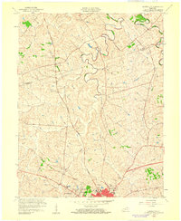 1959 Austerlitz1960 Print · USGSThe outskirts of Winchester and the rural reaches of the Bluegrass region are shown here at the end of the fifties. Researchers can find suburban growth in Bel Air, trace the Louisville and Nashville rail line, or locate the Stony Point Ch.
 - 1959 Map of Winchester, 1960 Print
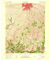 1959 Winchester1960 Print · USGSWinchester and the surrounding Bluegrass countryside are caught here in the late fifties as suburban growth began to reach beyond the historic city center. Genealogists can trace family footprints at Old Stone Ch, Providence Ch, and the rural settlement of Flanagan.
 - 1960 Map of Jenkins
 1960 Jenkins1960 Print · USGSEastern Kentucky and the West Virginia borderlands are captured at a mid-century peak of the coal and rail era. Trace the industrial corridors of the Chesapeake and Ohio RR through mountain hubs like Hazard and Jenkins.
 - 1960 Map of Winchester
 1960 Winchester1960 Print · USGSCentral Kentucky's diverse landscape is shown here at mid-century, from the bluegrass plains to the rugged Pottsville Escarpment. Genealogists and historians can trace the rail-and-river network connecting towns like Bardstown and Stanford alongside landmarks like Lake Cumberland.
 - 1964 Map of Louisville
 1964 Louisville1964 Print · USGSThe Ohio River valley and Kentucky Bluegrass are captured in the mid-1960s, showing a region balanced between industrial growth and its agrarian roots. Genealogists and historians can trace the development of county seats like Shelbyville and Paris, or locate established institutions such as Georgetown College and Bernheim Forest.
 - 1965 Map of Winchester, 1966 Print
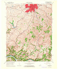 1965 Winchester1966 Print · USGSIn the mid-1960s, Winchester was a growing regional hub defined by its historic rail junctions and new suburban estates. Researchers can locate the grounds of Southeastern Christian College, rural centers like Providence, and the winding Kentucky River.3 unique versions available
 - 1965 Map of Austerlitz, 1966 Print
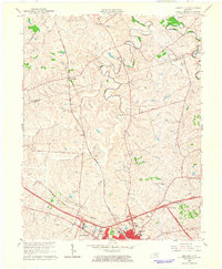 1965 Austerlitz1966 Print · USGSThe Clark County countryside around Winchester is shown during a period of transition in the mid-sixties as new parkways met historic rail lines. Genealogists and local researchers can trace family lands near Austerlitz, Stony Point, and the Louisville and Nashville railroad.
Showing maps 1-25 of 79
Top cities of Clark County
Frequently asked questions
- What are the different types of historical maps available for Clark County?
- What is the oldest map of Clark County?
- Where can I purchase historical maps of Clark County for my home or office?
- Where can I download high-res historical maps of Clark County?
- Are there historical topographic maps available for Clark County?
- Is there historical aerial imagery available for Clark County?
- Where are historical maps of Clark County sourced from?