2020s Maps of Crittenden County, Kentucky
Explore 16 historic maps of Crittenden County from the 2020s. These maps offer a rare glimpse into what life looked like during the 2020s — showing old roads, neighborhoods, homes, and landmarks that have changed or disappeared over time.
Whether you're researching your family's past, planning a metal detecting trip, or studying how Crittenden County's landscape evolved across the 2020s, these high-resolution maps are a powerful tool for exploring the history of this region.
- Focus on a specific era: All maps on this page are from the 2020s, giving you a focused view of this time period.
- See what’s changed: Compare century-old streets, trails, and buildings to today's modern landscape using overlays and satellite layers.
- Research with precision: Use these maps for genealogy, historical research, land use analysis, or educational projects.
- View, download, or print: Maps are fully viewable online in high resolution, and can be downloaded or printed for your own records.
Start exploring Crittenden County's history through authentic maps from the 2020s. This is your window into the past.
Crittenden County, KY maps
(16)- 2021 Map of Cave-in-Rock, 2021 Print
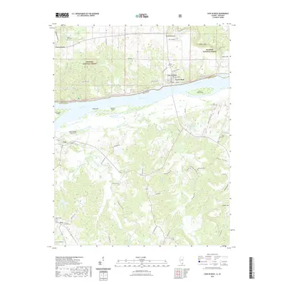 2021 Cave-in-Rock2021 Print · USGSCovers Crittenden County, including Cave-in-Rock, Cave-In-Rock, and other nearby areas
 - 2021 Map of Rosiclare, 2021 Print
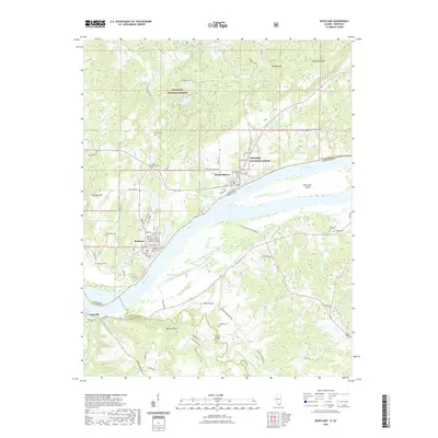 2021 Rosiclare2021 Print · USGSCovers Crittenden County, including Rosiclare, Elizabethtown, and other nearby areas
 - 2022 Map of Marion, 2022 Print
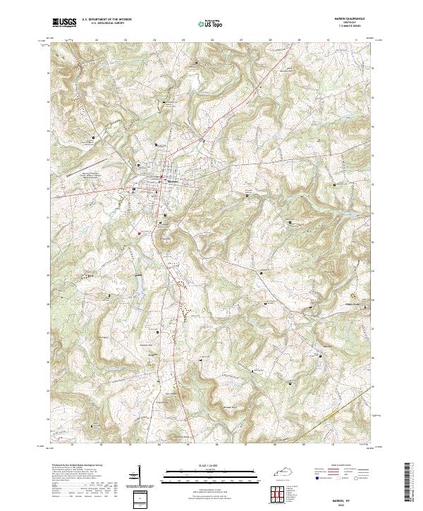 2022 Marion2022 Print · USGSMarion and the surrounding Kentucky hillsides are captured in this recent survey, showcasing the area's deep-rooted community network. Genealogists can trace family burial sites across the landscape, including Crooked Creek Baptist Church Cem, Crayne Cem, and Baker Cem.
 - 2022 Map of Lola, 2022 Print
 2022 Lola2022 Print · USGSLivingston County in the early twenty-first century remains a landscape of family legacy and rural quiet. Researchers can trace ancestral sites like Jameson Cem Number 2 and Hosick Cem Number 1 near the settlements of Lola and Salem.
 - 2022 Map of Salem, 2022 Print
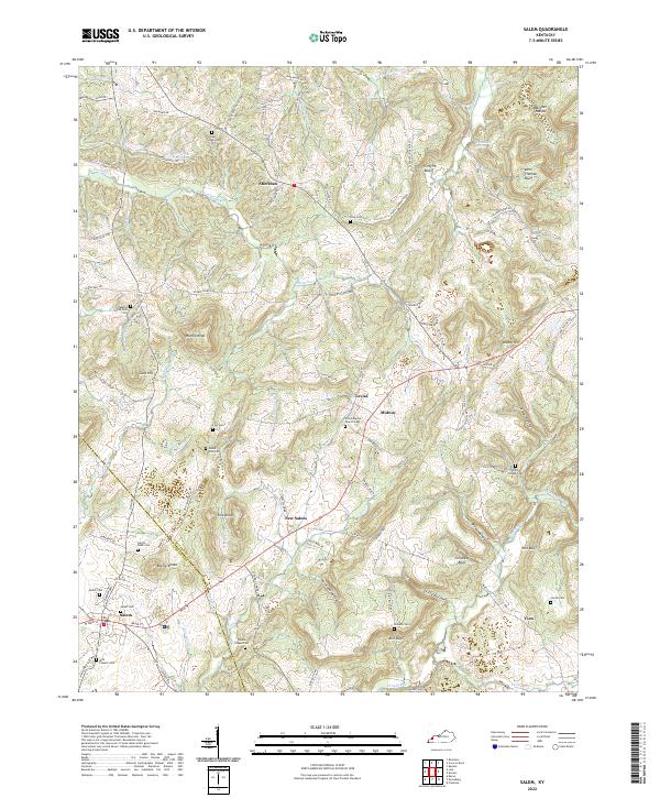 2022 Salem2022 Print · USGSThe borderlands of Livingston and Crittenden Counties are captured here in the early twenty-first century. Researchers can trace ancestral roots through numerous local sites like Mills Pioneer Cem, Union Baptist Church Cem, and the old crossroads at Levias.
 - 2022 Map of Fredonia, 2022 Print
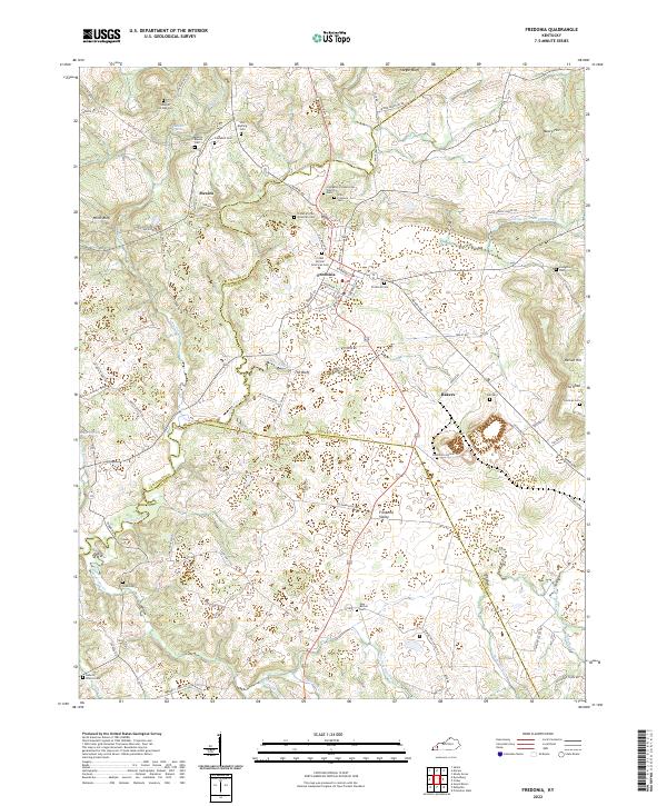 2022 Fredonia2022 Print · USGSCaldwell County's rural crossroads and family homesteads are preserved in this recent survey of the Kentucky Pennyroyal region. Researchers can trace land ties and lineage through numerous sites like Old Rushing Cem, Mexico, and the distinctive The Knob.
 - 2022 Map of Dekoven, 2022 Print
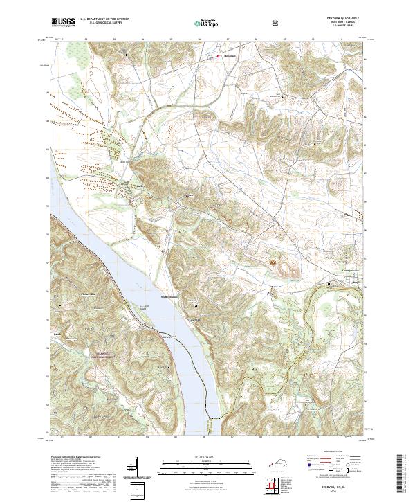 2022 Dekoven2022 Print · USGSThe riverfront and mining country of Union County come alive in this modern survey of the Kentucky-Illinois border. Genealogists can locate family landmarks such as Bells Mines Cem and Saint Ambrose Cem or trace the old roads leading into Caseyville and Dekoven.
 - 2022 Map of Dycusburg, 2022 Print
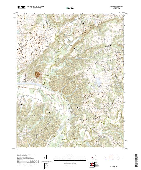 2022 Dycusburg2022 Print · USGSWestern Kentucky’s river country comes to life here as it appeared in recent years, centered on the historic Cumberland River corridor. Genealogists can trace family names at sites like Frances Presbyterian Church Cem, Stevenson Cem, and Pinckneyville Cem.
 - 2022 Map of Repton, 2022 Print
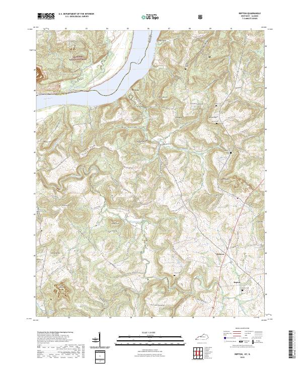 2022 Repton2022 Print · USGSCrittenden County at the river's edge remains a land of ridge-top roads and deep hollows. Genealogists can trace family footprints at Baker Church Cem, Repton Cem, and the historic crossroads of Mattoon.
 - 2022 Map of Dalton, 2022 Print
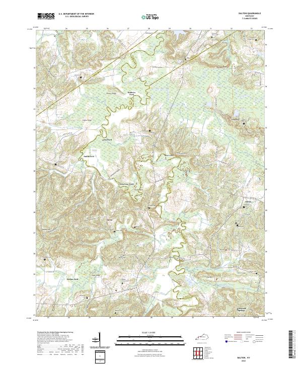 2022 Dalton2022 Print · USGSWestern Kentucky's river-driven geography is on full display in this modern survey of the Tradewater River corridor. Researchers can trace ancestral connections through numerous rural burial grounds like Holloman Cem and historic river crossings such as Utley Ford or Tom Gray Ford.
 - 2022 Map of Sturgis, 2022 Print
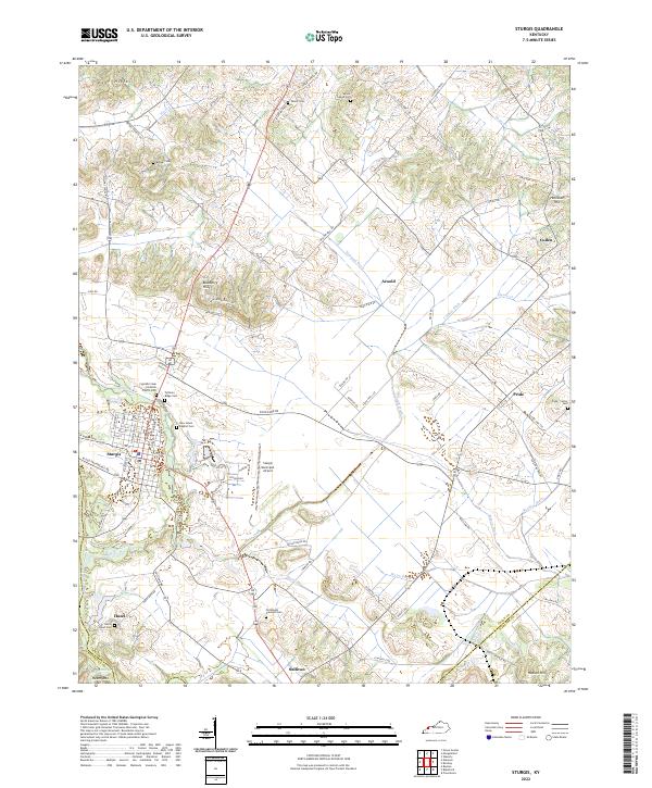 2022 Sturgis2022 Print · USGSThe town of Sturgis and its surrounding Kentucky farmland are captured in the early 2020s, revealing a landscape defined by complex drainage and rural community roots. Local history researchers can trace family names through the Cypress Creek Christian Church Cem or locate old settlements like Pride and Sullivan.
 - 2022 Map of Blackford, 2022 Print
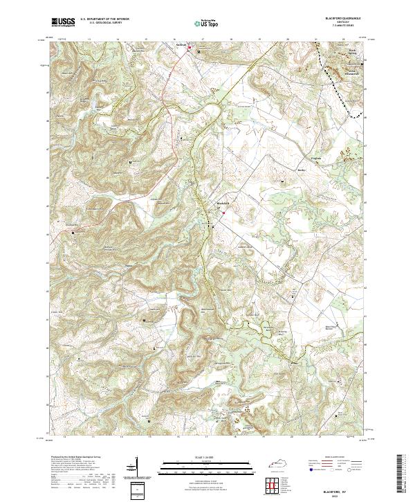 2022 Blackford2022 Print · USGSCrittenden and Webster counties come alive in this map of the Tradewater River basin as it appeared in the early 2020s. Genealogists can trace family roots through a dense network of burial sites like Sullivan Community Cem, Blackford Cem, and the Virginia Mine.
 - 2022 Map of Providence, 2022 Print
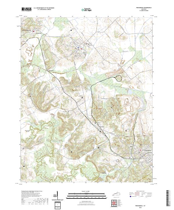 2022 Providence2022 Print · USGSProvidence and the surrounding Webster County coalfields are captured here in the early twenty-first century. Researchers can trace historic industrial sites like the Othawia Mine or locate family burial plots at Odd Fellows Cem and New Hopewell Cem.
 - 2022 Map of Shady Grove, 2022 Print
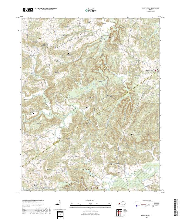 2022 Shady Grove2022 Print · USGSCrittenden and Caldwell Counties are depicted in this 2020s survey of western Kentucky's hilly borderlands. Genealogists can trace family names through numerous burial sites including Sugar Grove Cumberland Presbyterian Cemetery and Wilson Cemetery.
 - 2024 Map of Rosiclare, 2024 Print
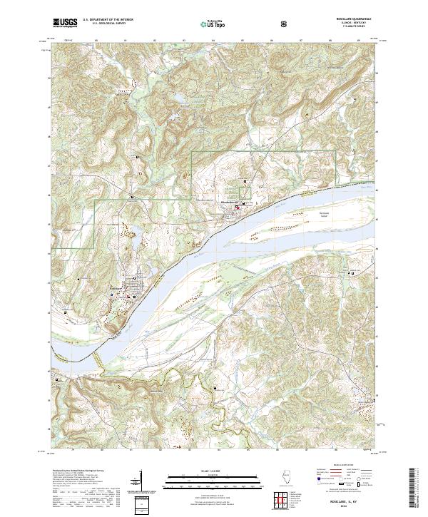 2024 Rosiclare2024 Print · USGSSouthern Illinois river life along the Ohio comes into focus in this contemporary survey of Hardin County. Genealogists and local historians can trace family roots through numerous burial sites like Fluorine Cem and Wallace Cem or locate the Hardin County Courthouse.
 - 2024 Map of Cave-in-Rock, 2024 Print
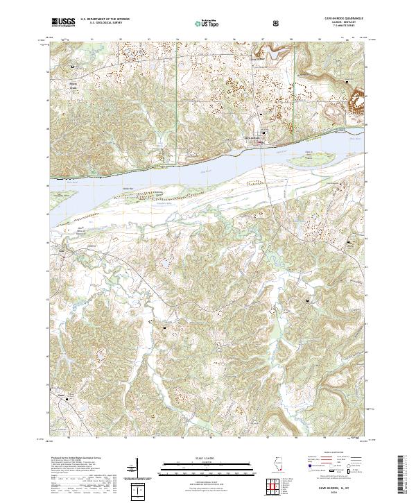 2024 Cave-in-Rock2024 Print · USGSThe Ohio River dominates this borderland between Illinois and Kentucky in the mid-2020s. Researchers can trace family history at Cave in Rock Cem, the Cook Graveyard, and the settlement of Tolu near Devils Elbow of Hurricane.
End of results
Showing maps 1-16 of 16
Top cities of Crittenden County
Frequently asked questions
- What are the different types of historical maps available for Crittenden County?
- What is the oldest map of Crittenden County?
- Where can I purchase historical maps of Crittenden County for my home or office?
- Where can I download high-res historical maps of Crittenden County?
- Are there historical topographic maps available for Crittenden County?
- Is there historical aerial imagery available for Crittenden County?
- Where are historical maps of Crittenden County sourced from?