Old Maps of Edmonson County, Kentucky
Explore 86 old maps of Edmonson County, spanning from 1922 to today. These high-resolution historic maps reveal how streets, neighborhoods, landmarks, and natural features evolved over time — perfect for genealogy, metal detecting, research, and local history exploration.
What you can do with these maps:
- See how Edmonson County changed over time: Compare historical maps to modern-day views to trace roads, homesites, rail lines & more.
- View detailed metadata: Each map includes creators, publishers, year, scale, and archive source.
- Overlay maps with satellite & LiDAR: Visualize the past alongside modern tools to explore terrain & human change.
- Trusted historical sources: Maps sourced from the USGS, Library of Congress, and other archives.
- Access maps your way: View online, download high-res files, or order prints for personal or research use.
Start exploring old maps of Edmonson County to uncover forgotten places, hidden landmarks, and the deep history beneath your feet.
Edmonson County, KY maps
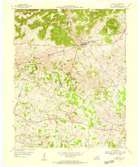
(86)- 1922 Map of Leitchfield
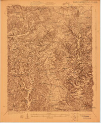 1922 Leitchfield1922 Print · USGSGrayson and Edmonson counties in the early twenties were defined by a robust network of small schools and local industry. Genealogists can trace family connections through landmarks like Duvall Cemetery, the Kentucky Rock Asphalt Co Mine, and the Rogers Springs School.
 - 1922 Map of Brownsville
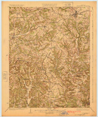
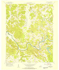
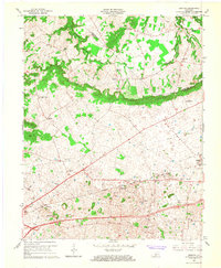
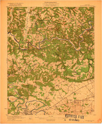 1922 Brownsville1922 Print · USGSEdmonson and Warren Counties are mapped here in the early 1920s, showing a river-centered economy still reliant on ferries and landings. Genealogists can trace family footprints across dozens of country school sites like Poplar Spring School and historic crossings like Sadler Ford.
 - 1922 Map of Mammoth Cave, 1957 Print
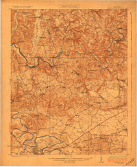
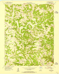
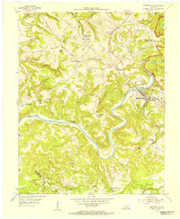
 1922 Mammoth Cave1957 Print · USGSThe Green River valley and the Kentucky karst country are captured here in the early 1920s, before the full development of the national park. Researchers can trace family-named landmarks and long-established crossings like Fishtrap Ferry, Good Spring Church, and the world-renowned Mammoth Cave.7 unique versions available
 - 1923 Map of Mammoth Cave
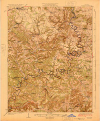
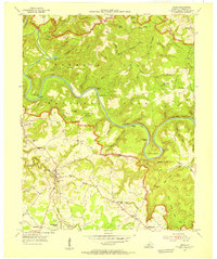
 1923 Mammoth Cave1923 Print · USGSThe subterranean wonders of Edmonson County are mapped in the early 1920s alongside the river ferries and rail towns of the Kentucky karst. Family historians can trace ancestral roots through dozens of local landmarks like Good Spring Church, Ollie School, and Houchins Ferry.6 unique versions available
 - 1923 Map of Brownsville
 1923 Brownsville1923 Print · USGSThe river-driven economies of Edmonson and Warren counties are preserved here in the early twentieth century. Researchers can trace ancestral locations through dozens of named sites like Bethlehem Church, Dalton Ferry, and rural schoolhouses including Poplar Spring School.3 unique versions available
 - 1925 Map of Cub Run
 1925 Cub Run1925 Print · USGSCentral Kentucky's rural landscape is captured here in the mid-1920s, dominated by the intricate loops of the Nolin River. Genealogists and historians can locate numerous family-named landmarks like Dickeys Mills, Sanders Store, and Hester School.3 unique versions available
 - 1925 Map of Leitchfield
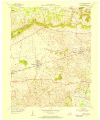
 1925 Leitchfield1925 Print · USGSGrayson and Edmonson counties are mapped in the mid-twenties as rural farming and coal communities. Genealogists can locate family landmarks like Rogers Springs School, the Meredith Coal Bank, and Beech Grove Church.2 unique versions available
 - 1953 Map of Ready, 1954 Print
 1953 Ready1954 Print · USGSEdmonson and Grayson Counties are captured here in the early fifties, showing a rural landscape defined by close-knit crossroads communities. Researchers can trace the locations of family landmarks and local institutions like Rabbit Flat Ch, Sunfish Sch, and the Woosley Cem.3 unique versions available
 - 1953 Map of Bee Spring, 1955 Print
 1953 Bee Spring1955 Print · USGSEdmonson and Grayson Counties come alive in this mid-century survey of the rugged ridges above the Nolin River. Genealogists and local historians can trace family locations near Sweeden, identify historic burial sites like Gibson Cem, and locate long-gone schoolhouses such as Decker Sch and St Johns Sch.
 - 1954 Map of Evansville
 1954 Evansville1954 Print · USGSThe Ohio River borderlands between Indiana and Kentucky appear here during a period of robust industrial and military growth. Genealogists and researchers can trace the rail corridors of the Illinois Central and find landmarks like US Lock and Dam No 48 or Camp Breckinridge.
 - 1954 Map of Dickeys Mills, 1955 Print
 1954 Dickeys Mills1955 Print · USGSThe Nolin River loops through the Kentucky karst country in the mid-fifties, just north of the legendary cave system. Trace family roots at Demunbruns Store, Temple Hill Ch, and cemeteries like Washington Meredith Cem.2 unique versions available
 - 1954 Map of Cub Run, 1955 Print
 1954 Cub Run1955 Print · USGSHart County and the surrounding Kentucky hills appear here in the mid-1950s, centered on the tight meanders of the Nolin River. Genealogists and local historians can trace rural family landmarks like Lines Mill, Broad Ford Sch, and Macedonia Ch.2 unique versions available
 - 1954 Map of Bristow, 1955 Print
 1954 Bristow1955 Print · USGSWarren and Edmonson Counties come alive in this mid-fifties study of the Kentucky karst and rail corridors. Genealogists can trace family roots through landmarks like Penns Chapel, Chalybeate Sch, and the rail-stop communities of Oakland and Bristow.2 unique versions available
 - 1954 Map of Brownsville, 1955 Print
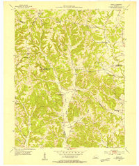
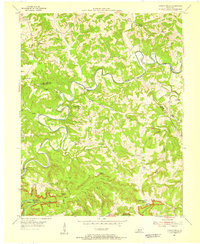
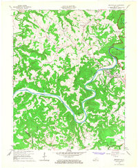
 1954 Brownsville1955 Print · USGSCentral Kentucky in the mid-1950s is defined by the winding Green River and the rural communities of Edmonson County. Genealogists and historians can trace family locations near Asphalt Sch, New Home Ch, and the rugged slopes of Shipley Knob.
 - 1954 Map of Rhoda, 1955 Print
 1954 Rhoda1955 Print · USGSThe Green River valley at the edge of the national park comes to life in the mid-fifties, showing the intersection of rural life and protected wilderness. Researchers can trace family sites at Rhoda and Arthur or locate historic congregation points like Beaver Dam Ch and Temple Hill Ch.
 - 1954 Map of Park City, 1955 Print
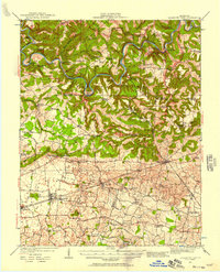
 1954 Park City1955 Print · USGSThe limestone country of Barren and Edmonson counties is captured here in the mid-1950s. Researchers can trace the legacy of travel and tourism through Diamond Caverns, the Dixie Highway, and rural stops like Bon Ayr.2 unique versions available
 - 1954 Map of Reedyville, 1955 Print
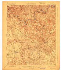
 1954 Reedyville1955 Print · USGSButler and Edmonson Counties come alive in the mid-1950s as a landscape of river navigation and ridge-top farming. Genealogists and historians can trace family sites like Threlkel Cem, the busy Honakers Ferry, and Lock No 5 on the Green River.3 unique versions available
 - 1954 Map of Smiths Grove, 1956 Print
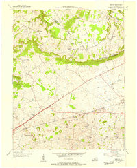
 1954 Smiths Grove1956 Print · USGSThe Warren County countryside south of the Green River corridor thrived as a mid-century transit hub during the 1950s. Genealogists and historians can trace the legacy of families near Smiths Grove through landmarks like Kinser Cem, Cole Sch, and the Louisville and Nashville rail line.
 - 1957 Map of Evansville, 1969 Print
 1957 Evansville1969 Print · USGSIndiana and Kentucky meet along the Ohio River in this mid-century survey of a vital industrial and transport corridor. Genealogists and historians can trace the development of river towns like Owensboro and Newburgh or locate old rail lines like the Southern Ry.3 unique versions available
 - 1961 Map of Evansville
 1961 Evansville1961 Print · USGSThe Ohio River valley and its surrounding coalfields are captured here during the late fifties and early sixties. Trace the industrial rail networks of the Illinois Central RR and explore regional landmarks like Mammoth Cave National Park and Angel Mounds State Memorial.2 unique versions available
 - 1965 Map of Bristow, 1967 Print
 1965 Bristow1967 Print · USGSRural Warren County at the height of the sixties is defined by its small communities and the prominent ridge of The Knobs. Researchers can trace family sites at Penns Chapel Cem, Jackson Grove Ch, and the old Bristow Sch.2 unique versions available
 - 1965 Map of Brownsville, 1967 Print
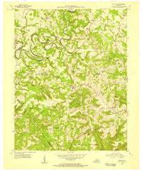
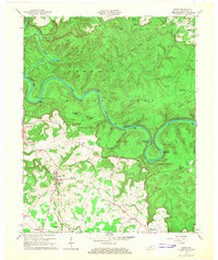
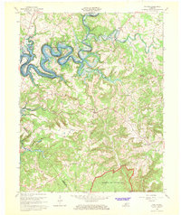
 1965 Brownsville1967 Print · USGSEdmonson County is documented in the mid-1960s as the GREEN RIVER winds through its center near Brownsville. Researchers can trace old family sites and rural landmarks like the Holly Springs Cem, Asphalt, and Gaging Station Lock No 6.
 - 1965 Map of Rhoda, 1967 Print
 1965 Rhoda1967 Print · USGSEdmonson County’s karst landscape is captured here in the mid-sixties, showing the intersection of parkland and rural life. Researchers can trace family history through Silent Grove Ch, Joppa Ch, and the crossing at Houchins Ferry.2 unique versions available
 - 1965 Map of Mammoth Cave, 1973 Print
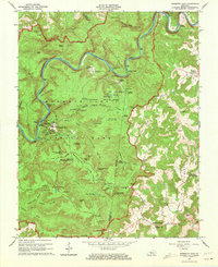 1965 Mammoth Cave1973 Print · USGSThe heart of Kentucky's cave country is captured here in the mid-1960s, showing the early infrastructure and historic portals of the national park. Genealogists and historians can trace old homesteads and family burial grounds like Holton Cem or visit rural congregations at Little Hope Ch and Freedom Ch.2 unique versions available
 - 1966 Map of Cub Run, 1968 Print
 1966 Cub Run1968 Print · USGSCentral Kentucky's rural landscape is captured here in the mid-1960s as the Nolin River Reservoir reshaped the valley. Researchers can trace old family sites near Cub Run, Big Windy, and rural pulpits like St Benedicts Ch.
Showing maps 1-25 of 86
Top cities of Edmonson County
Frequently asked questions
- What are the different types of historical maps available for Edmonson County?
- What is the oldest map of Edmonson County?
- Where can I purchase historical maps of Edmonson County for my home or office?
- Where can I download high-res historical maps of Edmonson County?
- Are there historical topographic maps available for Edmonson County?
- Is there historical aerial imagery available for Edmonson County?
- Where are historical maps of Edmonson County sourced from?