Old Maps of Furnace, Kentucky
Explore 11 old maps of Furnace, spanning from 1892 to today. These high-resolution historic maps reveal how streets, neighborhoods, landmarks, and natural features evolved over time — perfect for genealogy, metal detecting, research, and local history exploration.
What you can do with these maps:
- See how Furnace changed over time: Compare historical maps to modern-day views to trace roads, homesites, rail lines & more.
- View detailed metadata: Each map includes creators, publishers, year, scale, and archive source.
- Overlay maps with satellite & LiDAR: Visualize the past alongside modern tools to explore terrain & human change.
- Trusted historical sources: Maps sourced from the USGS, Library of Congress, and other archives.
- Access maps your way: View online, download high-res files, or order prints for personal or research use.
Start exploring old maps of Furnace to uncover forgotten places, hidden landmarks, and the deep history beneath your feet.
Furnace, KY maps
(11)- 1892 Map of Beattyville
 1892 Beattyville1892 Print · USGSThe Kentucky River and its headwaters define this late nineteenth-century survey of the rugged Cumberland Plateau. Researchers can trace the early industrial sites of Estill Furnace and Fitchburg Furnace alongside the path of the Kentucky Union Railroad.6 unique versions available
 - 1952 Map of Stanton, 1953 Print
 1952 Stanton1953 Print · USGSPowell County's river valley and mountain ridges are captured in the early fifties as they were shaped by rural industry and timber. Genealogists can locate family landmarks like the Arthur Cem, Morris Creek Ch, and the school at Furnace.
 - 1957 Map of Jenkins, 1974 Print
 1957 Jenkins1974 Print · USGSThe Cumberland Plateau in the mid-twentieth century reveals a complex landscape of winding river valleys and deep-seated industry. Genealogists and historians can trace the development of Hazard, Jenkins, and Pikeville alongside extensive Numerous Oil and Gas Fields and the routes of the Chesapeake & Ohio Railway.
 - 1960 Map of Jenkins
 1960 Jenkins1960 Print · USGSEastern Kentucky and the West Virginia borderlands are captured at a mid-century peak of the coal and rail era. Trace the industrial corridors of the Chesapeake and Ohio RR through mountain hubs like Hazard and Jenkins.
 - 1966 Map of Stanton, 1968 Print
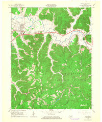 1966 Stanton1968 Print · USGSThe Red River valley in the mid-sixties shows a landscape transitioning between its pioneer industrial past and modern infrastructure. Genealogists and historians can trace family-named landmarks like Rogers Chapel, the Estill Furnace Ruins, and small settlements such as Furnace or Rosslyn.3 unique versions available
 - 1982 Map of Irvine, 1983 Print
 1982 Irvine1983 Print · USGSEastern Kentucky's hill country is mapped here in the early eighties, showcasing the complex river valleys and ridge-top settlements of the Cumberland Plateau. Researchers can trace historic rail lines like the Louisville & Nashville RR or locate rural communities such as Beattyville and Slade.
 - 2011 Map of Stanton, 2011 Print
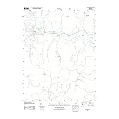 2011 Stanton2011 Print · USGSStanton and the surrounding valley are captured here in the early twenty-first century as the Red River winds through the hills of eastern Kentucky. Genealogists and local historians can trace family locations near Rogers Chapel, Billings Cemetery, or the historic settlement of Furnace.
 - 2013 Map of Stanton, 2013 Print
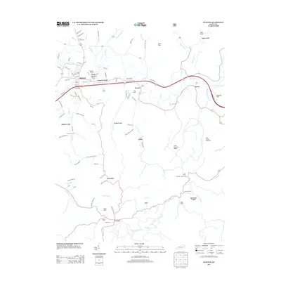 2013 Stanton2013 Print · USGSThe community of Stanton and the winding Red River valley are captured here just over a decade ago. Researchers can locate family landmarks like Hatton Creek Cem, study the layout of Furnace, or trace the ridgeline to High Rock Lookout Tower.
 - 2016 Map of Stanton, 2016 Print
 2016 Stanton2016 Print · USGSPowell County's rugged terrain and mountain settlements are captured here during the mid-2010s, bordering the Daniel Boone National Forest. Researchers can trace old family routes and rural development through places like Furnace, Rosslyn, and the winding Hatton Creek School Rd.
 - 2019 Map of Stanton, 2019 Print
 2019 Stanton2019 Print · USGSThe Powell County seat of Stanton and the surrounding forest lands are shown here in the late twenty-teens. Researchers can trace rural lineages through family-named landmarks like Billings Gem and sites like Hatton Creek School Rd or Halls Cem.
 - 2022 Map of Stanton, 2022 Print
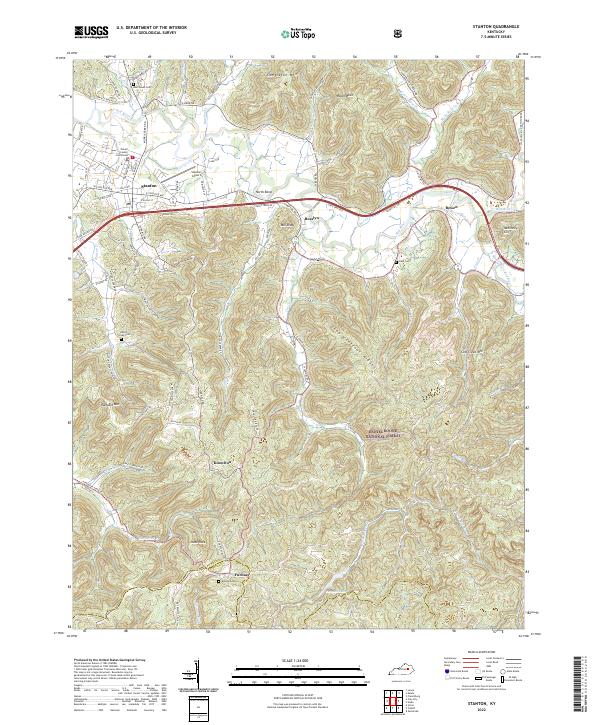 2022 Stanton2022 Print · USGSStanton and the Red River valley are documented here during a period of modern growth at the edge of the Kentucky highlands. Researchers can trace family roots at Rest Haven Cem or locate old industrial sites near Furnace and Knowlton.
End of results
Showing maps 1-11 of 11
Top cities near Furnace
- Stanton historical maps
- Irvine historical maps
- Jeffersonville historical maps
- Clay City historical maps
- Beattyville historical maps
- Camargo historical maps
See more
Frequently asked questions
- What are the different types of historical maps available for Furnace?
- What is the oldest map of Furnace?
- Where can I purchase historical maps of Furnace for my home or office?
- Where can I download high-res historical maps of Furnace?
- Are there historical topographic maps available for Furnace?
- Is there historical aerial imagery available for Furnace?
- Where are historical maps of Furnace sourced from?