1960s Maps of Lexington, Kentucky
Explore 11 historic maps of Lexington from the 1960s. These maps offer a rare glimpse into what life looked like during the 1960s — showing old roads, neighborhoods, homes, and landmarks that have changed or disappeared over time.
Whether you're researching your family's past, planning a metal detecting trip, or studying how Lexington's landscape evolved across the 1960s, these high-resolution maps are a powerful tool for exploring the history of this region.
- Focus on a specific era: All maps on this page are from the 1960s, giving you a focused view of this time period.
- See what’s changed: Compare century-old streets, trails, and buildings to today's modern landscape using overlays and satellite layers.
- Research with precision: Use these maps for genealogy, historical research, land use analysis, or educational projects.
- View, download, or print: Maps are fully viewable online in high resolution, and can be downloaded or printed for your own records.
Start exploring Lexington's history through authentic maps from the 1960s. This is your window into the past.
Lexington, KY maps
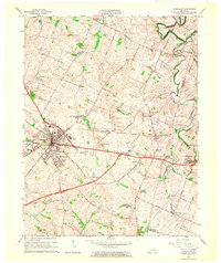
(11)- 1960 Map of Winchester
 1960 Winchester1960 Print · USGSCentral Kentucky's diverse landscape is shown here at mid-century, from the bluegrass plains to the rugged Pottsville Escarpment. Genealogists and historians can trace the rail-and-river network connecting towns like Bardstown and Stanford alongside landmarks like Lake Cumberland.
 - 1964 Map of Louisville
 1964 Louisville1964 Print · USGSThe Ohio River valley and Kentucky Bluegrass are captured in the mid-1960s, showing a region balanced between industrial growth and its agrarian roots. Genealogists and historians can trace the development of county seats like Shelbyville and Paris, or locate established institutions such as Georgetown College and Bernheim Forest.
 - 1965 Map of Versailles, 1966 Print
 1965 Versailles1966 Print · USGSWoodford County at the mid-century mark shows a landscape of established rail towns and developing parkways. Genealogists and local historians can trace the footprint of family-named landmarks like Steele Cem and early settlements such as Hunter Town and Little Texas.3 unique versions available
 - 1965 Map of Richmond North, 1966 Print
 1965 Richmond North1966 Print · USGSMadison County during the mid-sixties shows a landscape of established farmsteads and growing suburban fringes north of the county seat. Genealogists and local historians can trace family land near White Hall, Mt Nebo Ch, and the Daniel Boone Sch.3 unique versions available
 - 1965 Map of Coletown, 1966 Print
 1965 Coletown1966 Print · USGSSoutheast of Lexington during the mid-sixties, this area shows the transition from suburban growth to traditional Bluegrass farm country. Genealogists can locate family sites near Walnut Hill Ch, Coletown, and the Todds Cem.5 unique versions available
 - 1965 Map of Georgetown, 1966 Print
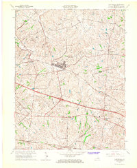
 1965 Georgetown1966 Print · USGSGeorgetown and northern Fayette County appear here in the mid-sixties, a landscape of rolling hills and historic crossroads before the interstate era took full hold. Researchers can trace local roots through Georgetown College, the Maple Grove Cem, and old stops like Paynes Depot.4 unique versions available
 - 1965 Map of Clintonville, 1967 Print
 1965 Clintonville1967 Print · USGSThe Bluegrass region east of Lexington was shaped by military expansion and traditional rail transport in the mid-1960s. Genealogists can locate family landmarks like Bethlehem Ch, the Briar Hill Sch, and settlements at Uttingertown or Chilesburg.3 unique versions available
 - 1965 Map of Lexington West, 1967 Print
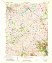
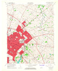
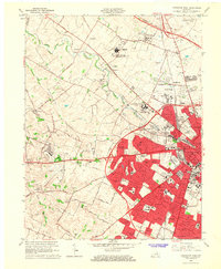 1965 Lexington West1967 Print · USGSMid-century Fayette County is shown here during a decade of rapid suburban growth west of the city center. Genealogists and historians can trace the development of neighborhoods like Meadowthorpe or find family plots in the Lexington Cemetery and Calvary Cemetery.5 unique versions available
 - 1965 Map of Nicholasville, 1967 Print
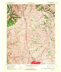
 1965 Nicholasville1967 Print · USGSMid-century Fayette and Jessamine counties are captured here during a period of suburban growth south of Lexington. Genealogists and historians can trace the development of Stonewall Estates, locate the Blue Grass Raceway, or find the Waveland Museum.4 unique versions available
 - 1965 Map of Ford, 1967 Print
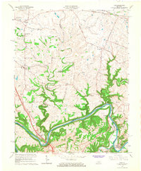 1965 Ford1967 Print · USGSThe Kentucky River corridor south of Winchester comes alive in the mid-1960s as a hub of river crossings and small Bluegrass hamlets. Researchers can trace family sites and local landmarks like Clays Ferry, Durbin Memorial Ch, and Niblicktown.2 unique versions available
 - 1965 Map of Lexington East, 1967 Print
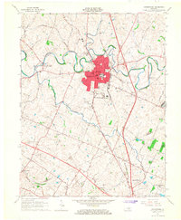
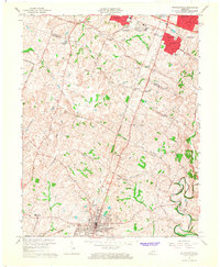
 1965 Lexington East1967 Print · USGSLexington and its eastern Fayette County suburbs are captured during a period of significant post-war expansion. Local historians can trace the development of residential areas like Chevy Chase and Idle Hour alongside established landmarks such as Transylvania University and the Bryan Station Spring Cem.6 unique versions available
End of results
Showing maps 1-11 of 11
Top cities near Lexington
- Georgetown historical maps
- Nicholasville historical maps
- Paris historical maps
- Wilmore historical maps
- Midway historical maps
- Zion Hill historical maps
Top neighborhoods of Lexington
- Gainesway historical maps
- Westmoreland historical maps
- Southeastern Hills historical maps
- Walnut Hill historical maps
- Fort Spring historical maps
- East Hickman historical maps
See more
Frequently asked questions
- What are the different types of historical maps available for Lexington?
- What is the oldest map of Lexington?
- Where can I purchase historical maps of Lexington for my home or office?
- Where can I download high-res historical maps of Lexington?
- Are there historical topographic maps available for Lexington?
- Is there historical aerial imagery available for Lexington?
- Where are historical maps of Lexington sourced from?