Old Maps of Floyd County, Kentucky
Explore 141 old maps of Floyd County, spanning from 1886 to today. These high-resolution historic maps reveal how streets, neighborhoods, landmarks, and natural features evolved over time — perfect for genealogy, metal detecting, research, and local history exploration.
What you can do with these maps:
- See how Floyd County changed over time: Compare historical maps to modern-day views to trace roads, homesites, rail lines & more.
- View detailed metadata: Each map includes creators, publishers, year, scale, and archive source.
- Overlay maps with satellite & LiDAR: Visualize the past alongside modern tools to explore terrain & human change.
- Trusted historical sources: Maps sourced from the USGS, Library of Congress, and other archives.
- Access maps your way: View online, download high-res files, or order prints for personal or research use.
Start exploring old maps of Floyd County to uncover forgotten places, hidden landmarks, and the deep history beneath your feet.
Floyd County, KY maps
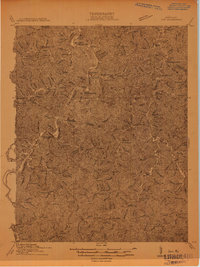
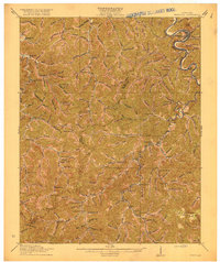
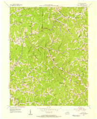
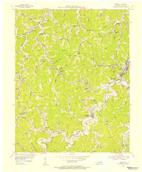
(141)- 1886 Map of Prestonsburg
 1886 Prestonsburg1886 Print · USGSEastern Kentucky's river-and-rail economy is captured here in the late nineteenth century as steam power reached deep into the mountains. Genealogists can trace family homesteads near Prestonburgh, Paintsville, and early settlements like Peach Orchard or Boon's Camp.
 - 1890 Map of Whitesburg
 1890 Whitesburg1890 Print · USGSThe Cumberland Plateau in the 1880s is a world of deep hollows and isolated mountain settlements. Genealogists can trace family roots in early communities like Whitesburgh and Pikeville or locate crossings at Pound Gap and Shelby Gap.
 - 1892 Map of Whitesburg
 1892 Whitesburg1892 Print · USGSEastern Kentucky and the Virginia borderlands appear here in the late nineteenth century as a landscape of isolated mountain hollows. Genealogists and historians can trace early family settlements along Kingdom Come Creek, Beef Hide, and the strategic passage at Pound Gap.4 unique versions available
 - 1892 Map of Prestonsburg
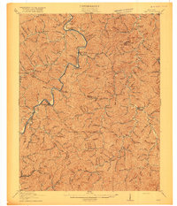
 1892 Prestonsburg1892 Print · USGSEastern Kentucky is shown in the late nineteenth century as a landscape of river-centered trade and early mountain settlement. Genealogists and historians can trace family-named locations like Laynesville, Oil Spring, and the post office at Eden (Inez P.O.).4 unique versions available
 - 1912 Map of Hindman
 1912 Hindman1912 Print · USGSThe Kentucky hills around Hindman appear in remarkable detail during the early twentieth century, showing a landscape defined by isolated hollows. Genealogists can trace early homesteads and communities like Elmrock, Kite, and Democrat, as well as numerous numbered schoolhouses along Troublesome Creek.
 - 1914 Map of Laynesville
 1914 Laynesville1914 Print · USGSEastern Kentucky's river valleys and mountain hollows are meticulously mapped here in the years before the Great War. Genealogists can trace the locations of dozens of early schoolhouses, from School No 16 to the Sandy Valley Normal School, alongside river towns like Laynesville and Betsy Layne.
 - 1914 Map of Inez
 1914 Inez1914 Print · USGSThe Big Sandy River valley in the early twentieth century was a landscape of coal-country settlements and riverside rail stops. Researchers can trace the development of small communities like Whitehouse and Inez or locate vanished landmarks like Wells Chapel and Graves Shoals Sta.
 - 1914 Map of Vergie
 1914 Vergie1914 Print · USGSPike County's coal hollows and creek-side settlements are captured here during the rail-driven expansion of the early twentieth century. Genealogists can locate family homesites near numerous numbered schoolhouses, the Sandy Valley & Elkhorn RR, and early post offices at Virgie and McDowell.
 - 1915 Map of Paintsville
 1915 Paintsville1915 Print · USGSEastern Kentucky during the first World War is captured here as the river-and-rail economy takes hold. Genealogists can trace family names through dozens of rural school districts and communities like Flatgap, Van Lear, and Staffordsville.
 - 1915 Map of Prestonsburg
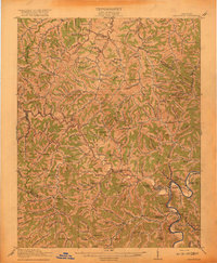
 1915 Prestonsburg1915 Print · USGSEastern Kentucky's coal and rail landscape is meticulously detailed in the years before the Great War. Genealogists and historians can trace families across Big Lick School, the Cliff Mine, and early post offices like Maytown Langley PO.2 unique versions available
 - 1915 Map of Hindman
 1915 Hindman1915 Print · USGSEastern Kentucky's high ridges and deep hollows are captured here during the mid-1910s, showing a landscape defined by isolated farmsteads and rural school districts. Genealogists can trace family footprints near Hindman or locate small settlements like Handshoe, Iris, and the WC TU School.4 unique versions available
 - 1916 Map of Harold
 1916 Harold1916 Print · USGSEastern Kentucky's river valleys and railroad corridors come alive in this mid-1910s survey of the Big Sandy region. Researchers can trace the development of the Chesapeake and Ohio line through river towns like Betsy Layne and Laynesville, or locate family-centric sites like Woods Emma PO and the Sandy Valley Normal School.3 unique versions available
 - 1916 Map of Pikeville
 1916 Pikeville1916 Print · USGSEastern Kentucky's coal and river country comes into focus in the mid-1910s as the railroad moves deep into the hollows. Genealogists and local historians can locate early family-named landmarks and mountain communities like Weeksbury, Virgie, and James Chapel.5 unique versions available
 - 1916 Map of Inez
 1916 Inez1916 Print · USGSMartin and Lawrence Counties are shown here during a period of rural growth and river-based transport. Genealogists can locate specific homesteads near Wells Chapel, track old post offices like Graves Shoals, or find local landmarks such as Sandlick School.3 unique versions available
 - 1917 Map of Paintsville
 1917 Paintsville1917 Print · USGSEastern Kentucky during the first World War is meticulously documented here, showing the densely packed hollows of Johnson County. Genealogists can trace family roots through numerous numbered schools and rural settlements like Oil Springs, Flat Gap, and Hager Hill PO Johnson Sta.3 unique versions available
 - 1918 Map of Prestonsburg
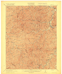 1918 Prestonsburg1918 Print · USGSEastern Kentucky's river-and-rail corridors are captured here just before the close of the Great War. Genealogists can trace family roots through hillside settlements and early postal stops like Maytown Langley PO, Ivyton, and Big Lick School.3 unique versions available
 - 1953 Map of Ivyton, 1955 Print
 1953 Ivyton1955 Print · USGSMagoffin and Johnson Counties are captured here in the early fifties, showing a landscape defined by traditional Appalachian settlements and a booming gas industry. Genealogists can trace family names across dozens of landmarks, from the Joe Howard Cem to the Crusade Sch and Salyers Ch.
 - 1954 Map of Broad Bottom, 1955 Print
 1954 Broad Bottom1955 Print · USGSThe Levisa Fork valley in the mid-1950s shows a landscape transformed by the gas industry and the railroad. Researchers can trace family-named sites like Blair Town and Snivley Chapel or find vanished landmarks like the Drive-in Theater and Pikeville Airfield.
 - 1954 Map of Offutt, 1955 Print
 1954 Offutt1955 Print · USGSThe hills of Eastern Kentucky in the mid-fifties are captured here as a dense network of hollows, rail corridors, and early energy extraction. Genealogists can trace family footprints at Butcher Hollow Sch, the Ward Cem, or the small settlement of Boons Camp.3 unique versions available
 - 1954 Map of Paintsville, 1955 Print
 1954 Paintsville1955 Print · USGSMid-century Johnson County comes to life as an industrial hub where the river and rail meet in the Appalachian foothills. Local historians can trace the development of Paintsville and outlying settlements like Staffordsville, Tutor Key, and the rail stops at Buchanan Station.
 - 1954 Map of Lancer, 1955 Print
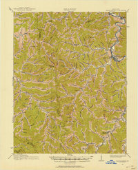
 1954 Lancer1955 Print · USGSFloyd County at the mid-century shows a landscape shaped by the new Dewey Reservoir and the winding Levisa Fork. Genealogists and historians can trace local life through dozens of rural landmarks like Brandy Keg Sch, Home Branch Sch, and the railroad stop at Lancer.2 unique versions available
 - 1954 Map of Martin, 1955 Print
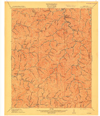
 1954 Martin1955 Print · USGSFloyd County's mountain hollers and rail stations are captured here during the mid-fifties, showing the deep integration of the coal industry and local life. Researchers can trace numerous family-named landmarks and rural hubs, from Philadelphia Church to rail stops like Samson Station and Permele Station.3 unique versions available
 - 1954 Map of Harold, 1955 Print
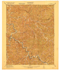
 1954 Harold1955 Print · USGSThe Levisa Fork valley in Floyd County was a bustling corridor of rail and river life in the mid-fifties. Genealogists can trace family footprints through numerous hollows and hamlets like Blue Moon, Justell, and Printer (Salisbury Sta).2 unique versions available
 - 1954 Map of Thomas, 1955 Print
 1954 Thomas1955 Print · USGSThe valleys of eastern Kentucky are captured here in the mid-1950s at the height of the local gas and oil boom. Genealogists can locate family landmarks like Thomas PO, McCombs, and several rural schools including Meathouse Creek Sch.3 unique versions available
 - 1954 Map of Kite, 1956 Print
 1954 Kite1956 Print · USGSEastern Kentucky's narrow valleys and coal-country settlements are meticulously detailed here during the mid-1950s. Genealogists and historians can trace numerous remote mountain schools and family cemeteries, including Kite Sch, Hollybush Ch, and Hall Cem.3 unique versions available
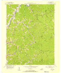
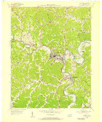
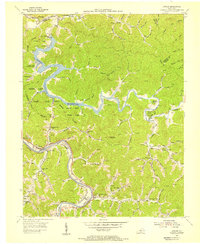
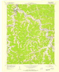
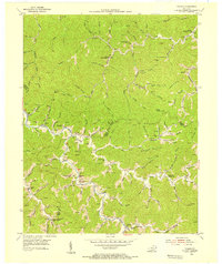
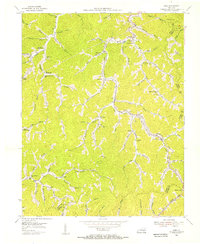
Showing maps 1-25 of 141
Top cities of Floyd County
- Prestonsburg historical maps
- Wheelwright historical maps
- Auxier historical maps
- Betsy Layne historical maps
- Martin historical maps
- Wayland historical maps
See more
Frequently asked questions
- What are the different types of historical maps available for Floyd County?
- What is the oldest map of Floyd County?
- Where can I purchase historical maps of Floyd County for my home or office?
- Where can I download high-res historical maps of Floyd County?
- Are there historical topographic maps available for Floyd County?
- Is there historical aerial imagery available for Floyd County?
- Where are historical maps of Floyd County sourced from?