1960s Maps of Floyd County, Kentucky
Explore 4 historic maps of Floyd County from the 1960s. These maps offer a rare glimpse into what life looked like during the 1960s — showing old roads, neighborhoods, homes, and landmarks that have changed or disappeared over time.
Whether you're researching your family's past, planning a metal detecting trip, or studying how Floyd County's landscape evolved across the 1960s, these high-resolution maps are a powerful tool for exploring the history of this region.
- Focus on a specific era: All maps on this page are from the 1960s, giving you a focused view of this time period.
- See what’s changed: Compare century-old streets, trails, and buildings to today's modern landscape using overlays and satellite layers.
- Research with precision: Use these maps for genealogy, historical research, land use analysis, or educational projects.
- View, download, or print: Maps are fully viewable online in high resolution, and can be downloaded or printed for your own records.
Start exploring Floyd County's history through authentic maps from the 1960s. This is your window into the past.
Floyd County, KY maps
(4)- 1960 Map of Jenkins
 1960 Jenkins1960 Print · USGSEastern Kentucky and the West Virginia borderlands are captured at a mid-century peak of the coal and rail era. Trace the industrial corridors of the Chesapeake and Ohio RR through mountain hubs like Hazard and Jenkins.
 - 1962 Map of Paintsville, 1964 Print
 1962 Paintsville1964 Print · USGSThe Levisa Fork region of Johnson County is shown here in the early 1960s as the coal and rail industries shaped the valley. Genealogists can locate family landmarks like Preston Cem and Stafford Ch or trace old stops like Thelma and West Van Lear.
 - 1962 Map of Ivyton, 1964 Print
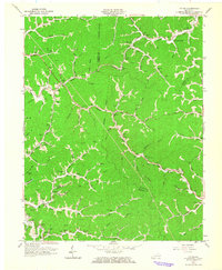 1962 Ivyton1964 Print · USGSMagoffin County's dissected plateau is shown in the early sixties as a center of gas production and traditional Appalachian rail transport. Genealogists can locate family landmarks like Dotson Cem and Marshall Cem or follow the Chesapeake and Ohio tracks through Riceville.
 - 1962 Map of Prestonsburg, 1964 Print
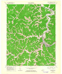 1962 Prestonsburg1964 Print · USGSThe Levisa Fork valley comes alive in the early sixties, showing the vital rail and river corridor of Floyd County. Genealogists and historians can trace family locations near Auxier, Harkins Chapel, and numerous Gas Wells throughout the hills.
End of results
Showing maps 1-4 of 4
Top cities of Floyd County
- Prestonsburg historical maps
- Wheelwright historical maps
- Auxier historical maps
- Betsy Layne historical maps
- Martin historical maps
- Wayland historical maps
See more
Frequently asked questions
- What are the different types of historical maps available for Floyd County?
- What is the oldest map of Floyd County?
- Where can I purchase historical maps of Floyd County for my home or office?
- Where can I download high-res historical maps of Floyd County?
- Are there historical topographic maps available for Floyd County?
- Is there historical aerial imagery available for Floyd County?
- Where are historical maps of Floyd County sourced from?