1900s (20th Century) Maps of Fulton, Kentucky
Explore 7 historic maps of Fulton from the 1900s (20th Century). These maps offer a rare glimpse into what life looked like during the 1900s — showing old roads, neighborhoods, homes, and landmarks that have changed or disappeared over time.
Whether you're researching your family's past, planning a metal detecting trip, or studying how Fulton's landscape evolved across the 1900s, these high-resolution maps are a powerful tool for exploring the history of this region.
- Focus on a specific era: All maps on this page are from the 1900s, giving you a focused view of this time period.
- See what’s changed: Compare century-old streets, trails, and buildings to today's modern landscape using overlays and satellite layers.
- Research with precision: Use these maps for genealogy, historical research, land use analysis, or educational projects.
- View, download, or print: Maps are fully viewable online in high resolution, and can be downloaded or printed for your own records.
Start exploring Fulton's history through authentic maps from the 1900s. This is your window into the past.
Fulton, KY maps
(7)- 1952 Map of Crutchfield, 1953 Print
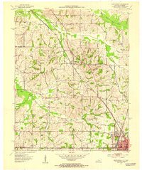 1952 Crutchfield1953 Print · USGSWestern Kentucky and the Tennessee borderlands are captured here in the early fifties during a period of steady rural growth. Researchers can trace local lineage through numerous landmarks like Huddleston Cem, Ledbetter Sch, and the Carr Institute in South Fulton.
 - 1952 Map of Water Valley, 1953 Print
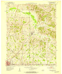 1952 Water Valley1953 Print · USGSIn the early 1950s, the border between Kentucky and Tennessee was a landscape of rail-driven towns and winding bayous. Genealogists and historians can trace family roots through landmarks like Camp Beauregard Cem, the settlement of Feliciana, and the Illinois Central rail line.
 - 1952 Map of Water Valley, 1957 Print
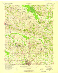 1952 Water Valley1957 Print · USGSWestern Kentucky and northern Tennessee are captured here in the early fifties as the Illinois Central railroad linked farming hubs and small towns. Genealogists can trace family names through dozens of landmarks like Camp Beauregard Cem, McWhort Cem, and Shiloh Sch Ch.
 - 1956 Map of Dyersburg, 1960 Print
 1956 Dyersburg1960 Print · USGSThe Four Rivers region comes alive in the mid-fifties, capturing the intricate borderlands of Tennessee, Kentucky, and Missouri. Genealogists and historians can trace the rail-and-river networks connecting Dyersburg, Caruthersville, and the shoreline of Reelfoot Lake.4 unique versions available
 - 1969 Map of Water Valley, 1971 Print
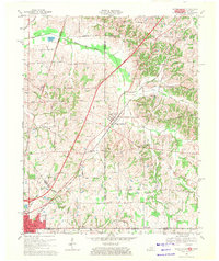 1969 Water Valley1971 Print · USGSThe Kentucky and Tennessee borderlands are captured here in the late sixties as the new parkway system began to reshape the rural landscape. Researchers can trace family history at Wesley Cem and Boaz Chapel or explore the site of Camp Beauregard near Water Valley.2 unique versions available
 - 1969 Map of Crutchfield, 1971 Print
 1969 Crutchfield1971 Print · USGSCrossing the Kentucky-Tennessee border in the late 1960s, this survey highlights the bustling rail-and-river geography near the state line. Genealogists can trace family names through landmarks like Riceville, Crossland Cem, and Mt Carmel Ch.
 - 1986 Map of Murray
 1986 Murray1986 Print · USGSWestern Kentucky in the mid-1980s reveals a landscape defined by the Tennessee and Cumberland rivers. Genealogists and historians can trace rail-town development along the Illinois Central Gulf RR and find family-named locations like Dukedom and Water Valley.2 unique versions available
End of results
Showing maps 1-7 of 7
Top cities near Fulton
- Union City historical maps
- Martin historical maps
- Mayfield historical maps
- Dresden historical maps
- South Fulton historical maps
- Clinton historical maps
See more
Top neighborhoods of Fulton
Frequently asked questions
- What are the different types of historical maps available for Fulton?
- What is the oldest map of Fulton?
- Where can I purchase historical maps of Fulton for my home or office?
- Where can I download high-res historical maps of Fulton?
- Are there historical topographic maps available for Fulton?
- Is there historical aerial imagery available for Fulton?
- Where are historical maps of Fulton sourced from?